Property Record
1156 Smith Store Rd, Covington, GA 30016
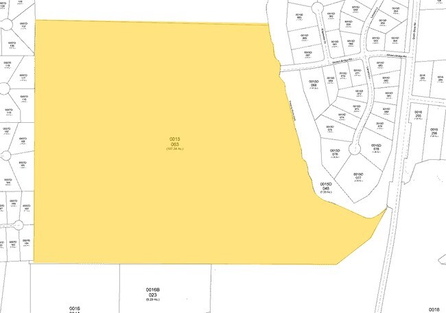

Property Detail
1156 Smith Store Rd
0015000000063000
92.17AC SMITH STORE RD
Residentialacreage
NEWTON COUNTY
R1
Georgia
A Areas with a 1% annual chance of flooding and a 26% chance of flooding over the life of a 30-year mortgage.
92.17 AC
2025
Newton County
2025
Atlanta
100902
Atlanta-Sandy Springs-Roswell, GA
1,440 SF
NEARBY LISTINGS FOR SALE OR LEASE
DEMOGRAPHICS near 1156 Smith Store Rd
1 mile
3 mile
5 mile
2025 Total Population
2,294
24,514
74,070
2030 Population
2,474
26,367
79,290
Pop Growth 2025-2030
+ 7.85%
+ 7.56%
+ 7.05%
Average Age
39
38
38
2025 Total Households
797
8,407
25,330
HH Growth 2025-2030
+ 8.03%
+ 7.71%
+ 7.17%
Median Household Inc
$90,996
$83,525
$82,764
Avg Household Size
2.80
2.90
2.90
2025 Avg HH Vehicles
2.00
2.00
2.00
Median Home Value
$327,293
$256,121
$273,063
Median Year Built
1997
1996
1997
Nearby Places
Map Layers
Map Styles
 Street
 Aerial
Layers
 Traffic
 Biking
Places
Listings with unknown addresses are not visible on the map
- Restaurants
- Banks
- Shops
- Fitness
- Groceries
PUBLIC TRANSPORTATION
AIRPORT
Hartsfield - Jackson Atlanta International
Drive
Walk
Distance
Hartsfield - Jackson Atlanta International
55 min
38.0 mi
Freight Ports
Georgia Ports - Savannah
Drive
Walk
Distance
Georgia Ports - Savannah
272 min
235.1 mi
Nearby Properties
Address
Land Use
TOTAL SIZE
Lot Size
Zoning
Address
Land Use
TOTAL SIZE
Lot Size
Zoning
1,158,095 SF
161.26 AC
Address
Land Use
TOTAL SIZE
Lot Size
Zoning
1,158,095 SF
0.01 AC
Address
Land Use
TOTAL SIZE
Lot Size
Zoning
65,360 SF
75.51 AC
E6
Address
Land Use
TOTAL SIZE
Lot Size
Zoning
66,660 SF
12.80 AC
C1
Address
Land Use
TOTAL SIZE
Lot Size
Zoning
81,730 SF
17.98 AC
C1
Address
Land Use
TOTAL SIZE
Lot Size
Zoning
65,360 SF
30.63 AC
E6
Address
Land Use
TOTAL SIZE
Lot Size
Zoning
50,096 SF
4.19 AC
C1
Address
Land Use
TOTAL SIZE
Lot Size
Zoning
63,328 SF
10.67 AC
C2
Address
Land Use
TOTAL SIZE
Lot Size
Zoning
58,892 SF
17.52 AC
E6
Address
Land Use
TOTAL SIZE
Lot Size
Zoning
6,000 SF
2.61 AC
C1
Address
Land Use
TOTAL SIZE
Lot Size
Zoning
19,363 SF
4 AC
AR
Address
Land Use
TOTAL SIZE
Lot Size
Zoning
30,000 SF
11.06 AC
E2
Address
Land Use
TOTAL SIZE
Lot Size
Zoning
17,558 SF
5.08 AC
AR/C1
Address
Land Use
TOTAL SIZE
Lot Size
Zoning
3,500 SF
0.85 AC
C1
Address
Land Use
TOTAL SIZE
Lot Size
Zoning
13,182 SF
1.89 AC
CN
Address
Land Use
TOTAL SIZE
Lot Size
Zoning
383.52 AC
Address
Land Use
TOTAL SIZE
Lot Size
Zoning
12,600 SF
1.33 AC
C2
Address
Land Use
TOTAL SIZE
Lot Size
Zoning
30,456 SF
6.99 AC
R2
Address
Land Use
TOTAL SIZE
Lot Size
Zoning
12,934 SF
2.37 AC
E3
Address
Land Use
TOTAL SIZE
Lot Size
Zoning
2,065 SF
15 AC
E2
Address
Land Use
TOTAL SIZE
Lot Size
Zoning
394.98 AC
AR
Address
Land Use
TOTAL SIZE
Lot Size
Zoning
2,346 SF
1.63 AC
Address
Land Use
TOTAL SIZE
Lot Size
Zoning
7,200 SF
1.07 AC
C2/C
Address
Land Use
TOTAL SIZE
Lot Size
Zoning
359.47 AC
A
Address
Land Use
TOTAL SIZE
Lot Size
Zoning
3,206 SF
1.45 AC
Address
Land Use
TOTAL SIZE
Lot Size
Zoning
3,780 SF
78.28 AC
E2
Address
Land Use
TOTAL SIZE
Lot Size
Zoning
4,644 SF
1.73 AC
C1
Address
Land Use
TOTAL SIZE
Lot Size
Zoning
4,826 SF
1.49 AC
C1
Address
Land Use
TOTAL SIZE
Lot Size
Zoning
8,400 SF
6.03 AC
AR
Address
Land Use
TOTAL SIZE
Lot Size
Zoning
8,320 SF
2.57 AC
The World's #1 Commercial Real Estate Marketplace
Connect with us
© 2026 CoStar Group
The information above has been obtained from sources believed reliable. While we do not doubt its accuracy we have not verified it and make no guarantee, warranty or representation about it. It is your responsibility to independently confirm its accuracy and completeness. Any projections, opinions, assumptions, or estimates used are for example only and do not represent the current or future performance of the property. The value of this transaction to you depends on tax and other factors which should be evaluated by your tax, financial, and legal advisors. You and your advisors should conduct a careful, independent investigation of the property to determine to your satisfaction the suitability of the property for your needs.