Property Record
1156 W Maple Ave, Mundelein, IL 60060


NEARBY LISTINGS FOR SALE OR LEASE
Property Detail
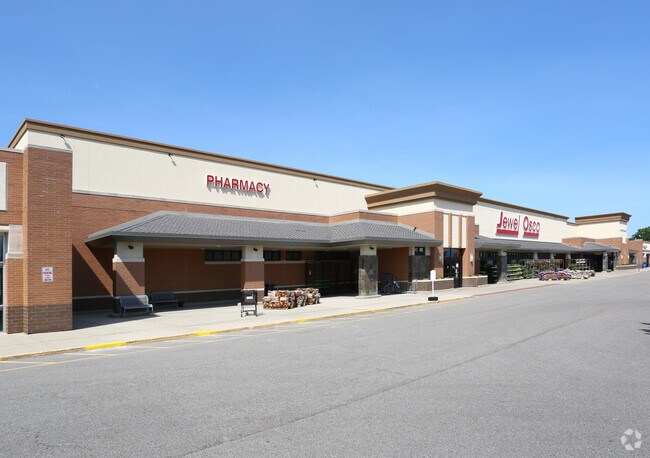
1156 W Maple Ave
Chicago-Naperville-Elgin, IL-IN-WI
Long Meadow Commons
10-24-113-016
LONG MEADOW COMMONS; LOT 1
Commercialbuilding
Lake
X
Illinois
17097C0144K
1
2023
12.88 AC
2024
Central Northwest
864105
Chicago
324,153 SF
DEMOGRAPHICS near 1156 W Maple Ave
1 Mile
3 Mile
5 Mile
2024 Total Population
10,155
43,951
113,610
2029 Population
9,985
43,349
112,838
Pop Growth 2024-2029
(1.67%)
(1.37%)
(0.68%)
Average Age
41
41
41
2024 Total Households
3,638
15,340
42,078
HH Growth 2024-2029
(1.79%)
(1.51%)
(0.71%)
Median Household Inc
$113,378
$113,537
$110,974
Avg Household Size
2.70
2.80
2.60
2024 Avg HH Vehicles
2.00
2.00
2.00
Median Home Value
$277,133
$330,815
$347,048
Median Year Built
1984
1983
1986
Nearby Places
Map Layers
Map Styles
 Street
 Aerial
- Restaurants
- Banks
- Shops
- Fitness
- Groceries
PUBLIC TRANSPORTATION
COMMUTER RAIL
Mundelein Station (North Central Service - Northeast Illinois Regional Commuter Railroad (Metra))
DRIVE
WALK
Distance
Mundelein Station (North Central Service - Northeast Illinois Regional Commuter Railroad (Metra))
6 min
1.9 mi
Prairie Crossing Station (NCS) (North Central Service - Northeast Illinois Regional Commuter Railroad (Metra))
DRIVE
WALK
Distance
Prairie Crossing Station (NCS) (North Central Service - Northeast Illinois Regional Commuter Railroad (Metra))
8 min
3.3 mi
AIRPORT
Chicago O'Hare International
DRIVE
WALK
Distance
Chicago O'Hare International
42 min
27.9 mi
Nearby Properties
Address
Land Use
TOTAL SIZE
Lot Size
Zoning
Address
Land Use
TOTAL SIZE
Lot Size
Zoning
1,401,971 SF
85.78 AC
Address
Land Use
TOTAL SIZE
Lot Size
Zoning
Address
Land Use
TOTAL SIZE
Lot Size
Zoning
596,712 SF
35.56 AC
Address
Land Use
TOTAL SIZE
Lot Size
Zoning
43.14 AC
Address
Land Use
TOTAL SIZE
Lot Size
Zoning
43.14 AC
Address
Land Use
TOTAL SIZE
Lot Size
Zoning
22.58 AC
Address
Land Use
TOTAL SIZE
Lot Size
Zoning
Address
Land Use
TOTAL SIZE
Lot Size
Zoning
12.65 AC
Address
Land Use
TOTAL SIZE
Lot Size
Zoning
2.60 AC
Address
Land Use
TOTAL SIZE
Lot Size
Zoning
340,535 SF
19.01 AC
Address
Land Use
TOTAL SIZE
Lot Size
Zoning
9.25 AC
Address
Land Use
TOTAL SIZE
Lot Size
Zoning
177,993 SF
10 AC
Address
Land Use
TOTAL SIZE
Lot Size
Zoning
135,180 SF
22.05 AC
Address
Land Use
TOTAL SIZE
Lot Size
Zoning
Address
Land Use
TOTAL SIZE
Lot Size
Zoning
217,620 SF
13.07 AC
Address
Land Use
TOTAL SIZE
Lot Size
Zoning
Address
Land Use
TOTAL SIZE
Lot Size
Zoning
Address
Land Use
TOTAL SIZE
Lot Size
Zoning
192,330 SF
10.23 AC
Address
Land Use
TOTAL SIZE
Lot Size
Zoning
786,312 SF
14.74 AC
Address
Land Use
TOTAL SIZE
Lot Size
Zoning
175,833 SF
7.70 AC
Address
Land Use
TOTAL SIZE
Lot Size
Zoning
175,818 SF
18 AC
Address
Land Use
TOTAL SIZE
Lot Size
Zoning
Address
Land Use
TOTAL SIZE
Lot Size
Zoning
428,703 SF
24.63 AC
Address
Land Use
TOTAL SIZE
Lot Size
Zoning
4.88 AC
Address
Land Use
TOTAL SIZE
Lot Size
Zoning
71,320 SF
26.33 AC
Address
Land Use
TOTAL SIZE
Lot Size
Zoning
Address
Land Use
TOTAL SIZE
Lot Size
Zoning
Address
Land Use
TOTAL SIZE
Lot Size
Zoning
95,180 SF
12.40 AC
Address
Land Use
TOTAL SIZE
Lot Size
Zoning
The World's #1 Commercial Real Estate Marketplace
Connect with us
© 2025 CoStar Group
The information above has been obtained from sources believed reliable. While we do not doubt its accuracy we have not verified it and make no guarantee, warranty or representation about it. It is your responsibility to independently confirm its accuracy and completeness. Any projections, opinions, assumptions, or estimates used are for example only and do not represent the current or future performance of the property. The value of this transaction to you depends on tax and other factors which should be evaluated by your tax, financial, and legal advisors. You and your advisors should conduct a careful, independent investigation of the property to determine to your satisfaction the suitability of the property for your needs.