Property Record
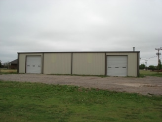
11560 Chapman Dr, Amarillo, TX 79118


Property Detail
11560 Chapman Dr
R-052-3750-1953-0
MCMURTRY ACRES, 164.02FT W X 194.56FT N BEG 332.52FT W & 1119.05FT N OF SE COR OF TR 21, 0.7300 ACRES
Utilities
RANDALL
B and X Area of moderate flood hazard, usually the area between the limits of the 100-year and 500-year floods.
Texas
2024
0.73 AC
2025
Amarillo
021706
Other Market Areas
4,800 SF
Amarillo, TX
NEARBY LISTINGS FOR SALE OR LEASE
DEMOGRAPHICS near 11560 Chapman Dr
1 mile
3 mile
5 mile
2025 Total Population
1,387
14,237
64,970
2030 Population
1,474
15,095
68,555
Pop Growth 2025-2030
+ 6.27%
+ 6.03%
+ 5.52%
Average Age
40
38
40
2025 Total Households
391
4,908
25,630
HH Growth 2025-2030
+ 7.16%
+ 6.01%
+ 5.44%
Median Household Inc
$48,333
$93,667
$86,411
Avg Household Size
2.70
2.70
2.50
2025 Avg HH Vehicles
2.00
2.00
2.00
Median Home Value
$181,249
$249,179
$246,669
Median Year Built
1990
2000
1993
Nearby Places
Map Layers
Map Styles
 Street
 Aerial
Transit
 Traffic
 Biking
Places
Listings with unknown addresses are not visible on the map
- Restaurants
- Banks
- Shops
- Fitness
- Groceries
PUBLIC TRANSPORTATION
AIRPORT
Rick Husband Amarillo International
Drive
Walk
Distance
Rick Husband Amarillo International
26 min
17.6 mi
Nearby Properties
Address
Land Use
TOTAL SIZE
Lot Size
Zoning
Address
Land Use
TOTAL SIZE
Lot Size
Zoning
362,796 SF
49.98 AC
A
Address
Land Use
TOTAL SIZE
Lot Size
Zoning
228,223 SF
20.83 AC
Address
Land Use
TOTAL SIZE
Lot Size
Zoning
258,757 SF
22.78 AC
A
Address
Land Use
TOTAL SIZE
Lot Size
Zoning
112,261 SF
21.82 AC
Address
Land Use
TOTAL SIZE
Lot Size
Zoning
148,486 SF
20.66 AC
Address
Land Use
TOTAL SIZE
Lot Size
Zoning
74,960 SF
7 AC
R2
Address
Land Use
TOTAL SIZE
Lot Size
Zoning
190,074 SF
12.07 AC
Address
Land Use
TOTAL SIZE
Lot Size
Zoning
161,321 SF
31 AC
A
Address
Land Use
TOTAL SIZE
Lot Size
Zoning
42,306 SF
8 AC
Address
Land Use
TOTAL SIZE
Lot Size
Zoning
243,210 SF
20.11 AC
Address
Land Use
TOTAL SIZE
Lot Size
Zoning
60,620 SF
16.33 AC
LC
Address
Land Use
TOTAL SIZE
Lot Size
Zoning
59,625 SF
12 AC
Address
Land Use
TOTAL SIZE
Lot Size
Zoning
663,313 SF
149.32 AC
Address
Land Use
TOTAL SIZE
Lot Size
Zoning
42,332 SF
7.44 AC
Address
Land Use
TOTAL SIZE
Lot Size
Zoning
97,796 SF
4 AC
Address
Land Use
TOTAL SIZE
Lot Size
Zoning
74,809 SF
12.56 AC
LC
Address
Land Use
TOTAL SIZE
Lot Size
Zoning
57,451 SF
7.55 AC
R2
Address
Land Use
TOTAL SIZE
Lot Size
Zoning
138,151 SF
7 AC
Address
Land Use
TOTAL SIZE
Lot Size
Zoning
18,112 SF
7.98 AC
Address
Land Use
TOTAL SIZE
Lot Size
Zoning
81,000 SF
7.21 AC
Address
Land Use
TOTAL SIZE
Lot Size
Zoning
33,528 SF
15 AC
Address
Land Use
TOTAL SIZE
Lot Size
Zoning
49,025 SF
4.37 AC
Address
Land Use
TOTAL SIZE
Lot Size
Zoning
42,349 SF
1.72 AC
LC
Address
Land Use
TOTAL SIZE
Lot Size
Zoning
42,597 SF
1.94 AC
LC
Address
Land Use
TOTAL SIZE
Lot Size
Zoning
43,700 SF
21.35 AC
Address
Land Use
TOTAL SIZE
Lot Size
Zoning
19,360 SF
14.72 AC
Address
Land Use
TOTAL SIZE
Lot Size
Zoning
64,650 SF
7.07 AC
Address
Land Use
TOTAL SIZE
Lot Size
Zoning
44,591 SF
4.24 AC
Address
Land Use
TOTAL SIZE
Lot Size
Zoning
122,012 SF
11.50 AC
Address
Land Use
TOTAL SIZE
Lot Size
Zoning
51,178 SF
48.86 AC
The World's #1 Commercial Real Estate Marketplace
Connect with us
© 2026 CoStar Group
The information above has been obtained from sources believed reliable. While we do not doubt its accuracy we have not verified it and make no guarantee, warranty or representation about it. It is your responsibility to independently confirm its accuracy and completeness. Any projections, opinions, assumptions, or estimates used are for example only and do not represent the current or future performance of the property. The value of this transaction to you depends on tax and other factors which should be evaluated by your tax, financial, and legal advisors. You and your advisors should conduct a careful, independent investigation of the property to determine to your satisfaction the suitability of the property for your needs.