Property Record
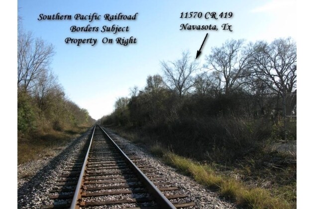
11568 County Road 419, Navasota, TX 77868


Property Detail
11568 County Road 419
R13786
A0046 J MOORE, TRACT 18, SERIAL # 04550143L, TITLE # 00472074, LABEL # TEX0025882, ACRES 99.98
Ranch
Grimes
1
Texas
A Areas with a 1% annual chance of flooding and a 26% chance of flooding over the life of a 30-year mortgage.
18
2025
99.98 AC
2025
Central Texas Area
180101
Other Market Areas
6,880 SF
NEARBY LISTINGS FOR SALE OR LEASE
DEMOGRAPHICS near 11568 County Road 419
1 mile
3 mile
5 mile
2025 Total Population
19
3,280
14,022
2030 Population
21
3,548
15,345
Pop Growth 2025-2030
+ 10.53%
+ 8.17%
+ 9.44%
Average Age
40
43
42
2025 Total Households
7
748
4,169
HH Growth 2025-2030
+ 14.29%
+ 11.76%
+ 11.42%
Median Household Inc
$99,999
$44,999
$56,037
Avg Household Size
2.60
2.70
2.60
2025 Avg HH Vehicles
2.00
2.00
2.00
Median Home Value
$250,000
$202,917
$204,617
Median Year Built
2002
1989
1986
Nearby Places
Map Layers
Map Styles
 Street
 Aerial
Layers
 Traffic
 Biking
Places
Listings with unknown addresses are not visible on the map
- Restaurants
- Banks
- Shops
- Fitness
- Groceries
PUBLIC TRANSPORTATION
AIRPORT
Easterwood Field
Drive
Walk
Distance
Easterwood Field
47 min
31.6 mi
Freight Ports
Port of Houston
Drive
Walk
Distance
Port of Houston
103 min
79.4 mi
SALE & LEASE HISTORY
LISTING DATE
SALE/LEASE

Sep 24, 2016
For Sale
Nearby Properties
Address
Land Use
TOTAL SIZE
Lot Size
Zoning
Address
Land Use
TOTAL SIZE
Lot Size
Zoning
70.65 AC
1C
Address
Land Use
TOTAL SIZE
Lot Size
Zoning
42.38 AC
1C
Address
Land Use
TOTAL SIZE
Lot Size
Zoning
267,353 SF
20 AC
1C
Address
Land Use
TOTAL SIZE
Lot Size
Zoning
Address
Land Use
TOTAL SIZE
Lot Size
Zoning
27.71 AC
1C
Address
Land Use
TOTAL SIZE
Lot Size
Zoning
Address
Land Use
TOTAL SIZE
Lot Size
Zoning
548 SF
3.46 AC
1
Address
Land Use
TOTAL SIZE
Lot Size
Zoning
1,287,420 SF
82.07 AC
1
Address
Land Use
TOTAL SIZE
Lot Size
Zoning
Address
Land Use
TOTAL SIZE
Lot Size
Zoning
78,330 SF
25 AC
1
Address
Land Use
TOTAL SIZE
Lot Size
Zoning
33,745 SF
5 AC
Address
Land Use
TOTAL SIZE
Lot Size
Zoning
1,126 SF
80.70 AC
1
Address
Land Use
TOTAL SIZE
Lot Size
Zoning
50,705 SF
589.41 AC
1
Address
Land Use
TOTAL SIZE
Lot Size
Zoning
3,553 SF
6.38 AC
1
Address
Land Use
TOTAL SIZE
Lot Size
Zoning
4.99 AC
1
Address
Land Use
TOTAL SIZE
Lot Size
Zoning
81,021 SF
2.37 AC
1
Address
Land Use
TOTAL SIZE
Lot Size
Zoning
47,920 SF
42.20 AC
1C
Address
Land Use
TOTAL SIZE
Lot Size
Zoning
112.14 AC
1
Address
Land Use
TOTAL SIZE
Lot Size
Zoning
5 AC
1
Address
Land Use
TOTAL SIZE
Lot Size
Zoning
Address
Land Use
TOTAL SIZE
Lot Size
Zoning
143.69 AC
1
Address
Land Use
TOTAL SIZE
Lot Size
Zoning
20,658 SF
47.46 AC
1
Address
Land Use
TOTAL SIZE
Lot Size
Zoning
23,302 SF
2.91 AC
1C
Address
Land Use
TOTAL SIZE
Lot Size
Zoning
1,064 SF
1.11 AC
1
Address
Land Use
TOTAL SIZE
Lot Size
Zoning
26,649 SF
337.50 AC
1
Address
Land Use
TOTAL SIZE
Lot Size
Zoning
Address
Land Use
TOTAL SIZE
Lot Size
Zoning
23,044 SF
8.24 AC
Address
Land Use
TOTAL SIZE
Lot Size
Zoning
8,156 SF
20.35 AC
Address
Land Use
TOTAL SIZE
Lot Size
Zoning
0.69 AC
Address
Land Use
TOTAL SIZE
Lot Size
Zoning
8.97 AC
1C
The World's #1 Commercial Real Estate Marketplace
Connect with us
© 2026 CoStar Group
The information above has been obtained from sources believed reliable. While we do not doubt its accuracy we have not verified it and make no guarantee, warranty or representation about it. It is your responsibility to independently confirm its accuracy and completeness. Any projections, opinions, assumptions, or estimates used are for example only and do not represent the current or future performance of the property. The value of this transaction to you depends on tax and other factors which should be evaluated by your tax, financial, and legal advisors. You and your advisors should conduct a careful, independent investigation of the property to determine to your satisfaction the suitability of the property for your needs.