Property Record
11575 State Route 9, Good Hope, IL 61438
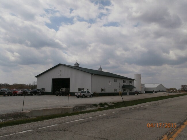
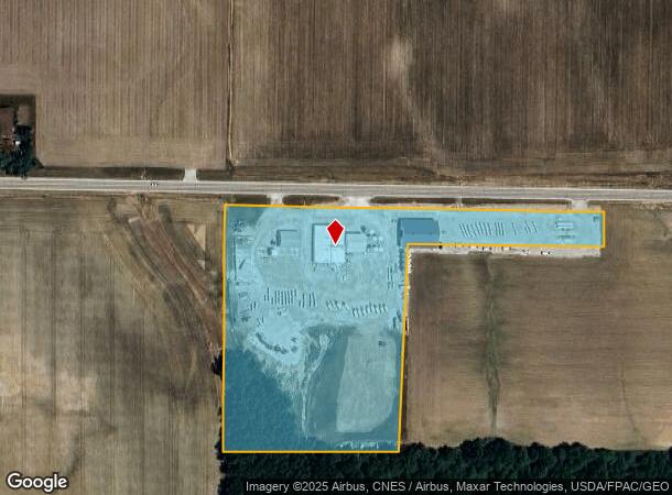
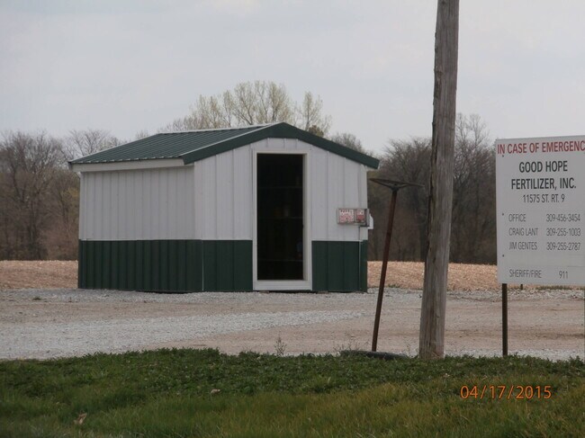
This Property Is For Sale
NEARBY LISTINGS FOR SALE OR LEASE
-
-
View all Good Hope listings for sale on LoopNet.com
Property Detail
11575 State Route 9
Other Market Areas
The Village Of Good Hope
Macomb, IL
S36 T7 R3 W END N SIDE SE
16-000-288-05
Mcdonough
Commercialnec
Illinois
2024
9.05 AC
2024
Illinois North Area
010300
DEMOGRAPHICS near 11575 State Route 9
1 Mile
3 Mile
5 Mile
2024 Total Population
379
540
1,277
2029 Population
353
507
1,213
Pop Growth 2024-2029
(6.86%)
(6.11%)
(5.01%)
Average Age
43
44
42
2024 Total Households
159
224
555
HH Growth 2024-2029
(6.92%)
(6.25%)
(5.41%)
Median Household Inc
$66,818
$68,235
$60,100
Avg Household Size
2.40
2.40
2.30
2024 Avg HH Vehicles
2.00
2.00
2.00
Median Home Value
$155,319
$160,937
$166,386
Median Year Built
1970
1970
1975
Nearby Places
- Restaurants
- Banks
- Shops
- Fitness
- Groceries
PUBLIC TRANSPORTATION
COMMUTER RAIL
Macomb Amtrak Station (Carl Sandburg - Amtrak, Illinois Zephyr - Amtrak)
DRIVE
WALK
Distance
Macomb Amtrak Station (Carl Sandburg - Amtrak, Illinois Zephyr - Amtrak)
9 min
6.7 mi
Freight Ports
Port Milwaukee
DRIVE
WALK
Distance
Port Milwaukee
315 min
279.9 mi
Nearby Properties
Address
Land Use
TOTAL SIZE
Lot Size
Zoning
Address
Land Use
TOTAL SIZE
Lot Size
Zoning
79,985 SF
36.28 AC
Address
Land Use
TOTAL SIZE
Lot Size
Zoning
161.43 AC
Address
Land Use
TOTAL SIZE
Lot Size
Zoning
132.11 AC
Address
Land Use
TOTAL SIZE
Lot Size
Zoning
132.47 AC
Address
Land Use
TOTAL SIZE
Lot Size
Zoning
136.31 AC
Address
Land Use
TOTAL SIZE
Lot Size
Zoning
122.60 AC
Address
Land Use
TOTAL SIZE
Lot Size
Zoning
115.17 AC
Address
Land Use
TOTAL SIZE
Lot Size
Zoning
166.01 AC
Address
Land Use
TOTAL SIZE
Lot Size
Zoning
87.31 AC
Address
Land Use
TOTAL SIZE
Lot Size
Zoning
3.24 AC
Address
Land Use
TOTAL SIZE
Lot Size
Zoning
155.70 AC
Address
Land Use
TOTAL SIZE
Lot Size
Zoning
112.93 AC
Address
Land Use
TOTAL SIZE
Lot Size
Zoning
90.38 AC
Address
Land Use
TOTAL SIZE
Lot Size
Zoning
23.97 AC
Address
Land Use
TOTAL SIZE
Lot Size
Zoning
141.30 AC
Address
Land Use
TOTAL SIZE
Lot Size
Zoning
78.79 AC
Address
Land Use
TOTAL SIZE
Lot Size
Zoning
2.62 AC
Address
Land Use
TOTAL SIZE
Lot Size
Zoning
78.96 AC
Address
Land Use
TOTAL SIZE
Lot Size
Zoning
67.10 AC
Address
Land Use
TOTAL SIZE
Lot Size
Zoning
83.18 AC
Address
Land Use
TOTAL SIZE
Lot Size
Zoning
63.51 AC
Address
Land Use
TOTAL SIZE
Lot Size
Zoning
Address
Land Use
TOTAL SIZE
Lot Size
Zoning
Address
Land Use
TOTAL SIZE
Lot Size
Zoning
Address
Land Use
TOTAL SIZE
Lot Size
Zoning
5.80 AC
Address
Land Use
TOTAL SIZE
Lot Size
Zoning
42.25 AC
Address
Land Use
TOTAL SIZE
Lot Size
Zoning
Address
Land Use
TOTAL SIZE
Lot Size
Zoning
Address
Land Use
TOTAL SIZE
Lot Size
Zoning
93.39 AC
The World's #1 Commercial Real Estate Marketplace
Connect with us
© 2025 CoStar Group
The information above has been obtained from sources believed reliable. While we do not doubt its accuracy we have not verified it and make no guarantee, warranty or representation about it. It is your responsibility to independently confirm its accuracy and completeness. Any projections, opinions, assumptions, or estimates used are for example only and do not represent the current or future performance of the property. The value of this transaction to you depends on tax and other factors which should be evaluated by your tax, financial, and legal advisors. You and your advisors should conduct a careful, independent investigation of the property to determine to your satisfaction the suitability of the property for your needs.