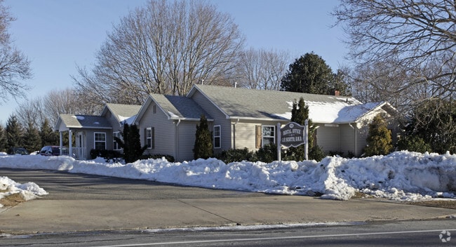
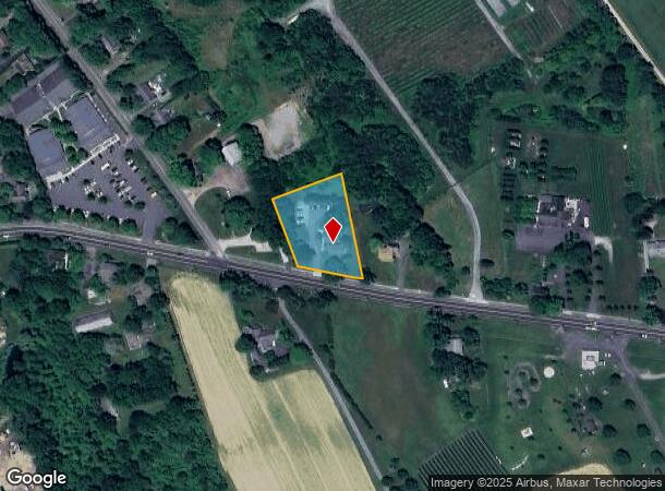
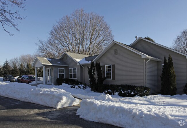
Property Record
1158 Main Rd, Riverhead, NY 11901
NEARBY LISTINGS FOR SALE OR LEASE
-
-
View all Riverhead listings for sale on LoopNet.com
Property Detail
1158 Main Rd
0600-068-00-01-00-010-001
LT LINE MOD DATED 6/24/96 LOT 1
Commercialbuilding
Suffolk
X
New York
36103C0478H
10
2024
1 AC
2024
Eastern Suffolk
170003
Long Island (New York)
2,050 SF
Nassau County-Suffolk County, NY
DEMOGRAPHICS near 1158 Main Rd
1 Mile
3 Mile
5 Mile
2024 Total Population
1,037
9,394
32,077
2029 Population
988
9,237
31,970
Pop Growth 2024-2029
(4.73%)
(1.67%)
(0.33%)
Average Age
46
44
42
2024 Total Households
404
3,411
11,431
HH Growth 2024-2029
(5.20%)
(2.23%)
(0.58%)
Median Household Inc
$131,132
$107,842
$83,395
Avg Household Size
2.50
2.60
2.70
2024 Avg HH Vehicles
2.00
2.00
2.00
Median Home Value
$697,674
$609,225
$498,040
Median Year Built
1968
1978
1979
Nearby Places
- Restaurants
- Banks
- Shops
- Fitness
- Groceries
PUBLIC TRANSPORTATION
COMMUTER RAIL
Riverhead Station (Greenport Branch - Long Island Rail Road)
DRIVE
WALK
Distance
Riverhead Station (Greenport Branch - Long Island Rail Road)
10 min
4.7 mi
Mattituck Station (Greenport Branch - Long Island Rail Road)
DRIVE
WALK
Distance
Mattituck Station (Greenport Branch - Long Island Rail Road)
9 min
5.0 mi
AIRPORT
Long Island MacArthur
DRIVE
WALK
Distance
Long Island MacArthur
52 min
33.3 mi
Freight Ports
Port of New Haven
DRIVE
WALK
Distance
Port of New Haven
155 min
63.8 mi
Nearby Properties
Address
Land Use
TOTAL SIZE
Lot Size
Zoning
Address
Land Use
TOTAL SIZE
Lot Size
Zoning
51.70 AC
R15
Address
Land Use
TOTAL SIZE
Lot Size
Zoning
222 AC
H2O
Address
Land Use
TOTAL SIZE
Lot Size
Zoning
81.70 AC
R60
Address
Land Use
TOTAL SIZE
Lot Size
Zoning
214.30 AC
10
Address
Land Use
TOTAL SIZE
Lot Size
Zoning
113,634 SF
27.49 AC
04
Address
Land Use
TOTAL SIZE
Lot Size
Zoning
28.97 AC
R40
Address
Land Use
TOTAL SIZE
Lot Size
Zoning
14,520 SF
21.20 AC
04
Address
Land Use
TOTAL SIZE
Lot Size
Zoning
274.40 AC
05
Address
Land Use
TOTAL SIZE
Lot Size
Zoning
4.20 AC
R10
Address
Land Use
TOTAL SIZE
Lot Size
Zoning
197.40 AC
OSC
Address
Land Use
TOTAL SIZE
Lot Size
Zoning
149.95 AC
APZ
Address
Land Use
TOTAL SIZE
Lot Size
Zoning
3,964 SF
1.10 AC
R40
Address
Land Use
TOTAL SIZE
Lot Size
Zoning
1,688 SF
34.47 AC
09
Address
Land Use
TOTAL SIZE
Lot Size
Zoning
6,352 SF
2.45 AC
R15
Address
Land Use
TOTAL SIZE
Lot Size
Zoning
5.47 AC
04
Address
Land Use
TOTAL SIZE
Lot Size
Zoning
5,596 SF
0.82 AC
R15
Address
Land Use
TOTAL SIZE
Lot Size
Zoning
5.01 AC
10
Address
Land Use
TOTAL SIZE
Lot Size
Zoning
5,000 SF
1.90 AC
R40
Address
Land Use
TOTAL SIZE
Lot Size
Zoning
227.20 AC
04
Address
Land Use
TOTAL SIZE
Lot Size
Zoning
5.10 AC
R60
Address
Land Use
TOTAL SIZE
Lot Size
Zoning
86.90 AC
03
Address
Land Use
TOTAL SIZE
Lot Size
Zoning
2,137 SF
9.73 AC
04 - FARM
Address
Land Use
TOTAL SIZE
Lot Size
Zoning
4,092 SF
5.21 AC
03
Address
Land Use
TOTAL SIZE
Lot Size
Zoning
15,996 SF
6.05 AC
3
Address
Land Use
TOTAL SIZE
Lot Size
Zoning
5,338 SF
159.30 AC
4
Address
Land Use
TOTAL SIZE
Lot Size
Zoning
1,154 SF
1.71 AC
10
Address
Land Use
TOTAL SIZE
Lot Size
Zoning
172.90 AC
RA80
Address
Land Use
TOTAL SIZE
Lot Size
Zoning
94.60 AC
04
Address
Land Use
TOTAL SIZE
Lot Size
Zoning
700 SF
5 AC
R60
Address
Land Use
TOTAL SIZE
Lot Size
Zoning
2,600 SF
27.30 AC
RB80
The World's #1 Commercial Real Estate Marketplace
Connect with us
© 2025 CoStar Group
The information above has been obtained from sources believed reliable. While we do not doubt its accuracy we have not verified it and make no guarantee, warranty or representation about it. It is your responsibility to independently confirm its accuracy and completeness. Any projections, opinions, assumptions, or estimates used are for example only and do not represent the current or future performance of the property. The value of this transaction to you depends on tax and other factors which should be evaluated by your tax, financial, and legal advisors. You and your advisors should conduct a careful, independent investigation of the property to determine to your satisfaction the suitability of the property for your needs.