Property Record
114 E Main St, Webster, MA 01570
NEARBY LISTINGS FOR SALE OR LEASE
Property Detail
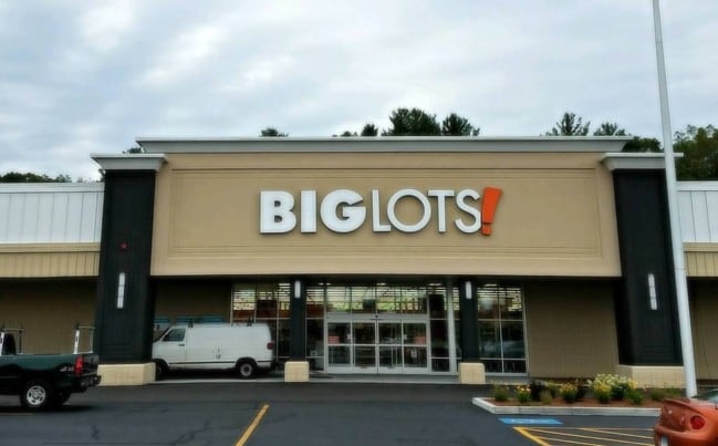
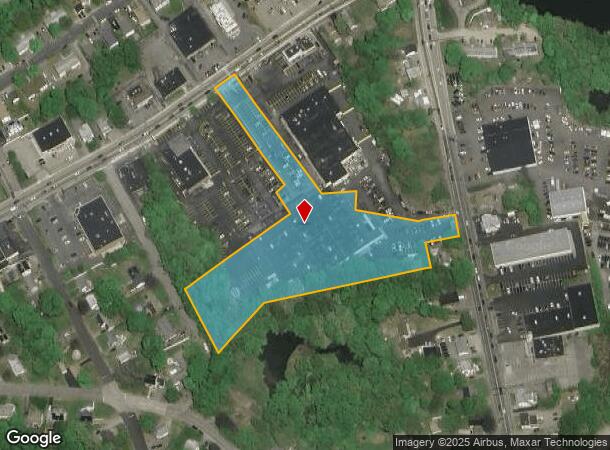
114 E Main St
Departmentstore
Worcester
X
Massachusetts
09015C0065F
4.09 AC
2025
Outlying Worcester
2025
Boston
754200
Worcester, MA
60,233 SF
WEBS-000025-E000000-000004
DEMOGRAPHICS near 114 E Main St
1 Mile
3 Mile
5 Mile
2024 Total Population
7,476
27,001
43,100
2029 Population
7,374
26,834
42,892
Pop Growth 2024-2029
(1.36%)
(0.62%)
(0.48%)
Average Age
41
43
42
2024 Total Households
3,384
11,356
17,331
HH Growth 2024-2029
(1.39%)
(0.65%)
(0.52%)
Median Household Inc
$51,939
$73,877
$85,933
Avg Household Size
2.20
2.30
2.40
2024 Avg HH Vehicles
2.00
2.00
2.00
Median Home Value
$259,979
$316,258
$324,970
Median Year Built
1951
1963
1967
Nearby Places
Map Layers
Map Styles
 Street
 Aerial
- Restaurants
- Banks
- Shops
- Fitness
- Groceries
PUBLIC TRANSPORTATION
AIRPORT
Worcester Regional
DRIVE
WALK
Distance
Worcester Regional
31 min
17.9 mi
Freight Ports
Port of Boston
DRIVE
WALK
Distance
Port of Boston
76 min
57.0 mi
SALE & LEASE HISTORY
LISTING DATE
SALE/LEASE

Sep 26, 2016
For Lease
Nearby Properties
Address
Land Use
TOTAL SIZE
Lot Size
Zoning
Address
Land Use
TOTAL SIZE
Lot Size
Zoning
60.14 AC
Address
Land Use
TOTAL SIZE
Lot Size
Zoning
95,274 SF
10.18 AC
Address
Land Use
TOTAL SIZE
Lot Size
Zoning
187,396 SF
90.39 AC
Address
Land Use
TOTAL SIZE
Lot Size
Zoning
34 AC
LI
Address
Land Use
TOTAL SIZE
Lot Size
Zoning
9.05 AC
INDUST
Address
Land Use
TOTAL SIZE
Lot Size
Zoning
131,686 SF
14.60 AC
INDUST
Address
Land Use
TOTAL SIZE
Lot Size
Zoning
13.22 AC
INDUST
Address
Land Use
TOTAL SIZE
Lot Size
Zoning
175,000 SF
10.01 AC
LI
Address
Land Use
TOTAL SIZE
Lot Size
Zoning
4.87 AC
INDUST
Address
Land Use
TOTAL SIZE
Lot Size
Zoning
20.31 AC
INDUST
Address
Land Use
TOTAL SIZE
Lot Size
Zoning
10.09 AC
Address
Land Use
TOTAL SIZE
Lot Size
Zoning
101,227 SF
8.48 AC
Address
Land Use
TOTAL SIZE
Lot Size
Zoning
2.15 AC
GB-4 W
Address
Land Use
TOTAL SIZE
Lot Size
Zoning
102,704 SF
31 AC
GB-4 W
Address
Land Use
TOTAL SIZE
Lot Size
Zoning
164,660 SF
15.40 AC
INDUST
Address
Land Use
TOTAL SIZE
Lot Size
Zoning
Address
Land Use
TOTAL SIZE
Lot Size
Zoning
123,910 SF
10 AC
INDUST
Address
Land Use
TOTAL SIZE
Lot Size
Zoning
60 AC
INDUST
Address
Land Use
TOTAL SIZE
Lot Size
Zoning
52,677 SF
15.17 AC
Address
Land Use
TOTAL SIZE
Lot Size
Zoning
3,600 SF
9.52 AC
GB
Address
Land Use
TOTAL SIZE
Lot Size
Zoning
8.96 AC
GB-5 W
Address
Land Use
TOTAL SIZE
Lot Size
Zoning
54,273 SF
8.94 AC
INDUST
Address
Land Use
TOTAL SIZE
Lot Size
Zoning
3.60 AC
Address
Land Use
TOTAL SIZE
Lot Size
Zoning
21,111 SF
1.71 AC
GB-4 W
Address
Land Use
TOTAL SIZE
Lot Size
Zoning
37,907 SF
28.50 AC
Address
Land Use
TOTAL SIZE
Lot Size
Zoning
18.60 AC
GB-5 W
Address
Land Use
TOTAL SIZE
Lot Size
Zoning
5.24 AC
GB-4 W
Address
Land Use
TOTAL SIZE
Lot Size
Zoning
33,063 SF
1.96 AC
Address
Land Use
TOTAL SIZE
Lot Size
Zoning
6.08 AC
MR-12,
Address
Land Use
TOTAL SIZE
Lot Size
Zoning
4.60 AC
I
The World's #1 Commercial Real Estate Marketplace
Connect with us
© 2026 CoStar Group
The information above has been obtained from sources believed reliable. While we do not doubt its accuracy we have not verified it and make no guarantee, warranty or representation about it. It is your responsibility to independently confirm its accuracy and completeness. Any projections, opinions, assumptions, or estimates used are for example only and do not represent the current or future performance of the property. The value of this transaction to you depends on tax and other factors which should be evaluated by your tax, financial, and legal advisors. You and your advisors should conduct a careful, independent investigation of the property to determine to your satisfaction the suitability of the property for your needs.