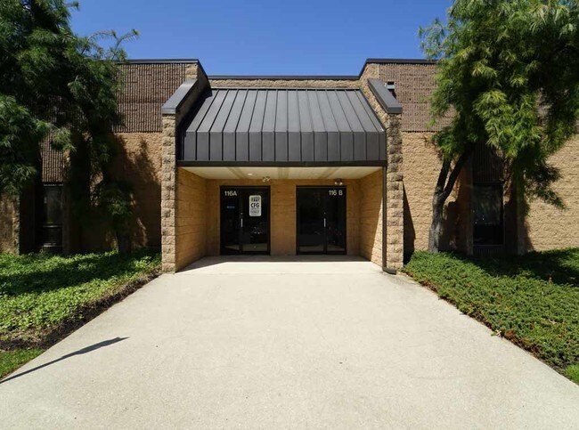
Property Record
116 Burrs Rd, Westampton, NJ 08060

Property Detail
116 Burrs Rd
Philadelphia-Camden-Wilmington, PA-NJ-DE-MD
Burlington
37-00906-07-00006
New Jersey
Warehouse
6
B and X Area of moderate flood hazard, usually the area between the limits of the 100-year and 500-year floods.
6.42 AC
2024
Burlington
2025
Philadelphia
702702
NEARBY LISTINGS FOR SALE OR LEASE
DEMOGRAPHICS near 116 Burrs Rd
1 mile
3 mile
5 mile
2025 Total Population
2,479
34,529
118,735
2030 Population
2,524
35,810
122,488
Pop Growth 2025-2030
+ 1.82%
+ 3.71%
+ 3.16%
Average Age
42
41
42
2025 Total Households
879
12,853
44,548
HH Growth 2025-2030
+ 1.82%
+ 4.03%
+ 3.32%
Median Household Inc
$130,322
$103,837
$100,622
Avg Household Size
2.80
2.60
2.60
2025 Avg HH Vehicles
2.00
2.00
2.00
Median Home Value
$386,153
$331,203
$329,191
Median Year Built
1984
1978
1974
Nearby Places
Map Layers
Map Styles
 Street
 Aerial
Layers
 Traffic
 Biking
Places
Listings with unknown addresses are not visible on the map
- Restaurants
- Banks
- Shops
- Fitness
- Groceries
PUBLIC TRANSPORTATION
COMMUTER RAIL
Bristol (R7 - Southeastern Pennsylvania Transportation Authority Regional Rail (SEPTA Regional Rail))
Drive
Walk
Distance
Bristol (R7 - Southeastern Pennsylvania Transportation Authority Regional Rail (SEPTA Regional Rail))
15 min
8.7 mi
Croydon (R7 - Southeastern Pennsylvania Transportation Authority Regional Rail (SEPTA Regional Rail))
Drive
Walk
Distance
Croydon (R7 - Southeastern Pennsylvania Transportation Authority Regional Rail (SEPTA Regional Rail))
16 min
9.2 mi
AIRPORT
Trenton Mercer
Drive
Walk
Distance
Trenton Mercer
37 min
25.0 mi
Philadelphia International
Drive
Walk
Distance
Philadelphia International
48 min
32.6 mi
Freight Ports
Port of Philadelphia
Drive
Walk
Distance
Port of Philadelphia
31 min
22.7 mi
SALE & LEASE HISTORY
LISTING DATE
SALE/LEASE

Sep 24, 2016
For Lease
Nov 30, 2018
For Lease
Jul 16, 2024
For Lease
Nearby Properties
Address
Land Use
TOTAL SIZE
Lot Size
Zoning
Address
Land Use
TOTAL SIZE
Lot Size
Zoning
3.10 AC
OB
Address
Land Use
TOTAL SIZE
Lot Size
Zoning
2,614 SF
55.41 AC
R40
Address
Land Use
TOTAL SIZE
Lot Size
Zoning
86.67 AC
R-5
Address
Land Use
TOTAL SIZE
Lot Size
Zoning
97,993 SF
63.75 AC
Address
Land Use
TOTAL SIZE
Lot Size
Zoning
30.76 AC
R-9
Address
Land Use
TOTAL SIZE
Lot Size
Zoning
100 AC
R-5
Address
Land Use
TOTAL SIZE
Lot Size
Zoning
19.38 AC
R1
Address
Land Use
TOTAL SIZE
Lot Size
Zoning
58.39 AC
B-2
Address
Land Use
TOTAL SIZE
Lot Size
Zoning
6.59 AC
GS
Address
Land Use
TOTAL SIZE
Lot Size
Zoning
0.52 AC
GS
Address
Land Use
TOTAL SIZE
Lot Size
Zoning
18.77 AC
Address
Land Use
TOTAL SIZE
Lot Size
Zoning
11.82 AC
R-5
Address
Land Use
TOTAL SIZE
Lot Size
Zoning
2,704 SF
28.75 AC
Address
Land Use
TOTAL SIZE
Lot Size
Zoning
308 SF
24.29 AC
BLI1
Address
Land Use
TOTAL SIZE
Lot Size
Zoning
190,000 SF
22.17 AC
Address
Land Use
TOTAL SIZE
Lot Size
Zoning
266,966 SF
39.90 AC
I-1
Address
Land Use
TOTAL SIZE
Lot Size
Zoning
217,986 SF
39.89 AC
I-1
Address
Land Use
TOTAL SIZE
Lot Size
Zoning
12.90 AC
Address
Land Use
TOTAL SIZE
Lot Size
Zoning
20.52 AC
RH
Address
Land Use
TOTAL SIZE
Lot Size
Zoning
302,372 SF
15.05 AC
Address
Land Use
TOTAL SIZE
Lot Size
Zoning
28 AC
B3
Address
Land Use
TOTAL SIZE
Lot Size
Zoning
150,480 SF
10.12 AC
Address
Land Use
TOTAL SIZE
Lot Size
Zoning
23.33 AC
B2
Address
Land Use
TOTAL SIZE
Lot Size
Zoning
17.63 AC
R-1
Address
Land Use
TOTAL SIZE
Lot Size
Zoning
300,609 SF
16.07 AC
I
Address
Land Use
TOTAL SIZE
Lot Size
Zoning
15.60 AC
RH
Address
Land Use
TOTAL SIZE
Lot Size
Zoning
115,000 SF
14.13 AC
C
Address
Land Use
TOTAL SIZE
Lot Size
Zoning
15 AC
R2
Address
Land Use
TOTAL SIZE
Lot Size
Zoning
15.64 AC
I2
Address
Land Use
TOTAL SIZE
Lot Size
Zoning
21.38 AC
R-1
The World's #1 Commercial Real Estate Marketplace
Connect with us
© 2026 CoStar Group
The information above has been obtained from sources believed reliable. While we do not doubt its accuracy we have not verified it and make no guarantee, warranty or representation about it. It is your responsibility to independently confirm its accuracy and completeness. Any projections, opinions, assumptions, or estimates used are for example only and do not represent the current or future performance of the property. The value of this transaction to you depends on tax and other factors which should be evaluated by your tax, financial, and legal advisors. You and your advisors should conduct a careful, independent investigation of the property to determine to your satisfaction the suitability of the property for your needs.