Property Record
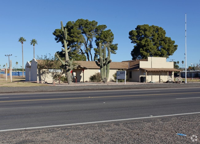
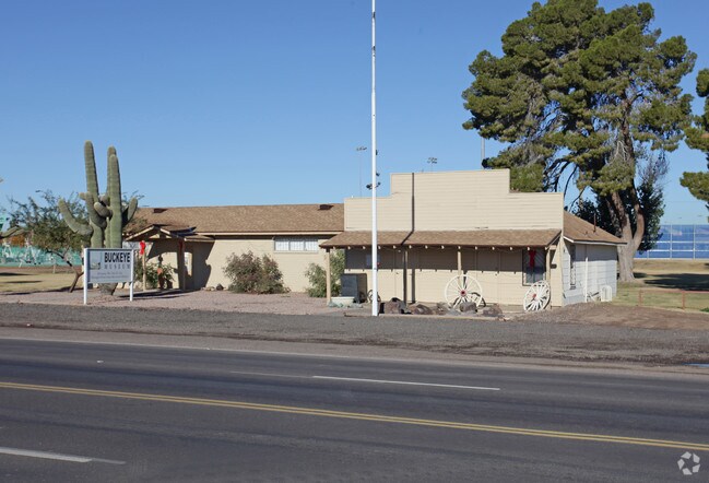
116 E Us Highway 85, Buckeye, AZ 85326

Property Detail
116 E Us Highway 85
400-23-039B
TH PT W2 SE4 NE4 LY N OF U S H/W 80 EX N 330F TH/OF & EX RD & EX POR NE4 SEC 5 DAF COM INT 9TH ST & EASON AVE (RECORD LONG ST) MCR 20-28 TH E 97.92F TO POB TH CONT E 351.19F TH S 01D 51M W 201.11F TH S 88D 8M E 17.56F TH S 1D 49M W 131.26F TH N 88D 8
Municipalproperty
Maricopa
SU
Arizona
C and X Area of minimal flood hazard, usually depicted on FIRMs as above the 500-year flood level.
8.06 AC
2025
South Buckeye
2025
Phoenix
050702
Phoenix-Mesa-Chandler, AZ
10,815 SF
NEARBY LISTINGS FOR SALE OR LEASE
DEMOGRAPHICS near 116 E Us Highway 85
1 mile
3 mile
5 mile
2025 Total Population
5,903
29,981
50,729
2030 Population
6,177
31,924
53,879
Pop Growth 2025-2030
+ 4.64%
+ 6.48%
+ 6.21%
Average Age
37
34
35
2025 Total Households
1,980
8,939
15,099
HH Growth 2025-2030
+ 4.55%
+ 6.52%
+ 6.31%
Median Household Inc
$63,861
$86,930
$89,310
Avg Household Size
2.90
3.30
3.30
2025 Avg HH Vehicles
2.00
2.00
2.00
Median Home Value
$312,604
$361,143
$369,437
Median Year Built
1986
2007
2007
Nearby Places
Map Layers
Map Styles
 Street
 Aerial
Layers
 Traffic
 Biking
Places
Listings with unknown addresses are not visible on the map
- Restaurants
- Banks
- Shops
- Fitness
- Groceries
PUBLIC TRANSPORTATION
AIRPORT
Phoenix Sky Harbor International
Drive
Walk
Distance
Phoenix Sky Harbor International
55 min
40.5 mi
Nearby Properties
Address
Land Use
TOTAL SIZE
Lot Size
Zoning
Address
Land Use
TOTAL SIZE
Lot Size
Zoning
2,310,631 SF
215.58 AC
Address
Land Use
TOTAL SIZE
Lot Size
Zoning
1,207,360 SF
67.69 AC
Address
Land Use
TOTAL SIZE
Lot Size
Zoning
13.35 AC
Address
Land Use
TOTAL SIZE
Lot Size
Zoning
1,834,456 SF
142.44 AC
C-G
Address
Land Use
TOTAL SIZE
Lot Size
Zoning
11.14 AC
Address
Land Use
TOTAL SIZE
Lot Size
Zoning
3,494 SF
6.20 AC
GC
Address
Land Use
TOTAL SIZE
Lot Size
Zoning
510,427 SF
64.69 AC
GC
Address
Land Use
TOTAL SIZE
Lot Size
Zoning
290,752 SF
21.32 AC
SU
Address
Land Use
TOTAL SIZE
Lot Size
Zoning
78,774 SF
7.57 AC
PUD
Address
Land Use
TOTAL SIZE
Lot Size
Zoning
122,714 SF
12.27 AC
C-C
Address
Land Use
TOTAL SIZE
Lot Size
Zoning
68,255 SF
3.16 AC
PUD
Address
Land Use
TOTAL SIZE
Lot Size
Zoning
85,712 SF
15.18 AC
PR
Address
Land Use
TOTAL SIZE
Lot Size
Zoning
228,652 SF
136.91 AC
SU
Address
Land Use
TOTAL SIZE
Lot Size
Zoning
60,201 SF
14.10 AC
PUD
Address
Land Use
TOTAL SIZE
Lot Size
Zoning
125,120 SF
8.49 AC
SU
Address
Land Use
TOTAL SIZE
Lot Size
Zoning
181,308 SF
20.19 AC
C-G
Address
Land Use
TOTAL SIZE
Lot Size
Zoning
20,248 SF
23.16 AC
SU
Address
Land Use
TOTAL SIZE
Lot Size
Zoning
3.10 AC
Address
Land Use
TOTAL SIZE
Lot Size
Zoning
178,939 SF
13.98 AC
CC
Address
Land Use
TOTAL SIZE
Lot Size
Zoning
150,139 SF
20.48 AC
C-G
Address
Land Use
TOTAL SIZE
Lot Size
Zoning
136,836 SF
8.85 AC
R-R
Address
Land Use
TOTAL SIZE
Lot Size
Zoning
53.11 AC
C-G
Address
Land Use
TOTAL SIZE
Lot Size
Zoning
40,859 SF
6.92 AC
PUD
Address
Land Use
TOTAL SIZE
Lot Size
Zoning
24,119 SF
5.13 AC
CC
Address
Land Use
TOTAL SIZE
Lot Size
Zoning
32,567 SF
7.38 AC
PR
Address
Land Use
TOTAL SIZE
Lot Size
Zoning
16,502 SF
2.26 AC
C-C
Address
Land Use
TOTAL SIZE
Lot Size
Zoning
36,051 SF
46 AC
R-R
Address
Land Use
TOTAL SIZE
Lot Size
Zoning
15,452 SF
6.50 AC
C-G
Address
Land Use
TOTAL SIZE
Lot Size
Zoning
21,000 SF
3.66 AC
C-C
The World's #1 Commercial Real Estate Marketplace
Connect with us
© 2026 CoStar Group
The information above has been obtained from sources believed reliable. While we do not doubt its accuracy we have not verified it and make no guarantee, warranty or representation about it. It is your responsibility to independently confirm its accuracy and completeness. Any projections, opinions, assumptions, or estimates used are for example only and do not represent the current or future performance of the property. The value of this transaction to you depends on tax and other factors which should be evaluated by your tax, financial, and legal advisors. You and your advisors should conduct a careful, independent investigation of the property to determine to your satisfaction the suitability of the property for your needs.