Property Record
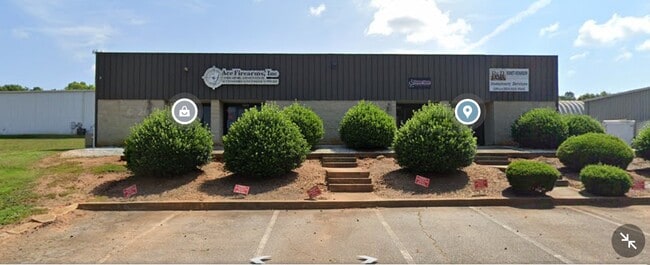
140 Kay Dr, Easley, SC 29640


Property Detail
140 Kay Dr
5049-14-34-7232
E/SIDE KAY DR, CALHOUN MEM HWY 123 PLAT 59/113A,113B, PLAT 304/6B, PLAT 439/17 PLAT 532/18 PLAT 603/266
Officebuilding
PICKENS
B and X Area of moderate flood hazard, usually the area between the limits of the 100-year and 500-year floods.
South Carolina
2025
8.80 AC
2025
Outlying Pickens County
010604
Greenville/Spartanburg
6,000 SF
Greenville-Anderson-Greer, SC
NEARBY LISTINGS FOR SALE OR LEASE
DEMOGRAPHICS near 140 Kay Dr
1 mile
3 mile
5 mile
2025 Total Population
1,193
20,670
73,786
2030 Population
1,246
21,608
78,124
Pop Growth 2025-2030
+ 4.44%
+ 4.54%
+ 5.88%
Average Age
41
42
40
2025 Total Households
492
8,323
29,003
HH Growth 2025-2030
+ 4.67%
+ 4.77%
+ 6.10%
Median Household Inc
$55,211
$62,568
$61,221
Avg Household Size
2.40
2.40
2.50
2025 Avg HH Vehicles
2.00
2.00
2.00
Median Home Value
$202,542
$254,668
$252,095
Median Year Built
1994
1992
1989
Nearby Places
Map Layers
Map Styles
 Street
 Aerial
Transit
 Traffic
 Biking
Places
Listings with unknown addresses are not visible on the map
- Restaurants
- Banks
- Shops
- Fitness
- Groceries
PUBLIC TRANSPORTATION
COMMUTER RAIL
Greenville Amtrak Station (Crescent - Amtrak)
Drive
Walk
Distance
Greenville Amtrak Station (Crescent - Amtrak)
15 min
7.3 mi
AIRPORT
Greenville Spartanburg International
Drive
Walk
Distance
Greenville Spartanburg International
35 min
21.5 mi
Freight Ports
North Charleston Terminal
Drive
Walk
Distance
North Charleston Terminal
240 min
211.0 mi
SALE & LEASE HISTORY
LISTING DATE
SALE/LEASE

Nov 15, 2022
For Lease
Nearby Properties
Address
Land Use
TOTAL SIZE
Lot Size
Zoning
Address
Land Use
TOTAL SIZE
Lot Size
Zoning
19,164 SF
3.22 AC
GC
Address
Land Use
TOTAL SIZE
Lot Size
Zoning
16.29 AC
GENERAL CO
Address
Land Use
TOTAL SIZE
Lot Size
Zoning
4,200 SF
0.98 AC
GC
Address
Land Use
TOTAL SIZE
Lot Size
Zoning
13.75 AC
GC
Address
Land Use
TOTAL SIZE
Lot Size
Zoning
5,427 SF
1.34 AC
Address
Land Use
TOTAL SIZE
Lot Size
Zoning
49,803 SF
18.36 AC
GC
Address
Land Use
TOTAL SIZE
Lot Size
Zoning
5,321 SF
3.38 AC
Address
Land Use
TOTAL SIZE
Lot Size
Zoning
36.37 AC
Address
Land Use
TOTAL SIZE
Lot Size
Zoning
72.10 AC
RS
Address
Land Use
TOTAL SIZE
Lot Size
Zoning
3.98 AC
NEIGHBORHO
Address
Land Use
TOTAL SIZE
Lot Size
Zoning
1,621 SF
50.70 AC
RS
Address
Land Use
TOTAL SIZE
Lot Size
Zoning
8.96 AC
R 10 ONE F
Address
Land Use
TOTAL SIZE
Lot Size
Zoning
187,150 SF
19.38 AC
GC
Address
Land Use
TOTAL SIZE
Lot Size
Zoning
21,258 SF
15 AC
GR2
Address
Land Use
TOTAL SIZE
Lot Size
Zoning
7.30 AC
R 10 ONE F
Address
Land Use
TOTAL SIZE
Lot Size
Zoning
135,439 SF
13.80 AC
GC
Address
Land Use
TOTAL SIZE
Lot Size
Zoning
140,718 SF
18.32 AC
PUD
Address
Land Use
TOTAL SIZE
Lot Size
Zoning
41.39 AC
Address
Land Use
TOTAL SIZE
Lot Size
Zoning
54.93 AC
GC
Address
Land Use
TOTAL SIZE
Lot Size
Zoning
16,494 SF
4.66 AC
GR2
Address
Land Use
TOTAL SIZE
Lot Size
Zoning
2 AC
GC
Address
Land Use
TOTAL SIZE
Lot Size
Zoning
3,668 SF
6.59 AC
Address
Land Use
TOTAL SIZE
Lot Size
Zoning
1.84 AC
LI
Address
Land Use
TOTAL SIZE
Lot Size
Zoning
3,200 SF
1.86 AC
GENERAL CO
Address
Land Use
TOTAL SIZE
Lot Size
Zoning
16,290 SF
4.68 AC
Address
Land Use
TOTAL SIZE
Lot Size
Zoning
18,777 SF
6.53 AC
GC
Address
Land Use
TOTAL SIZE
Lot Size
Zoning
34,254 SF
9.87 AC
Address
Land Use
TOTAL SIZE
Lot Size
Zoning
64,354 SF
4.57 AC
GC
Address
Land Use
TOTAL SIZE
Lot Size
Zoning
10,000 SF
2.10 AC
Address
Land Use
TOTAL SIZE
Lot Size
Zoning
60,480 SF
4 AC
GC
The World's #1 Commercial Real Estate Marketplace
Connect with us
© 2026 CoStar Group
The information above has been obtained from sources believed reliable. While we do not doubt its accuracy we have not verified it and make no guarantee, warranty or representation about it. It is your responsibility to independently confirm its accuracy and completeness. Any projections, opinions, assumptions, or estimates used are for example only and do not represent the current or future performance of the property. The value of this transaction to you depends on tax and other factors which should be evaluated by your tax, financial, and legal advisors. You and your advisors should conduct a careful, independent investigation of the property to determine to your satisfaction the suitability of the property for your needs.