Property Record
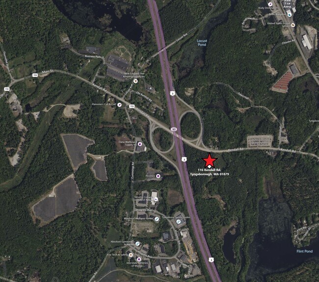
116 Kendall Rd, Tyngsboro, MA 01879
NEARBY LISTINGS FOR SALE OR LEASE
Property Detail
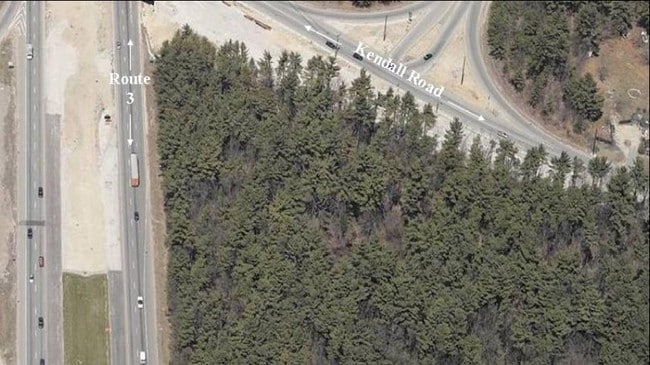
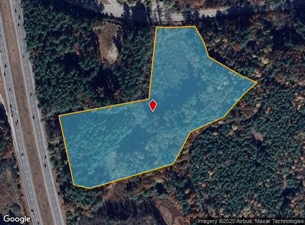
116 Kendall Rd
TYNG-000013-000003
Middlesex
Industrialacreage
Massachusetts
A
11.22 AC
25017C0112F
Groton/Townsend
2025
Boston
2025
Boston-Cambridge-Newton, MA-NH
313102
DEMOGRAPHICS near 116 Kendall Rd
1 Mile
3 Mile
5 Mile
2024 Total Population
887
24,970
89,233
2029 Population
881
25,131
89,562
Pop Growth 2024-2029
(0.68%)
+ 0.64%
+ 0.37%
Average Age
42
41
42
2024 Total Households
347
10,525
34,127
HH Growth 2024-2029
(0.86%)
+ 0.73%
+ 0.34%
Median Household Inc
$117,307
$106,072
$108,687
Avg Household Size
2.50
2.30
2.60
2024 Avg HH Vehicles
2.00
2.00
2.00
Median Home Value
$457,999
$464,504
$433,184
Median Year Built
1999
1986
1981
Nearby Places
Map Layers
Map Styles
 Street
 Aerial
- Restaurants
- Banks
- Shops
- Fitness
- Groceries
PUBLIC TRANSPORTATION
COMMUTER RAIL
Lowell (Lowell Line - Massachusetts Bay Transportation Authority Commuter Rail (Purple Line))
DRIVE
WALK
Distance
Lowell (Lowell Line - Massachusetts Bay Transportation Authority Commuter Rail (Purple Line))
15 min
8.4 mi
AIRPORT
Manchester Boston Regional
DRIVE
WALK
Distance
Manchester Boston Regional
31 min
21.4 mi
Freight Ports
Port of Boston
DRIVE
WALK
Distance
Port of Boston
57 min
42.4 mi
SALE & LEASE HISTORY
LISTING DATE
SALE/LEASE

Sep 24, 2016
For Sale
Nov 14, 2018
For Sale
May 16, 2019
For Sale
Feb 03, 2023
For Sale
Nearby Properties
Address
Land Use
TOTAL SIZE
Lot Size
Zoning
Address
Land Use
TOTAL SIZE
Lot Size
Zoning
38.17 AC
RC
Address
Land Use
TOTAL SIZE
Lot Size
Zoning
29.77 AC
RC
Address
Land Use
TOTAL SIZE
Lot Size
Zoning
80.11 AC
PI
Address
Land Use
TOTAL SIZE
Lot Size
Zoning
20.72 AC
RC
Address
Land Use
TOTAL SIZE
Lot Size
Zoning
15.19 AC
RC
Address
Land Use
TOTAL SIZE
Lot Size
Zoning
118.50 AC
PI
Address
Land Use
TOTAL SIZE
Lot Size
Zoning
20.80 AC
RC
Address
Land Use
TOTAL SIZE
Lot Size
Zoning
303,508 SF
171.19 AC
G1
Address
Land Use
TOTAL SIZE
Lot Size
Zoning
206,913 SF
18.30 AC
GB
Address
Land Use
TOTAL SIZE
Lot Size
Zoning
15.16 AC
GI
Address
Land Use
TOTAL SIZE
Lot Size
Zoning
52.45 AC
R18
Address
Land Use
TOTAL SIZE
Lot Size
Zoning
21.40 AC
RC
Address
Land Use
TOTAL SIZE
Lot Size
Zoning
127,494 SF
9.09 AC
GB
Address
Land Use
TOTAL SIZE
Lot Size
Zoning
199.97 AC
B2
Address
Land Use
TOTAL SIZE
Lot Size
Zoning
21.17 AC
RC
Address
Land Use
TOTAL SIZE
Lot Size
Zoning
8.09 AC
RC
Address
Land Use
TOTAL SIZE
Lot Size
Zoning
154,620 SF
8.63 AC
GB
Address
Land Use
TOTAL SIZE
Lot Size
Zoning
146,536 SF
7.45 AC
GB
Address
Land Use
TOTAL SIZE
Lot Size
Zoning
12.57 AC
RC
Address
Land Use
TOTAL SIZE
Lot Size
Zoning
144,018 SF
13.89 AC
PI
Address
Land Use
TOTAL SIZE
Lot Size
Zoning
233,668 SF
16.83 AC
PI
Address
Land Use
TOTAL SIZE
Lot Size
Zoning
45.10 AC
R1
Address
Land Use
TOTAL SIZE
Lot Size
Zoning
161,790 SF
9 AC
PI
Address
Land Use
TOTAL SIZE
Lot Size
Zoning
8.30 AC
B3
Address
Land Use
TOTAL SIZE
Lot Size
Zoning
135,324 SF
70.07 AC
R1
Address
Land Use
TOTAL SIZE
Lot Size
Zoning
56,460 SF
5.81 AC
GB
Address
Land Use
TOTAL SIZE
Lot Size
Zoning
90,463 SF
8.56 AC
RA
Address
Land Use
TOTAL SIZE
Lot Size
Zoning
120,888 SF
11.78 AC
HB
Address
Land Use
TOTAL SIZE
Lot Size
Zoning
149,960 SF
7.85 AC
GB
The World's #1 Commercial Real Estate Marketplace
Connect with us
© 2025 CoStar Group
The information above has been obtained from sources believed reliable. While we do not doubt its accuracy we have not verified it and make no guarantee, warranty or representation about it. It is your responsibility to independently confirm its accuracy and completeness. Any projections, opinions, assumptions, or estimates used are for example only and do not represent the current or future performance of the property. The value of this transaction to you depends on tax and other factors which should be evaluated by your tax, financial, and legal advisors. You and your advisors should conduct a careful, independent investigation of the property to determine to your satisfaction the suitability of the property for your needs.