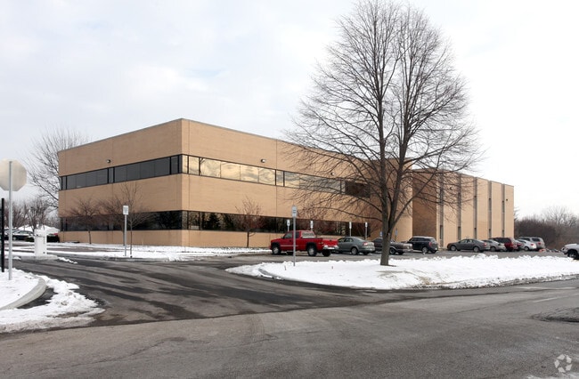
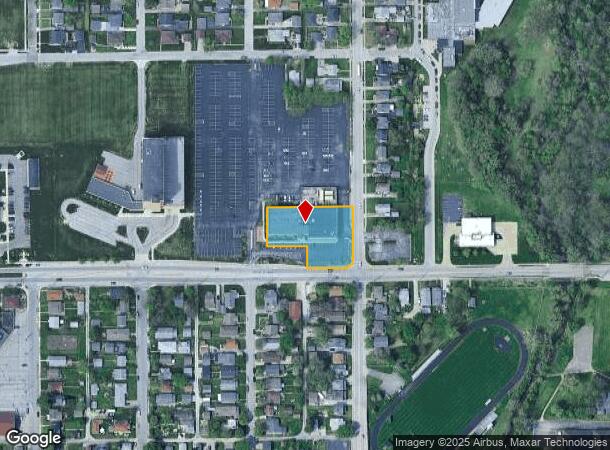
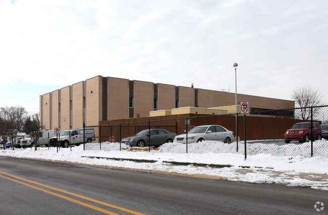
Property Record
116 N 13Th Ave, Beech Grove, IN 46107
NEARBY LISTINGS FOR SALE OR LEASE
Property Detail
116 N 13Th Ave
Indianapolis-Carmel-Anderson, IN
Beech Grove Sec C Pt
49-10-21-126-008.000-102
BEECH GROVE SEC C PT L2 THRU L4 & L17 THRUL20 B105 258.5FT SL X 117FT EL BEG 69.5FT NOF SE COR L1 B105
Charitableorganization
Marion
X
Indiana
18097C0251F
2
0
0.67 AC
2024
Beech Grove/SE County
380404
Indianapolis
53,142 SF
DEMOGRAPHICS near 116 N 13Th Ave
1 Mile
3 Mile
5 Mile
2024 Total Population
9,644
85,682
236,110
2029 Population
9,440
85,058
235,326
Pop Growth 2024-2029
(2.12%)
(0.73%)
(0.33%)
Average Age
41
37
37
2024 Total Households
3,958
33,813
97,184
HH Growth 2024-2029
(2.25%)
(0.82%)
(0.31%)
Median Household Inc
$61,311
$53,029
$58,631
Avg Household Size
2.40
2.40
2.30
2024 Avg HH Vehicles
2.00
2.00
2.00
Median Home Value
$137,003
$147,995
$177,197
Median Year Built
1956
1960
1962
Nearby Places
Map Layers
Map Styles
 Street
 Aerial
- Restaurants
- Banks
- Shops
- Fitness
- Groceries
PUBLIC TRANSPORTATION
COMMUTER RAIL
DRIVE
WALK
Distance
9 min
5.0 mi
AIRPORT
Indianapolis International
DRIVE
WALK
Distance
Indianapolis International
29 min
15.8 mi
Nearby Properties
Address
Land Use
TOTAL SIZE
Lot Size
Zoning
Address
Land Use
TOTAL SIZE
Lot Size
Zoning
41.83 AC
ZO01
Address
Land Use
TOTAL SIZE
Lot Size
Zoning
1,202,700 SF
77.25 AC
ZO01
Address
Land Use
TOTAL SIZE
Lot Size
Zoning
19,927 SF
28.82 AC
ZO01
Address
Land Use
TOTAL SIZE
Lot Size
Zoning
9,888 SF
124.20 AC
ZO01
Address
Land Use
TOTAL SIZE
Lot Size
Zoning
80,348 SF
2.95 AC
ZO01
Address
Land Use
TOTAL SIZE
Lot Size
Zoning
3.82 AC
ZO01
Address
Land Use
TOTAL SIZE
Lot Size
Zoning
405,664 SF
35.56 AC
ZO01
Address
Land Use
TOTAL SIZE
Lot Size
Zoning
51,196 SF
50.61 AC
ZO01
Address
Land Use
TOTAL SIZE
Lot Size
Zoning
352,000 SF
22.72 AC
ZO01
Address
Land Use
TOTAL SIZE
Lot Size
Zoning
3,003 SF
3.52 AC
ZO01
Address
Land Use
TOTAL SIZE
Lot Size
Zoning
1,660 SF
15.01 AC
ZO01
Address
Land Use
TOTAL SIZE
Lot Size
Zoning
2,331 SF
1.38 AC
ZO01
Address
Land Use
TOTAL SIZE
Lot Size
Zoning
405 SF
23.81 AC
ZO01
Address
Land Use
TOTAL SIZE
Lot Size
Zoning
2,486 SF
13.75 AC
ZO01
Address
Land Use
TOTAL SIZE
Lot Size
Zoning
3,280 SF
1.04 AC
ZO01
Address
Land Use
TOTAL SIZE
Lot Size
Zoning
4,179 SF
28.11 AC
ZO01
Address
Land Use
TOTAL SIZE
Lot Size
Zoning
4,212 SF
16 AC
Address
Land Use
TOTAL SIZE
Lot Size
Zoning
208,224 SF
23.41 AC
ZO01
Address
Land Use
TOTAL SIZE
Lot Size
Zoning
4,872 SF
12.37 AC
Address
Land Use
TOTAL SIZE
Lot Size
Zoning
1,575 SF
10.24 AC
Address
Land Use
TOTAL SIZE
Lot Size
Zoning
1,040 SF
15.62 AC
ZO01
Address
Land Use
TOTAL SIZE
Lot Size
Zoning
9,160 SF
2.54 AC
ZO01
Address
Land Use
TOTAL SIZE
Lot Size
Zoning
101,122 SF
16.44 AC
Address
Land Use
TOTAL SIZE
Lot Size
Zoning
38,598 SF
2.83 AC
ZO01
Address
Land Use
TOTAL SIZE
Lot Size
Zoning
209,756 SF
12.33 AC
ZO01
Address
Land Use
TOTAL SIZE
Lot Size
Zoning
87,807 SF
9.04 AC
ZO01
Address
Land Use
TOTAL SIZE
Lot Size
Zoning
151,946 SF
15.04 AC
Address
Land Use
TOTAL SIZE
Lot Size
Zoning
121,055 SF
12.71 AC
ZO01
Address
Land Use
TOTAL SIZE
Lot Size
Zoning
20,944 SF
8.27 AC
ZO01
Address
Land Use
TOTAL SIZE
Lot Size
Zoning
13,876 SF
28.93 AC
ZO01
The World's #1 Commercial Real Estate Marketplace
Connect with us
© 2025 CoStar Group
The information above has been obtained from sources believed reliable. While we do not doubt its accuracy we have not verified it and make no guarantee, warranty or representation about it. It is your responsibility to independently confirm its accuracy and completeness. Any projections, opinions, assumptions, or estimates used are for example only and do not represent the current or future performance of the property. The value of this transaction to you depends on tax and other factors which should be evaluated by your tax, financial, and legal advisors. You and your advisors should conduct a careful, independent investigation of the property to determine to your satisfaction the suitability of the property for your needs.