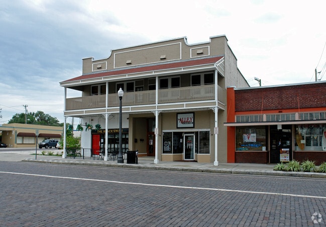
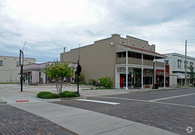
Property Record
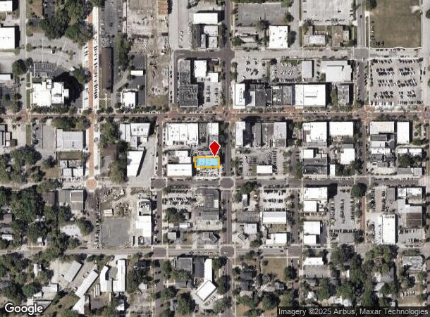
114 S Park Ave, Sanford, FL 32771
NEARBY LISTINGS FOR SALE OR LEASE
Property Detail
114 S Park Ave
Orlando-Kissimmee-Sanford, FL
Sanford Town Of
25-19-30-5AG-0304-009A
S 15.73 FT OF LOT 9 + N 29.27 FT OF LOT 10 BLK 3 TR 4 TOWN OF SANFORD PB 1 PG 58
Officebuilding
Seminole
X
Florida
12069C0450E
9,10
2024
0.12 AC
2024
Sanford
020101
Orlando
7,320 SF
DEMOGRAPHICS near 114 S Park Ave
1 Mile
3 Mile
5 Mile
2024 Total Population
6,085
42,843
106,117
2029 Population
6,418
45,209
112,003
Pop Growth 2024-2029
+ 5.47%
+ 5.52%
+ 5.55%
Average Age
42
38
39
2024 Total Households
2,531
16,095
40,221
HH Growth 2024-2029
+ 5.18%
+ 5.60%
+ 5.69%
Median Household Inc
$47,259
$51,518
$59,891
Avg Household Size
2.20
2.50
2.50
2024 Avg HH Vehicles
2.00
2.00
2.00
Median Home Value
$272,377
$233,820
$255,647
Median Year Built
1966
1984
1992
Nearby Places
- Restaurants
- Banks
- Shops
- Fitness
- Groceries
PUBLIC TRANSPORTATION
COMMUTER RAIL
DRIVE
WALK
Distance
5 min
1.8 mi
DRIVE
WALK
Distance
5 min
2.0 mi
AIRPORT
Orlando Sanford International
DRIVE
WALK
Distance
Orlando Sanford International
11 min
4.8 mi
Orlando International
DRIVE
WALK
Distance
Orlando International
44 min
33.8 mi
Daytona Beach International
DRIVE
WALK
Distance
Daytona Beach International
46 min
35.8 mi
Freight Ports
Port Canaveral
DRIVE
WALK
Distance
Port Canaveral
81 min
66.8 mi
Nearby Properties
Address
Land Use
TOTAL SIZE
Lot Size
Zoning
Address
Land Use
TOTAL SIZE
Lot Size
Zoning
36.94 AC
A1
Address
Land Use
TOTAL SIZE
Lot Size
Zoning
312 SF
10.47 AC
Address
Land Use
TOTAL SIZE
Lot Size
Zoning
413,982 SF
0.05 AC
RI1
Address
Land Use
TOTAL SIZE
Lot Size
Zoning
250 SF
14.29 AC
RMOI
Address
Land Use
TOTAL SIZE
Lot Size
Zoning
615.80 AC
RI1
Address
Land Use
TOTAL SIZE
Lot Size
Zoning
938 SF
9.46 AC
SC3
Address
Land Use
TOTAL SIZE
Lot Size
Zoning
492,285 SF
19.58 AC
PD
Address
Land Use
TOTAL SIZE
Lot Size
Zoning
209,950 SF
20.42 AC
RMOI
Address
Land Use
TOTAL SIZE
Lot Size
Zoning
245,806 SF
24.93 AC
RMOI
Address
Land Use
TOTAL SIZE
Lot Size
Zoning
1,001 SF
12.02 AC
MR3
Address
Land Use
TOTAL SIZE
Lot Size
Zoning
377.80 AC
C2
Address
Land Use
TOTAL SIZE
Lot Size
Zoning
864 SF
9.99 AC
A1
Address
Land Use
TOTAL SIZE
Lot Size
Zoning
209,424 SF
12.93 AC
MR2
Address
Land Use
TOTAL SIZE
Lot Size
Zoning
216,071 SF
77 AC
A1
Address
Land Use
TOTAL SIZE
Lot Size
Zoning
428,525 SF
20.81 AC
A1
Address
Land Use
TOTAL SIZE
Lot Size
Zoning
9.54 AC
M1
Address
Land Use
TOTAL SIZE
Lot Size
Zoning
112,946 SF
37.72 AC
PD
Address
Land Use
TOTAL SIZE
Lot Size
Zoning
115,431 SF
61 AC
PLI
Address
Land Use
TOTAL SIZE
Lot Size
Zoning
112,312 SF
9.40 AC
Address
Land Use
TOTAL SIZE
Lot Size
Zoning
480 SF
16.38 AC
MR3
Address
Land Use
TOTAL SIZE
Lot Size
Zoning
208,260 SF
1.79 AC
RMOI
Address
Land Use
TOTAL SIZE
Lot Size
Zoning
204,618 SF
11.92 AC
PD
Address
Land Use
TOTAL SIZE
Lot Size
Zoning
146,000 SF
8.56 AC
A1
Address
Land Use
TOTAL SIZE
Lot Size
Zoning
122,414 SF
9.86 AC
MR2
Address
Land Use
TOTAL SIZE
Lot Size
Zoning
75,481 SF
7.08 AC
M1
Address
Land Use
TOTAL SIZE
Lot Size
Zoning
5,150 SF
17.30 AC
SC3
Address
Land Use
TOTAL SIZE
Lot Size
Zoning
148,697 SF
11.44 AC
RI1
Address
Land Use
TOTAL SIZE
Lot Size
Zoning
125,618 SF
9.07 AC
MR3
Address
Land Use
TOTAL SIZE
Lot Size
Zoning
89,119 SF
2.67 AC
SC3
Address
Land Use
TOTAL SIZE
Lot Size
Zoning
4,648 SF
161.90 AC
A1
The World's #1 Commercial Real Estate Marketplace
Connect with us
© 2025 CoStar Group
The information above has been obtained from sources believed reliable. While we do not doubt its accuracy we have not verified it and make no guarantee, warranty or representation about it. It is your responsibility to independently confirm its accuracy and completeness. Any projections, opinions, assumptions, or estimates used are for example only and do not represent the current or future performance of the property. The value of this transaction to you depends on tax and other factors which should be evaluated by your tax, financial, and legal advisors. You and your advisors should conduct a careful, independent investigation of the property to determine to your satisfaction the suitability of the property for your needs.