Property Record
116 Roth Rd, Lathrop, CA 95330


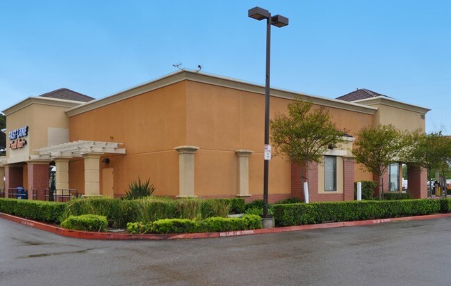
Property Detail
116 Roth Rd
196-020-20
06-PT TO RD PER 06035361
Servicestationmarket
San Joaquin
CC
California
2025
1.88 AC
2025
Tracy/Manteca
005119
Stockton/Modesto
5,100 SF
Stockton-Lodi, CA
NEARBY LISTINGS FOR SALE OR LEASE
-
-
View all Lathrop listings for sale on LoopNet.com
DEMOGRAPHICS near 116 Roth Rd
1 mile
3 mile
5 mile
2025 Total Population
1,594
26,286
124,029
2030 Population
1,653
27,540
130,313
Pop Growth 2025-2030
+ 3.70%
+ 4.77%
+ 5.07%
Average Age
38
41
38
2025 Total Households
441
7,867
35,119
HH Growth 2025-2030
+ 3.40%
+ 4.87%
+ 5.29%
Median Household Inc
$121,634
$104,639
$96,649
Avg Household Size
3.60
3.20
3.40
2025 Avg HH Vehicles
3.00
3.00
2.00
Median Home Value
$708,333
$666,419
$602,257
Median Year Built
2000
2000
1997
Nearby Places
Map Layers
Map Styles
 Street
 Aerial
Transit
 Traffic
 Biking
Places
Listings with unknown addresses are not visible on the map
- Restaurants
- Banks
- Shops
- Fitness
- Groceries
PUBLIC TRANSPORTATION
COMMUTER RAIL
Drive
Walk
Distance
12 min
6.2 mi
Drive
Walk
Distance
11 min
7.1 mi
AIRPORT
Stockton Metro
Drive
Walk
Distance
Stockton Metro
9 min
4.4 mi
Nearby Properties
Address
Land Use
TOTAL SIZE
Lot Size
Zoning
Address
Land Use
TOTAL SIZE
Lot Size
Zoning
730,300 SF
41.44 AC
Address
Land Use
TOTAL SIZE
Lot Size
Zoning
622,959 SF
31.75 AC
IW
Address
Land Use
TOTAL SIZE
Lot Size
Zoning
746,790 SF
39.23 AC
M2
Address
Land Use
TOTAL SIZE
Lot Size
Zoning
830,175 SF
46.57 AC
IG
Address
Land Use
TOTAL SIZE
Lot Size
Zoning
824,735 SF
52.87 AC
Address
Land Use
TOTAL SIZE
Lot Size
Zoning
745,640 SF
41.63 AC
Address
Land Use
TOTAL SIZE
Lot Size
Zoning
16.02 AC
Address
Land Use
TOTAL SIZE
Lot Size
Zoning
419,608 SF
23.01 AC
IG
Address
Land Use
TOTAL SIZE
Lot Size
Zoning
434,900 SF
17.05 AC
Address
Land Use
TOTAL SIZE
Lot Size
Zoning
343,732 SF
13.90 AC
Address
Land Use
TOTAL SIZE
Lot Size
Zoning
436,800 SF
21.71 AC
Address
Land Use
TOTAL SIZE
Lot Size
Zoning
452,000 SF
20.42 AC
Address
Land Use
TOTAL SIZE
Lot Size
Zoning
443,640 SF
24.30 AC
Address
Land Use
TOTAL SIZE
Lot Size
Zoning
178,761 SF
11.43 AC
Address
Land Use
TOTAL SIZE
Lot Size
Zoning
404,657 SF
24.89 AC
AG40
Address
Land Use
TOTAL SIZE
Lot Size
Zoning
164,000 SF
7.62 AC
Address
Land Use
TOTAL SIZE
Lot Size
Zoning
510,495 SF
23.54 AC
Address
Land Use
TOTAL SIZE
Lot Size
Zoning
15,476 SF
7.83 AC
CO
Address
Land Use
TOTAL SIZE
Lot Size
Zoning
247,485 SF
63.57 AC
Address
Land Use
TOTAL SIZE
Lot Size
Zoning
10.83 AC
Address
Land Use
TOTAL SIZE
Lot Size
Zoning
11.32 AC
Address
Land Use
TOTAL SIZE
Lot Size
Zoning
4,800 SF
32.64 AC
Address
Land Use
TOTAL SIZE
Lot Size
Zoning
7.72 AC
Address
Land Use
TOTAL SIZE
Lot Size
Zoning
Address
Land Use
TOTAL SIZE
Lot Size
Zoning
7.18 AC
Address
Land Use
TOTAL SIZE
Lot Size
Zoning
185,193 SF
9.85 AC
IG
Address
Land Use
TOTAL SIZE
Lot Size
Zoning
262,400 SF
11.73 AC
Address
Land Use
TOTAL SIZE
Lot Size
Zoning
319,400 SF
21.54 AC
Address
Land Use
TOTAL SIZE
Lot Size
Zoning
145,230 SF
8.62 AC
Address
Land Use
TOTAL SIZE
Lot Size
Zoning
2,924 SF
13.72 AC
IL
The World's #1 Commercial Real Estate Marketplace
Connect with us
© 2026 CoStar Group
The information above has been obtained from sources believed reliable. While we do not doubt its accuracy we have not verified it and make no guarantee, warranty or representation about it. It is your responsibility to independently confirm its accuracy and completeness. Any projections, opinions, assumptions, or estimates used are for example only and do not represent the current or future performance of the property. The value of this transaction to you depends on tax and other factors which should be evaluated by your tax, financial, and legal advisors. You and your advisors should conduct a careful, independent investigation of the property to determine to your satisfaction the suitability of the property for your needs.