Property Record
116 Sconticut Neck Rd, Fairhaven, MA 02719


Save to a Folder
{{folder.Name}}
{{folder.ListingIds.length}} Properties
{{folder.ListingIds.length}} Property
Create a New Folder
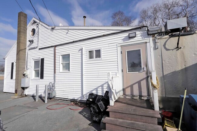
This Property Is For Sale
Property Detail
116 Sconticut Neck Rd
FAIR-000028A-000000-000193
BRISTOL
Restaurantbuilding
Massachusetts
B
193
B and X Area of moderate flood hazard, usually the area between the limits of the 100-year and 500-year floods.
0.15 AC
2025
Attleboro/New Bedford
2025
Boston
655400
Providence-Warwick, RI-MA
775 SF
NEARBY LISTINGS FOR SALE OR LEASE
DEMOGRAPHICS near 116 Sconticut Neck Rd
1 mile
3 mile
5 mile
2025 Total Population
3,509
45,552
123,847
2030 Population
3,612
45,712
124,117
Pop Growth 2025-2030
+ 2.94%
+ 0.35%
+ 0.22%
Average Age
46
42
42
2025 Total Households
1,471
19,429
51,804
HH Growth 2025-2030
+ 2.92%
+ 0.43%
+ 0.30%
Median Household Inc
$98,437
$57,909
$63,938
Avg Household Size
2.40
2.30
2.30
2025 Avg HH Vehicles
2.00
1.00
2.00
Median Home Value
$445,750
$421,432
$405,750
Median Year Built
1957
1948
1948
Nearby Places
Map Layers
Map Styles
 Street
 Aerial
Layers
 Traffic
 Biking
Places
Listings with unknown addresses are not visible on the map
- Restaurants
- Banks
- Shops
- Fitness
- Groceries
PUBLIC TRANSPORTATION
AIRPORT
Rhode Island Tf Green International
Drive
Walk
Distance
Rhode Island Tf Green International
59 min
40.1 mi
Freight Ports
Port of New Bedford Harbor
Drive
Walk
Distance
Port of New Bedford Harbor
8 min
3.9 mi
Nearby Properties
Address
Land Use
TOTAL SIZE
Lot Size
Zoning
Address
Land Use
TOTAL SIZE
Lot Size
Zoning
228,726 SF
5.51 AC
MUB
Address
Land Use
TOTAL SIZE
Lot Size
Zoning
61.86 AC
I
Address
Land Use
TOTAL SIZE
Lot Size
Zoning
269,020 SF
2.26 AC
MUB
Address
Land Use
TOTAL SIZE
Lot Size
Zoning
231,634 SF
2.45 AC
IB
Address
Land Use
TOTAL SIZE
Lot Size
Zoning
27.48 AC
B
Address
Land Use
TOTAL SIZE
Lot Size
Zoning
127,514 SF
4.23 AC
MUB
Address
Land Use
TOTAL SIZE
Lot Size
Zoning
188,739 SF
2.57 AC
IB
Address
Land Use
TOTAL SIZE
Lot Size
Zoning
5.59 AC
RC
Address
Land Use
TOTAL SIZE
Lot Size
Zoning
183,450 SF
2.51 AC
RA
Address
Land Use
TOTAL SIZE
Lot Size
Zoning
183,196 SF
8.14 AC
MUB
Address
Land Use
TOTAL SIZE
Lot Size
Zoning
146,081 SF
2.15 AC
MUB
Address
Land Use
TOTAL SIZE
Lot Size
Zoning
147,850 SF
2.50 AC
RC
Address
Land Use
TOTAL SIZE
Lot Size
Zoning
73,520 SF
18.44 AC
R45
Address
Land Use
TOTAL SIZE
Lot Size
Zoning
212,875 SF
7.24 AC
WI
Address
Land Use
TOTAL SIZE
Lot Size
Zoning
11.11 AC
B
Address
Land Use
TOTAL SIZE
Lot Size
Zoning
2,190 SF
9.73 AC
IA
Address
Land Use
TOTAL SIZE
Lot Size
Zoning
8.69 AC
RA
Address
Land Use
TOTAL SIZE
Lot Size
Zoning
91,660 SF
1.26 AC
MUB
Address
Land Use
TOTAL SIZE
Lot Size
Zoning
101,289 SF
1.98 AC
RC
Address
Land Use
TOTAL SIZE
Lot Size
Zoning
128,298 SF
1.99 AC
MUB
Address
Land Use
TOTAL SIZE
Lot Size
Zoning
74,409 SF
9.40 AC
B
Address
Land Use
TOTAL SIZE
Lot Size
Zoning
5.30 AC
RC
Address
Land Use
TOTAL SIZE
Lot Size
Zoning
20.70 AC
I
Address
Land Use
TOTAL SIZE
Lot Size
Zoning
40,446 SF
4.36 AC
WI
Address
Land Use
TOTAL SIZE
Lot Size
Zoning
92,628 SF
0.96 AC
MUB
Address
Land Use
TOTAL SIZE
Lot Size
Zoning
47,962 SF
7 AC
B
Address
Land Use
TOTAL SIZE
Lot Size
Zoning
10.01 AC
MUB
Address
Land Use
TOTAL SIZE
Lot Size
Zoning
117,497 SF
0.53 AC
MUB
Address
Land Use
TOTAL SIZE
Lot Size
Zoning
64,179 SF
1.03 AC
IA
Address
Land Use
TOTAL SIZE
Lot Size
Zoning
74,630 SF
15.20 AC
RA
The World's #1 Commercial Real Estate Marketplace
Connect with us
© 2026 CoStar Group
The information above has been obtained from sources believed reliable. While we do not doubt its accuracy we have not verified it and make no guarantee, warranty or representation about it. It is your responsibility to independently confirm its accuracy and completeness. Any projections, opinions, assumptions, or estimates used are for example only and do not represent the current or future performance of the property. The value of this transaction to you depends on tax and other factors which should be evaluated by your tax, financial, and legal advisors. You and your advisors should conduct a careful, independent investigation of the property to determine to your satisfaction the suitability of the property for your needs.