Property Record
116 View Pointe Dr, Lagrange, GA 30241

Property Detail
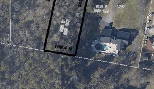
116 View Pointe Dr
LaGrange, GA-AL
116 VIEW POINTE DR / PG 302,303
048-3-000-057
TROUP
Residentialacreage
Georgia
01-LR
11
B and X Area of moderate flood hazard, usually the area between the limits of the 100-year and 500-year floods.
0.77 AC
2025
Troup County
2025
Columbus GA
960201
NEARBY LISTINGS FOR SALE OR LEASE
-
-
View all Lagrange listings for sale on LoopNet.com
DEMOGRAPHICS near 116 View Pointe Dr
1 mile
3 mile
5 mile
2024 Total Population
449
8,549
29,611
2029 Population
459
8,712
30,565
Pop Growth 2024-2029
+ 2.23%
+ 1.91%
+ 3.22%
Average Age
44
40
39
2024 Total Households
166
3,335
11,713
HH Growth 2024-2029
+ 2.41%
+ 2.01%
+ 3.40%
Median Household Inc
$95,651
$82,081
$60,756
Avg Household Size
2.60
2.50
2.50
2024 Avg HH Vehicles
3.00
2.00
2.00
Median Home Value
$334,166
$305,864
$253,201
Median Year Built
1993
1990
1984
Nearby Places
Map Layers
Map Styles
 Street
 Aerial
Transit
 Traffic
 Biking
Places
Listings with unknown addresses are not visible on the map
- Restaurants
- Banks
- Shops
- Fitness
- Groceries
SALE & LEASE HISTORY
LISTING DATE
SALE/LEASE

Jun 04, 2018
For Sale
Nearby Properties
Address
Land Use
TOTAL SIZE
Lot Size
Zoning
Address
Land Use
TOTAL SIZE
Lot Size
Zoning
191,357 SF
89.77 AC
01-SU-R
Address
Land Use
TOTAL SIZE
Lot Size
Zoning
92,762 SF
78.28 AC
16- SU-R
Address
Land Use
TOTAL SIZE
Lot Size
Zoning
8,424 SF
11 AC
16- CR-MR
Address
Land Use
TOTAL SIZE
Lot Size
Zoning
218,488 SF
32.40 AC
16- CR-MX
Address
Land Use
TOTAL SIZE
Lot Size
Zoning
751.57 AC
16- SU-R
Address
Land Use
TOTAL SIZE
Lot Size
Zoning
16,916 SF
15.33 AC
16- SU-R
Address
Land Use
TOTAL SIZE
Lot Size
Zoning
44,520 SF
11.08 AC
16- CR-MR
Address
Land Use
TOTAL SIZE
Lot Size
Zoning
5,000 SF
5.88 AC
01-LC
Address
Land Use
TOTAL SIZE
Lot Size
Zoning
38,102 SF
23.98 AC
01-LR
Address
Land Use
TOTAL SIZE
Lot Size
Zoning
19,989 SF
178.17 AC
16- TN-R
Address
Land Use
TOTAL SIZE
Lot Size
Zoning
6,860 SF
12.63 AC
01-SU-R
Address
Land Use
TOTAL SIZE
Lot Size
Zoning
2,200 SF
8.76 AC
16- CR-MX
Address
Land Use
TOTAL SIZE
Lot Size
Zoning
5,481 SF
2.09 AC
16- CR-MX
Address
Land Use
TOTAL SIZE
Lot Size
Zoning
7,276 SF
2.43 AC
16- CR-MR
Address
Land Use
TOTAL SIZE
Lot Size
Zoning
17,000 SF
3.10 AC
01-HC
Address
Land Use
TOTAL SIZE
Lot Size
Zoning
3,200 SF
13.03 AC
16- SU-R
Address
Land Use
TOTAL SIZE
Lot Size
Zoning
15,000 SF
3.07 AC
01-LC
Address
Land Use
TOTAL SIZE
Lot Size
Zoning
421.58 AC
01-LR
Address
Land Use
TOTAL SIZE
Lot Size
Zoning
2,600 SF
6.70 AC
01-HC
Address
Land Use
TOTAL SIZE
Lot Size
Zoning
9,217 SF
2.91 AC
01-LC
Address
Land Use
TOTAL SIZE
Lot Size
Zoning
9,936 SF
1.36 AC
16- TN-MX
Address
Land Use
TOTAL SIZE
Lot Size
Zoning
14,008 SF
2.90 AC
16- CR-MX
Address
Land Use
TOTAL SIZE
Lot Size
Zoning
275.61 AC
01-SU-R
Address
Land Use
TOTAL SIZE
Lot Size
Zoning
13,644 SF
3.04 AC
16- CR-MX
Address
Land Use
TOTAL SIZE
Lot Size
Zoning
2,816 SF
1.52 AC
01-LR
Address
Land Use
TOTAL SIZE
Lot Size
Zoning
5,000 SF
13.90 AC
16- CR-MX
Address
Land Use
TOTAL SIZE
Lot Size
Zoning
80.33 AC
16- SU-R
Address
Land Use
TOTAL SIZE
Lot Size
Zoning
5,476 SF
0.55 AC
16- CR-MX
Address
Land Use
TOTAL SIZE
Lot Size
Zoning
7,350 SF
17.63 AC
01-HC
Address
Land Use
TOTAL SIZE
Lot Size
Zoning
205 AC
16- SU-R
The World's #1 Commercial Real Estate Marketplace
Connect with us
© 2026 CoStar Group
The information above has been obtained from sources believed reliable. While we do not doubt its accuracy we have not verified it and make no guarantee, warranty or representation about it. It is your responsibility to independently confirm its accuracy and completeness. Any projections, opinions, assumptions, or estimates used are for example only and do not represent the current or future performance of the property. The value of this transaction to you depends on tax and other factors which should be evaluated by your tax, financial, and legal advisors. You and your advisors should conduct a careful, independent investigation of the property to determine to your satisfaction the suitability of the property for your needs.