Property Record
116 W Central Ave, Asheboro, NC 27203


NEARBY LISTINGS FOR SALE OR LEASE
Property Detail
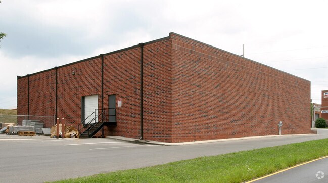
116 W Central Ave
7763-00-6309
Central Ave
Warehouse
CENTRAL AVE;N PL:162-36
X
Randolph
3710776300J
North Carolina
2025
1.09 AC
2025
North Asheboro
030400
Greensboro/Winston-Salem
867 SF
Greensboro-High Point, NC
DEMOGRAPHICS near 116 W Central Ave
1 Mile
3 Mile
5 Mile
2024 Total Population
5,929
18,313
41,551
2029 Population
6,155
19,024
43,199
Pop Growth 2024-2029
+ 3.81%
+ 3.88%
+ 3.97%
Average Age
35
38
39
2024 Total Households
2,376
7,016
16,489
HH Growth 2024-2029
+ 3.75%
+ 3.85%
+ 3.94%
Median Household Inc
$51,615
$52,715
$49,525
Avg Household Size
2.40
2.50
2.40
2024 Avg HH Vehicles
2.00
2.00
2.00
Median Home Value
$122,956
$137,818
$141,682
Median Year Built
1990
1984
1978
Nearby Places
Map Layers
Map Styles
 Street
 Aerial
- Restaurants
- Banks
- Shops
- Fitness
- Groceries
PUBLIC TRANSPORTATION
AIRPORT
Piedmont Triad International
DRIVE
WALK
Distance
Piedmont Triad International
42 min
30.6 mi
SALE & LEASE HISTORY
LISTING DATE
SALE/LEASE

Feb 06, 2019
For Sale
Nearby Properties
Address
Land Use
TOTAL SIZE
Lot Size
Zoning
Address
Land Use
TOTAL SIZE
Lot Size
Zoning
19,346 SF
46.13 AC
I2
Address
Land Use
TOTAL SIZE
Lot Size
Zoning
145,020 SF
62.15 AC
I-1
Address
Land Use
TOTAL SIZE
Lot Size
Zoning
312,205 SF
6.83 AC
B2
Address
Land Use
TOTAL SIZE
Lot Size
Zoning
54,565 SF
65.17 AC
B2
Address
Land Use
TOTAL SIZE
Lot Size
Zoning
394,076 SF
28.62 AC
I2 (CZ)
Address
Land Use
TOTAL SIZE
Lot Size
Zoning
283,127 SF
95.67 AC
I2
Address
Land Use
TOTAL SIZE
Lot Size
Zoning
4,068 SF
30.24 AC
I3
Address
Land Use
TOTAL SIZE
Lot Size
Zoning
4,800 SF
24.07 AC
RA6
Address
Land Use
TOTAL SIZE
Lot Size
Zoning
26.07 AC
B2
Address
Land Use
TOTAL SIZE
Lot Size
Zoning
84,857 SF
8.31 AC
B2
Address
Land Use
TOTAL SIZE
Lot Size
Zoning
143,671 SF
11.48 AC
I2
Address
Land Use
TOTAL SIZE
Lot Size
Zoning
172,096 SF
11.84 AC
I2
Address
Land Use
TOTAL SIZE
Lot Size
Zoning
6,336 SF
13.69 AC
OA6 (CZ)
Address
Land Use
TOTAL SIZE
Lot Size
Zoning
1,920 SF
13.75 AC
RA6
Address
Land Use
TOTAL SIZE
Lot Size
Zoning
159,217 SF
25.99 AC
I1
Address
Land Use
TOTAL SIZE
Lot Size
Zoning
85,333 SF
31.10 AC
I2
Address
Land Use
TOTAL SIZE
Lot Size
Zoning
1,948 SF
71.18 AC
I3
Address
Land Use
TOTAL SIZE
Lot Size
Zoning
2,800 SF
6.64 AC
RA6
Address
Land Use
TOTAL SIZE
Lot Size
Zoning
125,738 SF
27.16 AC
I2
Address
Land Use
TOTAL SIZE
Lot Size
Zoning
25,184 SF
8.23 AC
RA6
Address
Land Use
TOTAL SIZE
Lot Size
Zoning
179,650 SF
10.04 AC
I2
Address
Land Use
TOTAL SIZE
Lot Size
Zoning
115,296 SF
25.95 AC
I3
Address
Land Use
TOTAL SIZE
Lot Size
Zoning
66,585 SF
7.16 AC
OA6
Address
Land Use
TOTAL SIZE
Lot Size
Zoning
1,595 SF
53.92 AC
R10 (CZ)
Address
Land Use
TOTAL SIZE
Lot Size
Zoning
16,540 SF
11.38 AC
I2
Address
Land Use
TOTAL SIZE
Lot Size
Zoning
16,500 SF
9.81 AC
I2
Address
Land Use
TOTAL SIZE
Lot Size
Zoning
33,334 SF
11.99 AC
B2
Address
Land Use
TOTAL SIZE
Lot Size
Zoning
7,652 SF
7.94 AC
RA6 (CZ)
Address
Land Use
TOTAL SIZE
Lot Size
Zoning
62,145 SF
10.12 AC
I2
Address
Land Use
TOTAL SIZE
Lot Size
Zoning
22,728 SF
1.78 AC
B2
The World's #1 Commercial Real Estate Marketplace
Connect with us
© 2026 CoStar Group
The information above has been obtained from sources believed reliable. While we do not doubt its accuracy we have not verified it and make no guarantee, warranty or representation about it. It is your responsibility to independently confirm its accuracy and completeness. Any projections, opinions, assumptions, or estimates used are for example only and do not represent the current or future performance of the property. The value of this transaction to you depends on tax and other factors which should be evaluated by your tax, financial, and legal advisors. You and your advisors should conduct a careful, independent investigation of the property to determine to your satisfaction the suitability of the property for your needs.