Property Record
116 Walnut St, Athens, PA 18810

Property Detail
116 Walnut St
Sayre, PA
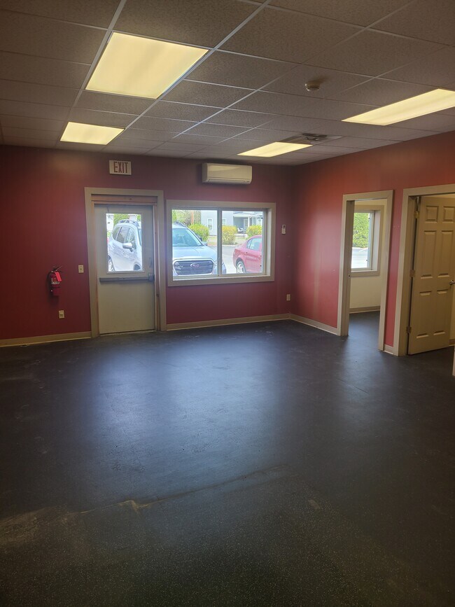
PRO CARE & STORAGE
07-020.14-152-000-000
Bradford
Commercialofficeresidentialmixeduse
Pennsylvania
B and X Area of moderate flood hazard, usually the area between the limits of the 100-year and 500-year floods.
3.14 AC
2026
Pennsylvania Central Area
2026
Other Market Areas
950400
NEARBY LISTINGS FOR SALE OR LEASE
DEMOGRAPHICS near 116 Walnut St
1 mile
3 mile
5 mile
2025 Total Population
4,699
14,550
20,923
2030 Population
4,548
14,151
20,470
Pop Growth 2025-2030
(3.21%)
(2.74%)
(2.17%)
Average Age
41
42
42
2025 Total Households
2,055
6,383
8,974
HH Growth 2025-2030
(3.21%)
(2.73%)
(2.20%)
Median Household Inc
$50,577
$53,450
$56,238
Avg Household Size
2.20
2.20
2.20
2025 Avg HH Vehicles
2.00
2.00
2.00
Median Home Value
$166,792
$170,204
$171,558
Median Year Built
1948
1949
1957
Nearby Places
Map Layers
Map Styles
 Street
 Aerial
Layers
 Traffic
 Biking
Places
Listings with unknown addresses are not visible on the map
- Restaurants
- Banks
- Shops
- Fitness
- Groceries
PUBLIC TRANSPORTATION
AIRPORT
Elmira/Corning Regional
Drive
Walk
Distance
Elmira/Corning Regional
39 min
30.1 mi
Freight Ports
Albany, NY Port
Drive
Walk
Distance
Albany, NY Port
216 min
180.1 mi
SALE & LEASE HISTORY
LISTING DATE
SALE/LEASE

Apr 18, 2022
For Lease
Nearby Properties
Address
Land Use
TOTAL SIZE
Lot Size
Zoning
Address
Land Use
TOTAL SIZE
Lot Size
Zoning
11.29 AC
Address
Land Use
TOTAL SIZE
Lot Size
Zoning
1.39 AC
Address
Land Use
TOTAL SIZE
Lot Size
Zoning
64,032 SF
5.50 AC
ZONE
Address
Land Use
TOTAL SIZE
Lot Size
Zoning
0.56 AC
Address
Land Use
TOTAL SIZE
Lot Size
Zoning
Address
Land Use
TOTAL SIZE
Lot Size
Zoning
132,462 SF
36 AC
ZONE
Address
Land Use
TOTAL SIZE
Lot Size
Zoning
626 SF
0.77 AC
ZONE
Address
Land Use
TOTAL SIZE
Lot Size
Zoning
Address
Land Use
TOTAL SIZE
Lot Size
Zoning
1.38 AC
Address
Land Use
TOTAL SIZE
Lot Size
Zoning
39.76 AC
Address
Land Use
TOTAL SIZE
Lot Size
Zoning
19.61 AC
Address
Land Use
TOTAL SIZE
Lot Size
Zoning
Address
Land Use
TOTAL SIZE
Lot Size
Zoning
18,619 SF
0.46 AC
ZONE
Address
Land Use
TOTAL SIZE
Lot Size
Zoning
73,434 SF
0.75 AC
ZONE
Address
Land Use
TOTAL SIZE
Lot Size
Zoning
22.42 AC
Address
Land Use
TOTAL SIZE
Lot Size
Zoning
1.32 AC
Address
Land Use
TOTAL SIZE
Lot Size
Zoning
36,720 SF
15.93 AC
01 - NOT Z
Address
Land Use
TOTAL SIZE
Lot Size
Zoning
2.29 AC
ZONE
Address
Land Use
TOTAL SIZE
Lot Size
Zoning
4.63 AC
Address
Land Use
TOTAL SIZE
Lot Size
Zoning
Address
Land Use
TOTAL SIZE
Lot Size
Zoning
1.57 AC
Address
Land Use
TOTAL SIZE
Lot Size
Zoning
50,700 SF
6.29 AC
ZONE
Address
Land Use
TOTAL SIZE
Lot Size
Zoning
11.48 AC
Address
Land Use
TOTAL SIZE
Lot Size
Zoning
9.11 AC
Address
Land Use
TOTAL SIZE
Lot Size
Zoning
1,664 SF
5.10 AC
ZONE
Address
Land Use
TOTAL SIZE
Lot Size
Zoning
28,992 SF
4.89 AC
ZONE
Address
Land Use
TOTAL SIZE
Lot Size
Zoning
4,000 SF
15.94 AC
03 - MULTI
Address
Land Use
TOTAL SIZE
Lot Size
Zoning
12.51 AC
Address
Land Use
TOTAL SIZE
Lot Size
Zoning
7,228 SF
0.35 AC
ZONE
Address
Land Use
TOTAL SIZE
Lot Size
Zoning
4,240 SF
15 AC
03 - MULTI
The World's #1 Commercial Real Estate Marketplace
Connect with us
© 2026 CoStar Group
The information above has been obtained from sources believed reliable. While we do not doubt its accuracy we have not verified it and make no guarantee, warranty or representation about it. It is your responsibility to independently confirm its accuracy and completeness. Any projections, opinions, assumptions, or estimates used are for example only and do not represent the current or future performance of the property. The value of this transaction to you depends on tax and other factors which should be evaluated by your tax, financial, and legal advisors. You and your advisors should conduct a careful, independent investigation of the property to determine to your satisfaction the suitability of the property for your needs.