Property Record
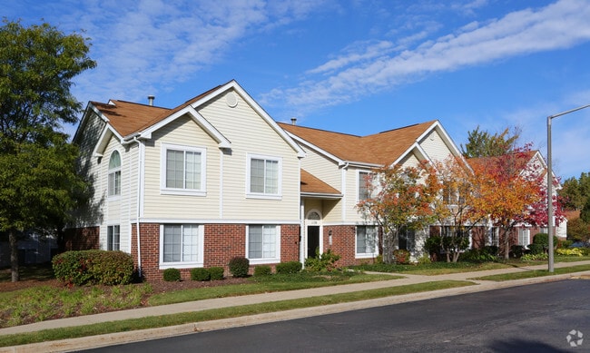
1160 Windbrooke Dr, Buffalo Grove, IL 60089


NEARBY LISTINGS FOR SALE OR LEASE
Property Detail
1160 Windbrooke Dr
Chicago-Naperville-Elgin, IL-IN-WI
Windbrooke Sub
15-28-410-002
WINDBROOKE SUB; LOT 1
Commercialbuilding
Lake
AE
Illinois
17097C0262K
1
2023
17.02 AC
2024
Southwest Lake County
864520
Chicago
DEMOGRAPHICS near 1160 Windbrooke Dr
1 Mile
3 Mile
5 Mile
2024 Total Population
10,506
81,605
213,070
2029 Population
10,404
80,199
209,303
Pop Growth 2024-2029
(0.97%)
(1.72%)
(1.77%)
Average Age
40
43
41
2024 Total Households
3,814
30,788
80,222
HH Growth 2024-2029
(1.05%)
(1.89%)
(1.98%)
Median Household Inc
$134,490
$109,414
$102,452
Avg Household Size
2.70
2.60
2.60
2024 Avg HH Vehicles
2.00
2.00
2.00
Median Home Value
$430,090
$357,785
$379,875
Median Year Built
1985
1982
1980
Nearby Places
Map Layers
Map Styles
 Street
 Aerial
- Restaurants
- Banks
- Shops
- Fitness
- Groceries
PUBLIC TRANSPORTATION
COMMUTER RAIL
Buffalo Grove Station (North Central Service - Northeast Illinois Regional Commuter Railroad (Metra))
DRIVE
WALK
Distance
Buffalo Grove Station (North Central Service - Northeast Illinois Regional Commuter Railroad (Metra))
2 min
11 min
0.6 mi
Prairie View Station (North Central Service - Northeast Illinois Regional Commuter Railroad (Metra))
DRIVE
WALK
Distance
Prairie View Station (North Central Service - Northeast Illinois Regional Commuter Railroad (Metra))
6 min
3.0 mi
AIRPORT
Chicago O'Hare International
DRIVE
WALK
Distance
Chicago O'Hare International
28 min
17.8 mi
Chicago Midway International
DRIVE
WALK
Distance
Chicago Midway International
54 min
31.2 mi
Freight Ports
Port Milwaukee
DRIVE
WALK
Distance
Port Milwaukee
79 min
64.5 mi
Nearby Properties
Address
Land Use
TOTAL SIZE
Lot Size
Zoning
Address
Land Use
TOTAL SIZE
Lot Size
Zoning
28.14 AC
Address
Land Use
TOTAL SIZE
Lot Size
Zoning
65.17 AC
Address
Land Use
TOTAL SIZE
Lot Size
Zoning
Address
Land Use
TOTAL SIZE
Lot Size
Zoning
24.64 AC
Address
Land Use
TOTAL SIZE
Lot Size
Zoning
18.40 AC
Address
Land Use
TOTAL SIZE
Lot Size
Zoning
8.21 AC
Address
Land Use
TOTAL SIZE
Lot Size
Zoning
14.26 AC
Address
Land Use
TOTAL SIZE
Lot Size
Zoning
12.58 AC
Address
Land Use
TOTAL SIZE
Lot Size
Zoning
Address
Land Use
TOTAL SIZE
Lot Size
Zoning
16.20 AC
Address
Land Use
TOTAL SIZE
Lot Size
Zoning
Address
Land Use
TOTAL SIZE
Lot Size
Zoning
Address
Land Use
TOTAL SIZE
Lot Size
Zoning
13.53 AC
Address
Land Use
TOTAL SIZE
Lot Size
Zoning
22.16 AC
Address
Land Use
TOTAL SIZE
Lot Size
Zoning
46.27 AC
Address
Land Use
TOTAL SIZE
Lot Size
Zoning
20.03 AC
Address
Land Use
TOTAL SIZE
Lot Size
Zoning
362,944 SF
12.74 AC
Address
Land Use
TOTAL SIZE
Lot Size
Zoning
Address
Land Use
TOTAL SIZE
Lot Size
Zoning
840 SF
2.37 AC
Address
Land Use
TOTAL SIZE
Lot Size
Zoning
Address
Land Use
TOTAL SIZE
Lot Size
Zoning
510,569 SF
3.55 AC
Address
Land Use
TOTAL SIZE
Lot Size
Zoning
Address
Land Use
TOTAL SIZE
Lot Size
Zoning
579,858 SF
3.56 AC
Address
Land Use
TOTAL SIZE
Lot Size
Zoning
20.95 AC
Address
Land Use
TOTAL SIZE
Lot Size
Zoning
10.07 AC
Address
Land Use
TOTAL SIZE
Lot Size
Zoning
Address
Land Use
TOTAL SIZE
Lot Size
Zoning
15.37 AC
Address
Land Use
TOTAL SIZE
Lot Size
Zoning
Address
Land Use
TOTAL SIZE
Lot Size
Zoning
29.76 AC
The World's #1 Commercial Real Estate Marketplace
Connect with us
© 2025 CoStar Group
The information above has been obtained from sources believed reliable. While we do not doubt its accuracy we have not verified it and make no guarantee, warranty or representation about it. It is your responsibility to independently confirm its accuracy and completeness. Any projections, opinions, assumptions, or estimates used are for example only and do not represent the current or future performance of the property. The value of this transaction to you depends on tax and other factors which should be evaluated by your tax, financial, and legal advisors. You and your advisors should conduct a careful, independent investigation of the property to determine to your satisfaction the suitability of the property for your needs.