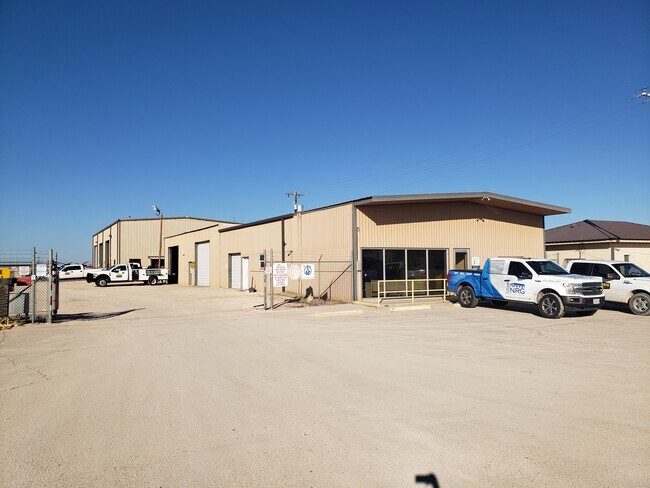
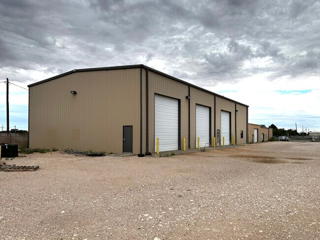
Property Record
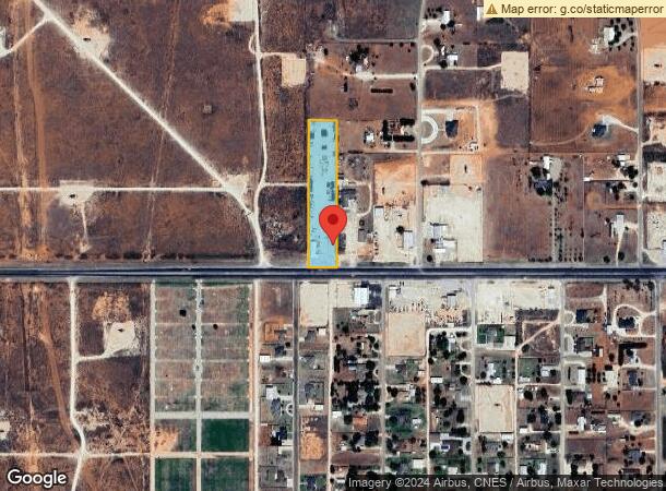
Highway 83, Denver City, TX 79323
NEARBY LISTINGS FOR SALE OR LEASE
-
-
View all Denver City listings for lease on LoopNet.com
Property Detail
Highway 83
Other Market Areas
Mead Tracts Sub
7117
TR 15 MEAD TRACTS SEC 894 BLK D
Commercialnec
Yoakum
2025
Texas
2025
2.42 AC
950200
Panhandle Area
22,342 SF
DEMOGRAPHICS near Highway 83
1 Mile
3 Mile
5 Mile
2024 Total Population
782
5,490
5,823
2029 Population
760
5,374
5,698
Pop Growth 2024-2029
(2.81%)
(2.11%)
(2.15%)
Average Age
36
37
37
2024 Total Households
252
1,874
1,993
HH Growth 2024-2029
(3.17%)
(2.03%)
(2.06%)
Median Household Inc
$114,705
$70,539
$70,769
Avg Household Size
3.10
2.90
2.90
2024 Avg HH Vehicles
2.00
2.00
2.00
Median Home Value
$253,103
$158,093
$156,354
Median Year Built
1984
1981
1980
Nearby Places
Map Layers
Map Styles
 Street
 Aerial
- Restaurants
- Banks
- Shops
- Fitness
- Groceries
SALE & LEASE HISTORY
LISTING DATE
SALE/LEASE

Jan 04, 2024
For Lease
Jan 04, 2024
For Sale
Nearby Properties
Address
Land Use
TOTAL SIZE
Lot Size
Zoning
Address
Land Use
TOTAL SIZE
Lot Size
Zoning
42,600 SF
44.77 AC
Address
Land Use
TOTAL SIZE
Lot Size
Zoning
17.71 AC
Address
Land Use
TOTAL SIZE
Lot Size
Zoning
89,065 SF
1.29 AC
Address
Land Use
TOTAL SIZE
Lot Size
Zoning
2.27 AC
Address
Land Use
TOTAL SIZE
Lot Size
Zoning
96,553 SF
3.73 AC
Address
Land Use
TOTAL SIZE
Lot Size
Zoning
37,973 SF
2.30 AC
Address
Land Use
TOTAL SIZE
Lot Size
Zoning
6,330 SF
2.22 AC
Address
Land Use
TOTAL SIZE
Lot Size
Zoning
161,473 SF
3.77 AC
Address
Land Use
TOTAL SIZE
Lot Size
Zoning
18,161 SF
4.22 AC
Address
Land Use
TOTAL SIZE
Lot Size
Zoning
48,976 SF
2.57 AC
Address
Land Use
TOTAL SIZE
Lot Size
Zoning
43,708 SF
0.96 AC
Address
Land Use
TOTAL SIZE
Lot Size
Zoning
24,302 SF
1.05 AC
Address
Land Use
TOTAL SIZE
Lot Size
Zoning
47,903 SF
12.50 AC
Address
Land Use
TOTAL SIZE
Lot Size
Zoning
48.75 AC
Address
Land Use
TOTAL SIZE
Lot Size
Zoning
27,934 SF
0.96 AC
Address
Land Use
TOTAL SIZE
Lot Size
Zoning
90,039 SF
0.96 AC
Address
Land Use
TOTAL SIZE
Lot Size
Zoning
42,296 SF
1.69 AC
Address
Land Use
TOTAL SIZE
Lot Size
Zoning
27,168 SF
0.96 AC
Address
Land Use
TOTAL SIZE
Lot Size
Zoning
130,384 SF
20.36 AC
Address
Land Use
TOTAL SIZE
Lot Size
Zoning
15,622 SF
2.33 AC
Address
Land Use
TOTAL SIZE
Lot Size
Zoning
18,564 SF
0.48 AC
Address
Land Use
TOTAL SIZE
Lot Size
Zoning
34,524 SF
10.30 AC
Address
Land Use
TOTAL SIZE
Lot Size
Zoning
10,612 SF
2.42 AC
Address
Land Use
TOTAL SIZE
Lot Size
Zoning
12,976 SF
0.64 AC
Address
Land Use
TOTAL SIZE
Lot Size
Zoning
23,055 SF
0.56 AC
Address
Land Use
TOTAL SIZE
Lot Size
Zoning
26,942 SF
0.64 AC
Address
Land Use
TOTAL SIZE
Lot Size
Zoning
13,451 SF
2 AC
The World's #1 Commercial Real Estate Marketplace
Connect with us
© 2026 CoStar Group
The information above has been obtained from sources believed reliable. While we do not doubt its accuracy we have not verified it and make no guarantee, warranty or representation about it. It is your responsibility to independently confirm its accuracy and completeness. Any projections, opinions, assumptions, or estimates used are for example only and do not represent the current or future performance of the property. The value of this transaction to you depends on tax and other factors which should be evaluated by your tax, financial, and legal advisors. You and your advisors should conduct a careful, independent investigation of the property to determine to your satisfaction the suitability of the property for your needs.