Property Record
11615 Galm Rd, San Antonio, TX 78254


Property Detail
11615 Galm Rd
San Antonio-New Braunfels, TX
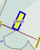
CB 4450L (DISTRICT 7 FIRE & RESCUE STATION 115) BLK 1 LOT 1 2017 NEW ACCT PER PLAT 9708/215-217 FILED 12/1/16
04450-901-0010
Bexar
Officebuilding
Texas
B and X Area of moderate flood hazard, usually the area between the limits of the 100-year and 500-year floods.
476
0
3 AC
2025
Far Northwest
182106
San Antonio
8,860 SF
NEARBY LISTINGS FOR SALE OR LEASE
DEMOGRAPHICS near 11615 Galm Rd
1 mile
3 mile
5 mile
2025 Total Population
14,248
99,217
206,738
2030 Population
15,177
105,111
218,489
Pop Growth 2025-2030
+ 6.52%
+ 5.94%
+ 5.68%
Average Age
33
34
36
2025 Total Households
4,530
32,583
69,996
HH Growth 2025-2030
+ 6.69%
+ 6.04%
+ 5.70%
Median Household Inc
$121,015
$99,018
$100,711
Avg Household Size
3.10
3.00
2.90
2025 Avg HH Vehicles
2.00
2.00
2.00
Median Home Value
$330,250
$318,700
$323,817
Median Year Built
2010
2008
2004
Nearby Places
Map Layers
Map Styles
 Street
 Aerial
Transit
 Traffic
 Biking
Places
Listings with unknown addresses are not visible on the map
- Restaurants
- Banks
- Shops
- Fitness
- Groceries
PUBLIC TRANSPORTATION
AIRPORT
San Antonio International
Drive
Walk
Distance
San Antonio International
29 min
18.5 mi
Freight Ports
Calhoun Port
Drive
Walk
Distance
Calhoun Port
205 min
166.0 mi
Nearby Properties
Address
Land Use
TOTAL SIZE
Lot Size
Zoning
Address
Land Use
TOTAL SIZE
Lot Size
Zoning
8,159.10 AC
Address
Land Use
TOTAL SIZE
Lot Size
Zoning
411,503 SF
48.90 AC
Address
Land Use
TOTAL SIZE
Lot Size
Zoning
276,500 SF
15.51 AC
Address
Land Use
TOTAL SIZE
Lot Size
Zoning
342,773 SF
19.58 AC
Address
Land Use
TOTAL SIZE
Lot Size
Zoning
408,011 SF
43.98 AC
Address
Land Use
TOTAL SIZE
Lot Size
Zoning
149,500 SF
9.36 AC
Address
Land Use
TOTAL SIZE
Lot Size
Zoning
268,511 SF
16.95 AC
Address
Land Use
TOTAL SIZE
Lot Size
Zoning
294,979 SF
18.70 AC
Address
Land Use
TOTAL SIZE
Lot Size
Zoning
268,790 SF
12.47 AC
Address
Land Use
TOTAL SIZE
Lot Size
Zoning
268,165 SF
14.84 AC
Address
Land Use
TOTAL SIZE
Lot Size
Zoning
281,880 SF
14.13 AC
Address
Land Use
TOTAL SIZE
Lot Size
Zoning
287,684 SF
19.22 AC
Address
Land Use
TOTAL SIZE
Lot Size
Zoning
260,527 SF
16.70 AC
Address
Land Use
TOTAL SIZE
Lot Size
Zoning
235,065 SF
14.46 AC
Address
Land Use
TOTAL SIZE
Lot Size
Zoning
246,905 SF
14.36 AC
Address
Land Use
TOTAL SIZE
Lot Size
Zoning
257,067 SF
13.25 AC
Address
Land Use
TOTAL SIZE
Lot Size
Zoning
111,633 SF
14.67 AC
Address
Land Use
TOTAL SIZE
Lot Size
Zoning
256,474 SF
9.34 AC
Address
Land Use
TOTAL SIZE
Lot Size
Zoning
229,430 SF
11.92 AC
Address
Land Use
TOTAL SIZE
Lot Size
Zoning
353,996 SF
15.54 AC
Address
Land Use
TOTAL SIZE
Lot Size
Zoning
161,790 SF
11.28 AC
Address
Land Use
TOTAL SIZE
Lot Size
Zoning
162,083 SF
9.30 AC
Address
Land Use
TOTAL SIZE
Lot Size
Zoning
100,706 SF
10.90 AC
Address
Land Use
TOTAL SIZE
Lot Size
Zoning
15,315 SF
586.01 AC
Address
Land Use
TOTAL SIZE
Lot Size
Zoning
66,800 SF
14.75 AC
Address
Land Use
TOTAL SIZE
Lot Size
Zoning
142,104 SF
13.05 AC
Address
Land Use
TOTAL SIZE
Lot Size
Zoning
3,665 SF
52.80 AC
Address
Land Use
TOTAL SIZE
Lot Size
Zoning
5,156 SF
61.16 AC
Address
Land Use
TOTAL SIZE
Lot Size
Zoning
71,170 SF
7.52 AC
Address
Land Use
TOTAL SIZE
Lot Size
Zoning
136,591 SF
18.33 AC
The World's #1 Commercial Real Estate Marketplace
Connect with us
© 2026 CoStar Group
The information above has been obtained from sources believed reliable. While we do not doubt its accuracy we have not verified it and make no guarantee, warranty or representation about it. It is your responsibility to independently confirm its accuracy and completeness. Any projections, opinions, assumptions, or estimates used are for example only and do not represent the current or future performance of the property. The value of this transaction to you depends on tax and other factors which should be evaluated by your tax, financial, and legal advisors. You and your advisors should conduct a careful, independent investigation of the property to determine to your satisfaction the suitability of the property for your needs.