Property Record
11615 Highway 70, Arlington, TN 38002
NEARBY LISTINGS FOR SALE OR LEASE
Property Detail
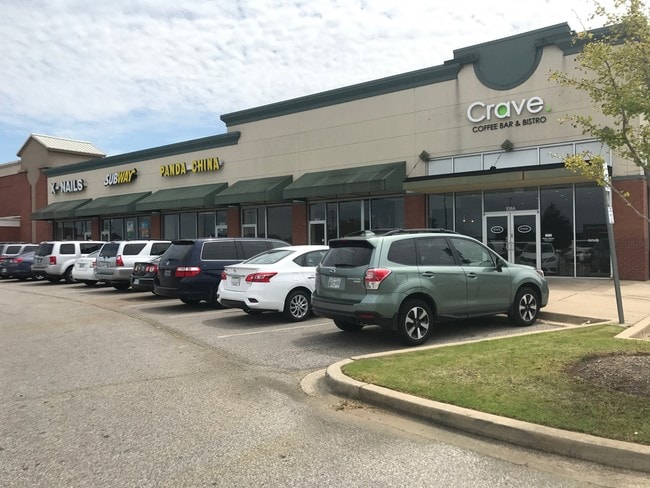
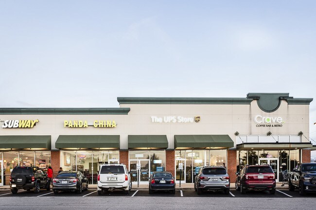
11615 Highway 70
A0-141-0-0378
Arlington Collection/Kroger V-463 The
Regionalshoppingcenterormallwithanchorstore
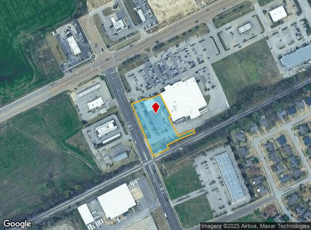
ES AIRLINE RD SEE MAP GRID# 56 F
AE
Shelby
47157C0220G
Tennessee
2024
1.48 AC
2025
Northeast
020902
Memphis
16,357 SF
Memphis, TN-MS-AR
DEMOGRAPHICS near 11615 Highway 70
1 Mile
3 Mile
5 Mile
2024 Total Population
1,768
14,880
22,606
2029 Population
1,727
14,627
22,486
Pop Growth 2024-2029
(2.32%)
(1.70%)
(0.53%)
Average Age
35
35
37
2024 Total Households
558
4,657
7,259
HH Growth 2024-2029
(2.51%)
(1.85%)
(0.54%)
Median Household Inc
$110,190
$109,684
$113,016
Avg Household Size
3.20
3.20
3.10
2024 Avg HH Vehicles
2.00
2.00
2.00
Median Home Value
$341,783
$325,099
$350,400
Median Year Built
2006
2004
2004
Nearby Places
Map Layers
Map Styles
 Street
 Aerial
- Restaurants
- Banks
- Shops
- Fitness
- Groceries
PUBLIC TRANSPORTATION
AIRPORT
Memphis International
DRIVE
WALK
Distance
Memphis International
36 min
31.7 mi
Freight Ports
Port of Shreveport
DRIVE
WALK
Distance
Port of Shreveport
1 min
304.3 mi
SALE & LEASE HISTORY
LISTING DATE
SALE/LEASE

Sep 25, 2016
For Lease
Oct 05, 2018
For Sale
Nov 09, 2017
For Lease
Nearby Properties
Address
Land Use
TOTAL SIZE
Lot Size
Zoning
Address
Land Use
TOTAL SIZE
Lot Size
Zoning
2,008,800 SF
146.24 AC
Address
Land Use
TOTAL SIZE
Lot Size
Zoning
93,928 SF
3.85 AC
M-1
Address
Land Use
TOTAL SIZE
Lot Size
Zoning
44,125 SF
5.26 AC
M-1
Address
Land Use
TOTAL SIZE
Lot Size
Zoning
51,237 SF
12.46 AC
RS-13
Address
Land Use
TOTAL SIZE
Lot Size
Zoning
105,178 SF
15.78 AC
M-1
Address
Land Use
TOTAL SIZE
Lot Size
Zoning
38,926 SF
2.90 AC
S-C
Address
Land Use
TOTAL SIZE
Lot Size
Zoning
53,670 SF
6.69 AC
M-1
Address
Land Use
TOTAL SIZE
Lot Size
Zoning
35,909 SF
1.07 AC
M-1
Address
Land Use
TOTAL SIZE
Lot Size
Zoning
29,762 SF
2.63 AC
S-C
Address
Land Use
TOTAL SIZE
Lot Size
Zoning
159,960 SF
54.99 AC
M-1
Address
Land Use
TOTAL SIZE
Lot Size
Zoning
58,203 SF
3.49 AC
O
Address
Land Use
TOTAL SIZE
Lot Size
Zoning
50,600 SF
1.91 AC
M-1
Address
Land Use
TOTAL SIZE
Lot Size
Zoning
296,005 SF
23.11 AC
M-1
Address
Land Use
TOTAL SIZE
Lot Size
Zoning
26,125 SF
6.20 AC
M-1
Address
Land Use
TOTAL SIZE
Lot Size
Zoning
95,550 SF
6.14 AC
M-1
Address
Land Use
TOTAL SIZE
Lot Size
Zoning
47,140 SF
4.36 AC
M-1
Address
Land Use
TOTAL SIZE
Lot Size
Zoning
85,875 SF
4.96 AC
S-C
Address
Land Use
TOTAL SIZE
Lot Size
Zoning
61,344 SF
10.58 AC
O
Address
Land Use
TOTAL SIZE
Lot Size
Zoning
19,031 SF
3 AC
E
Address
Land Use
TOTAL SIZE
Lot Size
Zoning
2,094 SF
25.33 AC
RS-15
Address
Land Use
TOTAL SIZE
Lot Size
Zoning
51,738 SF
6.05 AC
B-E
Address
Land Use
TOTAL SIZE
Lot Size
Zoning
5.87 AC
M-1
Address
Land Use
TOTAL SIZE
Lot Size
Zoning
19,800 SF
2.14 AC
S-C
Address
Land Use
TOTAL SIZE
Lot Size
Zoning
23,952 SF
3.61 AC
S-C
Address
Land Use
TOTAL SIZE
Lot Size
Zoning
13,966 SF
1.32 AC
S-C
Address
Land Use
TOTAL SIZE
Lot Size
Zoning
4,536 SF
2.12 AC
E
Address
Land Use
TOTAL SIZE
Lot Size
Zoning
8,219 SF
2.06 AC
S-C
Address
Land Use
TOTAL SIZE
Lot Size
Zoning
8,774 SF
2.08 AC
S-C
Address
Land Use
TOTAL SIZE
Lot Size
Zoning
6,985 SF
2.84 AC
RS-13
Address
Land Use
TOTAL SIZE
Lot Size
Zoning
99,805 SF
4.42 AC
M-1
The World's #1 Commercial Real Estate Marketplace
Connect with us
© 2026 CoStar Group
The information above has been obtained from sources believed reliable. While we do not doubt its accuracy we have not verified it and make no guarantee, warranty or representation about it. It is your responsibility to independently confirm its accuracy and completeness. Any projections, opinions, assumptions, or estimates used are for example only and do not represent the current or future performance of the property. The value of this transaction to you depends on tax and other factors which should be evaluated by your tax, financial, and legal advisors. You and your advisors should conduct a careful, independent investigation of the property to determine to your satisfaction the suitability of the property for your needs.