Property Record
11615 Sw County Road 769, Arcadia, FL 34269
NEARBY LISTINGS FOR SALE OR LEASE
Property Detail
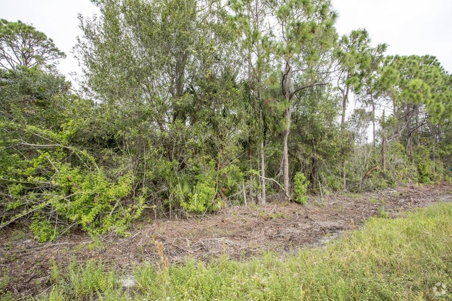
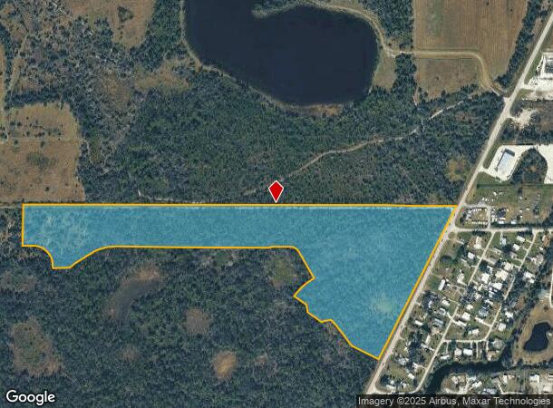
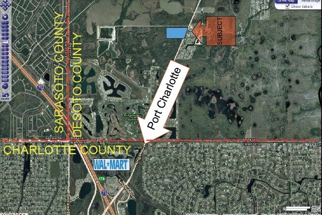
11615 Sw County Road 769
29-39-23-0000-0012-0000
THAT PART OF S1/2 LYG W OF KINGS HWY LESS N 520 FT & LESS THE FOLLOWING: COMM SW COR OF SEC 30 TH S 89D06M37S E 2659.62 FT TO SW COR OF SE1/4 OF SEC 30 TH N 89D55M34S E 2105.36 FT TO POB TH N 00D07M54S W 216.38 FT TH N 10D48M55S W 52.83 FT TH S 86D06
Miscellaneous
DeSoto
AE
Florida
12015C0066G
48 AC
2024
Florida Central South Area
2024
Other Market Areas
010405
Arcadia, FL
DEMOGRAPHICS near 11615 Sw County Road 769
1 Mile
3 Mile
5 Mile
2024 Total Population
694
15,597
46,406
2029 Population
775
18,411
54,951
Pop Growth 2024-2029
+ 11.67%
+ 18.04%
+ 18.41%
Average Age
51
53
51
2024 Total Households
300
7,262
20,389
HH Growth 2024-2029
+ 12.33%
+ 18.44%
+ 18.78%
Median Household Inc
$58,571
$62,707
$61,104
Avg Household Size
2.30
2.10
2.20
2024 Avg HH Vehicles
2.00
2.00
2.00
Median Home Value
$201,429
$258,477
$236,992
Median Year Built
1990
1995
1993
Nearby Places
Map Layers
Map Styles
 Street
 Aerial
- Restaurants
- Banks
- Shops
- Fitness
- Groceries
PUBLIC TRANSPORTATION
AIRPORT
Punta Gorda
DRIVE
WALK
Distance
Punta Gorda
18 min
12.0 mi
Freight Ports
Port Manatee
DRIVE
WALK
Distance
Port Manatee
79 min
66.4 mi
Nearby Properties
Address
Land Use
TOTAL SIZE
Lot Size
Zoning
Address
Land Use
TOTAL SIZE
Lot Size
Zoning
202,009 SF
20.89 AC
PD
Address
Land Use
TOTAL SIZE
Lot Size
Zoning
204,731 SF
16.11 AC
PD
Address
Land Use
TOTAL SIZE
Lot Size
Zoning
229,973 SF
21.33 AC
PD
Address
Land Use
TOTAL SIZE
Lot Size
Zoning
217,784 SF
38.63 AC
PD
Address
Land Use
TOTAL SIZE
Lot Size
Zoning
73,222 SF
5.14 AC
PD
Address
Land Use
TOTAL SIZE
Lot Size
Zoning
41,148 SF
155.85 AC
RSF-3
Address
Land Use
TOTAL SIZE
Lot Size
Zoning
83,180 SF
9.31 AC
PD
Address
Land Use
TOTAL SIZE
Lot Size
Zoning
95,547 SF
14.06 AC
PD
Address
Land Use
TOTAL SIZE
Lot Size
Zoning
173.33 AC
P/I
Address
Land Use
TOTAL SIZE
Lot Size
Zoning
27,082 SF
2.05 AC
PD
Address
Land Use
TOTAL SIZE
Lot Size
Zoning
23,798 SF
1.71 AC
PD
Address
Land Use
TOTAL SIZE
Lot Size
Zoning
98,552 SF
11.42 AC
CG
Address
Land Use
TOTAL SIZE
Lot Size
Zoning
594.36 AC
A-10
Address
Land Use
TOTAL SIZE
Lot Size
Zoning
82.27 AC
PD
Address
Land Use
TOTAL SIZE
Lot Size
Zoning
153.66 AC
P/I
Address
Land Use
TOTAL SIZE
Lot Size
Zoning
12,977 SF
2.29 AC
PD
Address
Land Use
TOTAL SIZE
Lot Size
Zoning
13,642 SF
2.55 AC
PD
Address
Land Use
TOTAL SIZE
Lot Size
Zoning
11,773 SF
1.55 AC
PD
Address
Land Use
TOTAL SIZE
Lot Size
Zoning
74,434 SF
4.42 AC
CG
Address
Land Use
TOTAL SIZE
Lot Size
Zoning
23,566 SF
20.33 AC
RMF10
Address
Land Use
TOTAL SIZE
Lot Size
Zoning
662.52 AC
EC
Address
Land Use
TOTAL SIZE
Lot Size
Zoning
9,908 SF
40 AC
RVC
Address
Land Use
TOTAL SIZE
Lot Size
Zoning
36,049 SF
4.12 AC
PD
Address
Land Use
TOTAL SIZE
Lot Size
Zoning
31.27 AC
PD
Address
Land Use
TOTAL SIZE
Lot Size
Zoning
14,945 SF
2.47 AC
RMF15
Address
Land Use
TOTAL SIZE
Lot Size
Zoning
22,306 SF
1.97 AC
CG
Address
Land Use
TOTAL SIZE
Lot Size
Zoning
10,175 SF
3.35 AC
PD
Address
Land Use
TOTAL SIZE
Lot Size
Zoning
24,509 SF
3.72 AC
PD
Address
Land Use
TOTAL SIZE
Lot Size
Zoning
172.19 AC
PUD
Address
Land Use
TOTAL SIZE
Lot Size
Zoning
509 AC
A-5
The World's #1 Commercial Real Estate Marketplace
Connect with us
© 2025 CoStar Group
The information above has been obtained from sources believed reliable. While we do not doubt its accuracy we have not verified it and make no guarantee, warranty or representation about it. It is your responsibility to independently confirm its accuracy and completeness. Any projections, opinions, assumptions, or estimates used are for example only and do not represent the current or future performance of the property. The value of this transaction to you depends on tax and other factors which should be evaluated by your tax, financial, and legal advisors. You and your advisors should conduct a careful, independent investigation of the property to determine to your satisfaction the suitability of the property for your needs.