Property Record
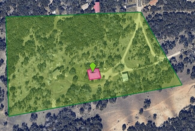
1162 Thunder Cloud, Spring Branch, TX 78070

Property Detail
1162 Thunder Cloud
San Antonio-New Braunfels, TX
A-668 SUR-610 H WEHE, ACRES 15.96
78-0668-0001-00
Comal
Commercialnec
Texas
2024
15.96 AC
2025
Comal County
310610
San Antonio
6,003 SF
NEARBY LISTINGS FOR SALE OR LEASE
-
-
View all Spring Branch listings for sale on LoopNet.com
DEMOGRAPHICS near 1162 Thunder Cloud
1 mile
3 mile
5 mile
2025 Total Population
991
6,639
17,992
2030 Population
1,150
7,755
21,228
Pop Growth 2025-2030
+ 16.04%
+ 16.81%
+ 17.99%
Average Age
44
43
43
2025 Total Households
356
2,390
6,417
HH Growth 2025-2030
+ 16.01%
+ 16.95%
+ 18.06%
Median Household Inc
$145,833
$118,097
$136,368
Avg Household Size
2.80
2.70
2.70
2025 Avg HH Vehicles
3.00
2.00
3.00
Median Home Value
$693,023
$654,003
$623,348
Median Year Built
2001
2005
2006
Nearby Places
Map Layers
Map Styles
 Street
 Aerial
Transit
 Traffic
 Biking
Places
Listings with unknown addresses are not visible on the map
- Restaurants
- Banks
- Shops
- Fitness
- Groceries
PUBLIC TRANSPORTATION
AIRPORT
San Antonio International
Drive
Walk
Distance
San Antonio International
38 min
26.5 mi
Freight Ports
Calhoun Port
Drive
Walk
Distance
Calhoun Port
216 min
172.5 mi
Nearby Properties
Address
Land Use
TOTAL SIZE
Lot Size
Zoning
Address
Land Use
TOTAL SIZE
Lot Size
Zoning
269,288 SF
14.67 AC
Address
Land Use
TOTAL SIZE
Lot Size
Zoning
60,591 SF
3.88 AC
Address
Land Use
TOTAL SIZE
Lot Size
Zoning
47,845 SF
4.65 AC
Address
Land Use
TOTAL SIZE
Lot Size
Zoning
54,329 SF
3.07 AC
Address
Land Use
TOTAL SIZE
Lot Size
Zoning
53,381 SF
15.01 AC
Address
Land Use
TOTAL SIZE
Lot Size
Zoning
1,800 SF
6.12 AC
Address
Land Use
TOTAL SIZE
Lot Size
Zoning
304.30 AC
Address
Land Use
TOTAL SIZE
Lot Size
Zoning
3,200 SF
2.26 AC
Address
Land Use
TOTAL SIZE
Lot Size
Zoning
24,762 SF
3.98 AC
Address
Land Use
TOTAL SIZE
Lot Size
Zoning
256.40 AC
Address
Land Use
TOTAL SIZE
Lot Size
Zoning
13.41 AC
Address
Land Use
TOTAL SIZE
Lot Size
Zoning
99,412 SF
8.01 AC
Address
Land Use
TOTAL SIZE
Lot Size
Zoning
266.79 AC
Address
Land Use
TOTAL SIZE
Lot Size
Zoning
1,792 SF
5 AC
Address
Land Use
TOTAL SIZE
Lot Size
Zoning
10,968 SF
20 AC
Address
Land Use
TOTAL SIZE
Lot Size
Zoning
7.91 AC
Address
Land Use
TOTAL SIZE
Lot Size
Zoning
8,608 SF
1.39 AC
Address
Land Use
TOTAL SIZE
Lot Size
Zoning
8,470 SF
6.17 AC
Address
Land Use
TOTAL SIZE
Lot Size
Zoning
9,796 SF
2.81 AC
Address
Land Use
TOTAL SIZE
Lot Size
Zoning
20,000 SF
12.24 AC
Address
Land Use
TOTAL SIZE
Lot Size
Zoning
20,349 SF
2.93 AC
Address
Land Use
TOTAL SIZE
Lot Size
Zoning
13,646 SF
11.32 AC
Address
Land Use
TOTAL SIZE
Lot Size
Zoning
11,220 SF
1.52 AC
Address
Land Use
TOTAL SIZE
Lot Size
Zoning
194.26 AC
Address
Land Use
TOTAL SIZE
Lot Size
Zoning
3,828 SF
5.02 AC
Address
Land Use
TOTAL SIZE
Lot Size
Zoning
40.32 AC
Address
Land Use
TOTAL SIZE
Lot Size
Zoning
10,238 SF
4.99 AC
Address
Land Use
TOTAL SIZE
Lot Size
Zoning
10,710 SF
1.79 AC
Address
Land Use
TOTAL SIZE
Lot Size
Zoning
17,121 SF
5.03 AC
Address
Land Use
TOTAL SIZE
Lot Size
Zoning
14,238 SF
2.23 AC
The World's #1 Commercial Real Estate Marketplace
Connect with us
© 2026 CoStar Group
The information above has been obtained from sources believed reliable. While we do not doubt its accuracy we have not verified it and make no guarantee, warranty or representation about it. It is your responsibility to independently confirm its accuracy and completeness. Any projections, opinions, assumptions, or estimates used are for example only and do not represent the current or future performance of the property. The value of this transaction to you depends on tax and other factors which should be evaluated by your tax, financial, and legal advisors. You and your advisors should conduct a careful, independent investigation of the property to determine to your satisfaction the suitability of the property for your needs.