Property Record
11620 Fm 1960, Huffman, TX 77336


Property Detail
11620 Fm 1960
0410050020197
TR 1R-1 ABST 49 J MERRY
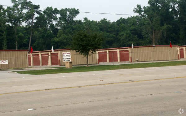
Publicstorage
HARRIS
B and X Area of moderate flood hazard, usually the area between the limits of the 100-year and 500-year floods.
Texas
2024
2 AC
2025
Northeast Outlier
251702
Houston
68,156 SF
Houston-Pasadena-The Woodlands, TX
NEARBY LISTINGS FOR SALE OR LEASE
-
-
View all Huffman listings for sale on LoopNet.com
DEMOGRAPHICS near 11620 Fm 1960
1 mile
3 mile
5 mile
2025 Total Population
4,119
15,066
64,689
2030 Population
4,474
16,243
69,201
Pop Growth 2025-2030
+ 8.62%
+ 7.81%
+ 6.97%
Average Age
36
39
40
2025 Total Households
1,406
5,455
22,438
HH Growth 2025-2030
+ 8.75%
+ 7.81%
+ 7.10%
Median Household Inc
$54,607
$73,286
$109,453
Avg Household Size
2.90
2.70
2.80
2025 Avg HH Vehicles
2.00
2.00
2.00
Median Home Value
$248,055
$304,621
$347,586
Median Year Built
1993
1997
1997
Nearby Places
Map Layers
Map Styles
 Street
 Aerial
Layers
 Traffic
 Biking
Places
Listings with unknown addresses are not visible on the map
- Restaurants
- Banks
- Shops
- Fitness
- Groceries
PUBLIC TRANSPORTATION
AIRPORT
George Bush Intcntl/Houston
Drive
Walk
Distance
George Bush Intcntl/Houston
29 min
19.1 mi
William P Hobby
Drive
Walk
Distance
William P Hobby
57 min
35.8 mi
Freight Ports
Port of Houston
Drive
Walk
Distance
Port of Houston
44 min
27.8 mi
SALE & LEASE HISTORY
LISTING DATE
SALE/LEASE

Sep 27, 2023
For Sale
Nearby Properties
Address
Land Use
TOTAL SIZE
Lot Size
Zoning
Address
Land Use
TOTAL SIZE
Lot Size
Zoning
203,282 SF
15.53 AC
Address
Land Use
TOTAL SIZE
Lot Size
Zoning
184,199 SF
14.27 AC
Address
Land Use
TOTAL SIZE
Lot Size
Zoning
1,505.43 AC
Address
Land Use
TOTAL SIZE
Lot Size
Zoning
58,784 SF
4 AC
Address
Land Use
TOTAL SIZE
Lot Size
Zoning
79.87 AC
Address
Land Use
TOTAL SIZE
Lot Size
Zoning
39,921 SF
3.42 AC
Address
Land Use
TOTAL SIZE
Lot Size
Zoning
16,020 SF
14.47 AC
Address
Land Use
TOTAL SIZE
Lot Size
Zoning
146,352 SF
5.41 AC
Address
Land Use
TOTAL SIZE
Lot Size
Zoning
9,542 SF
39.75 AC
Address
Land Use
TOTAL SIZE
Lot Size
Zoning
25,064 SF
5.46 AC
Address
Land Use
TOTAL SIZE
Lot Size
Zoning
23,100 SF
1.21 AC
Address
Land Use
TOTAL SIZE
Lot Size
Zoning
22,171 SF
2.05 AC
Address
Land Use
TOTAL SIZE
Lot Size
Zoning
14,200 SF
11.98 AC
Address
Land Use
TOTAL SIZE
Lot Size
Zoning
321.21 AC
Address
Land Use
TOTAL SIZE
Lot Size
Zoning
75.49 AC
Address
Land Use
TOTAL SIZE
Lot Size
Zoning
237.60 AC
Address
Land Use
TOTAL SIZE
Lot Size
Zoning
38,764 SF
2.76 AC
Address
Land Use
TOTAL SIZE
Lot Size
Zoning
12.74 AC
Address
Land Use
TOTAL SIZE
Lot Size
Zoning
116.80 AC
Address
Land Use
TOTAL SIZE
Lot Size
Zoning
8,350 SF
1.82 AC
Address
Land Use
TOTAL SIZE
Lot Size
Zoning
86,351 SF
9.79 AC
Address
Land Use
TOTAL SIZE
Lot Size
Zoning
55.67 AC
Address
Land Use
TOTAL SIZE
Lot Size
Zoning
27,943 SF
1.72 AC
Address
Land Use
TOTAL SIZE
Lot Size
Zoning
17,624 SF
0.96 AC
Address
Land Use
TOTAL SIZE
Lot Size
Zoning
29,200 SF
7.90 AC
Address
Land Use
TOTAL SIZE
Lot Size
Zoning
69.29 AC
Address
Land Use
TOTAL SIZE
Lot Size
Zoning
19,740 SF
3 AC
Address
Land Use
TOTAL SIZE
Lot Size
Zoning
17,480 SF
0.86 AC
Address
Land Use
TOTAL SIZE
Lot Size
Zoning
12,100 SF
1.38 AC
The World's #1 Commercial Real Estate Marketplace
Connect with us
© 2026 CoStar Group
The information above has been obtained from sources believed reliable. While we do not doubt its accuracy we have not verified it and make no guarantee, warranty or representation about it. It is your responsibility to independently confirm its accuracy and completeness. Any projections, opinions, assumptions, or estimates used are for example only and do not represent the current or future performance of the property. The value of this transaction to you depends on tax and other factors which should be evaluated by your tax, financial, and legal advisors. You and your advisors should conduct a careful, independent investigation of the property to determine to your satisfaction the suitability of the property for your needs.