Property Record
11629 Northland Dr Ne, Rockford, MI 49341


NEARBY LISTINGS FOR SALE OR LEASE
-
-
View all Rockford listings for lease on LoopNet.com
Property Detail
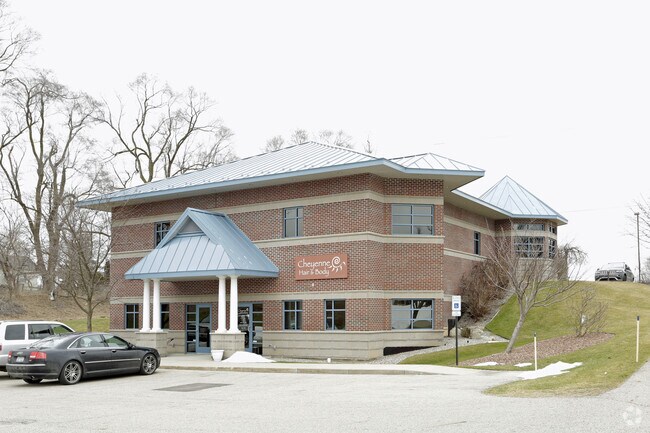
11629 Northland Dr Ne
41-06-12-477-010
410612477010 PART OF SE 1/4 COM 430.50 FT N 88D 48M 22S W ALONG S SEC LINE & 207.39 FT N 0D 35M 11S E ALONG W LINE OF E
Commercialnec
Kent
X
Michigan
26081C0195D
1.37 AC
2024
Outlying Kent County
2025
West Michigan
010602
Grand Rapids-Wyoming, MI
3,104 SF
DEMOGRAPHICS near 11629 Northland Dr Ne
1 Mile
3 Mile
5 Mile
2024 Total Population
1,284
9,844
32,872
2029 Population
1,303
9,974
33,333
Pop Growth 2024-2029
+ 1.48%
+ 1.32%
+ 1.40%
Average Age
39
39
39
2024 Total Households
443
3,432
11,797
HH Growth 2024-2029
+ 1.35%
+ 1.28%
+ 1.40%
Median Household Inc
$125,685
$107,968
$95,225
Avg Household Size
2.90
2.80
2.80
2024 Avg HH Vehicles
2.00
2.00
2.00
Median Home Value
$300,990
$283,789
$277,406
Median Year Built
1993
1993
1992
Nearby Places
Map Layers
Map Styles
 Street
 Aerial
- Restaurants
- Banks
- Shops
- Fitness
- Groceries
PUBLIC TRANSPORTATION
AIRPORT
Gerald R Ford International
DRIVE
WALK
Distance
Gerald R Ford International
39 min
25.7 mi
SALE & LEASE HISTORY
LISTING DATE
SALE/LEASE

Dec 16, 2020
For Lease
Nearby Properties
Address
Land Use
TOTAL SIZE
Lot Size
Zoning
Address
Land Use
TOTAL SIZE
Lot Size
Zoning
178,942 SF
143.48 AC
I-1
Address
Land Use
TOTAL SIZE
Lot Size
Zoning
178,942 SF
202.41 AC
I-1
Address
Land Use
TOTAL SIZE
Lot Size
Zoning
413,330 SF
20.83 AC
I-1
Address
Land Use
TOTAL SIZE
Lot Size
Zoning
40,800 SF
109.96 AC
IC
Address
Land Use
TOTAL SIZE
Lot Size
Zoning
99.87 AC
R4
Address
Land Use
TOTAL SIZE
Lot Size
Zoning
121,183 SF
6.83 AC
I-1
Address
Land Use
TOTAL SIZE
Lot Size
Zoning
13,955 SF
196.11 AC
MHP
Address
Land Use
TOTAL SIZE
Lot Size
Zoning
64,075 SF
11.13 AC
I-1
Address
Land Use
TOTAL SIZE
Lot Size
Zoning
3,400 SF
8.59 AC
C2
Address
Land Use
TOTAL SIZE
Lot Size
Zoning
36,324 SF
8.29 AC
C2
Address
Land Use
TOTAL SIZE
Lot Size
Zoning
8.86 AC
C2
Address
Land Use
TOTAL SIZE
Lot Size
Zoning
Address
Land Use
TOTAL SIZE
Lot Size
Zoning
66,590 SF
4.06 AC
I-1
Address
Land Use
TOTAL SIZE
Lot Size
Zoning
Address
Land Use
TOTAL SIZE
Lot Size
Zoning
49,647 SF
5.30 AC
I-1
Address
Land Use
TOTAL SIZE
Lot Size
Zoning
68,724 SF
7.53 AC
I-1
Address
Land Use
TOTAL SIZE
Lot Size
Zoning
64,632 SF
3.75 AC
I-1
Address
Land Use
TOTAL SIZE
Lot Size
Zoning
75,000 SF
6.60 AC
I-1
Address
Land Use
TOTAL SIZE
Lot Size
Zoning
1,400 SF
60 AC
I-1
Address
Land Use
TOTAL SIZE
Lot Size
Zoning
54,186 SF
3.17 AC
I-1
Address
Land Use
TOTAL SIZE
Lot Size
Zoning
23,280 SF
Address
Land Use
TOTAL SIZE
Lot Size
Zoning
56,500 SF
5.94 AC
I-1
Address
Land Use
TOTAL SIZE
Lot Size
Zoning
3.56 AC
C2
Address
Land Use
TOTAL SIZE
Lot Size
Zoning
24,800 SF
3.90 AC
Address
Land Use
TOTAL SIZE
Lot Size
Zoning
16,000 SF
9.83 AC
Address
Land Use
TOTAL SIZE
Lot Size
Zoning
572 SF
16.47 AC
R-4
Address
Land Use
TOTAL SIZE
Lot Size
Zoning
Address
Land Use
TOTAL SIZE
Lot Size
Zoning
8,684 SF
3.54 AC
Address
Land Use
TOTAL SIZE
Lot Size
Zoning
31,843 SF
3.48 AC
C2
Address
Land Use
TOTAL SIZE
Lot Size
Zoning
The World's #1 Commercial Real Estate Marketplace
Connect with us
© 2025 CoStar Group
The information above has been obtained from sources believed reliable. While we do not doubt its accuracy we have not verified it and make no guarantee, warranty or representation about it. It is your responsibility to independently confirm its accuracy and completeness. Any projections, opinions, assumptions, or estimates used are for example only and do not represent the current or future performance of the property. The value of this transaction to you depends on tax and other factors which should be evaluated by your tax, financial, and legal advisors. You and your advisors should conduct a careful, independent investigation of the property to determine to your satisfaction the suitability of the property for your needs.