Property Record
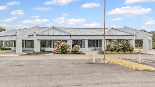
1163 Wards Rd, Altavista, VA 24517
NEARBY LISTINGS FOR SALE OR LEASE
Property Detail
1163 Wards Rd
0700-0A000-070-0
WARDS RD - PARCEL 1
Commercialnec
Campbell
X
Virginia
51143C0040E
10.97 AC
2025
Lynchburg
2025
Other Market Areas
020600
Lynchburg, VA
8,180 SF
DEMOGRAPHICS near 1163 Wards Rd
1 Mile
3 Mile
5 Mile
2024 Total Population
300
1,756
7,934
2029 Population
297
1,734
7,799
Pop Growth 2024-2029
(1.00%)
(1.25%)
(1.70%)
Average Age
46
46
44
2024 Total Households
128
766
3,420
HH Growth 2024-2029
(0.78%)
(1.04%)
(1.70%)
Median Household Inc
$59,999
$53,513
$46,057
Avg Household Size
2.30
2.30
2.30
2024 Avg HH Vehicles
3.00
2.00
2.00
Median Home Value
$127,272
$140,282
$138,950
Median Year Built
1978
1979
1971
Nearby Places
Map Layers
Map Styles
 Street
 Aerial
- Restaurants
- Banks
- Shops
- Fitness
- Groceries
PUBLIC TRANSPORTATION
AIRPORT
Lynchburg Regional/Preston Glenn Field
DRIVE
WALK
Distance
Lynchburg Regional/Preston Glenn Field
24 min
15.3 mi
Freight Ports
Virginia Port Authority - Richmond
DRIVE
WALK
Distance
Virginia Port Authority - Richmond
170 min
121.6 mi
Nearby Properties
Address
Land Use
TOTAL SIZE
Lot Size
Zoning
Address
Land Use
TOTAL SIZE
Lot Size
Zoning
378,974 SF
99.53 AC
Address
Land Use
TOTAL SIZE
Lot Size
Zoning
6,660 SF
62.32 AC
Address
Land Use
TOTAL SIZE
Lot Size
Zoning
154,479 SF
20.42 AC
Address
Land Use
TOTAL SIZE
Lot Size
Zoning
31,456 SF
3.59 AC
Address
Land Use
TOTAL SIZE
Lot Size
Zoning
32,536 SF
2.90 AC
Address
Land Use
TOTAL SIZE
Lot Size
Zoning
8,115 SF
523.50 AC
A1
Address
Land Use
TOTAL SIZE
Lot Size
Zoning
28,000 SF
4.44 AC
Address
Land Use
TOTAL SIZE
Lot Size
Zoning
3,232 SF
263.28 AC
A1
Address
Land Use
TOTAL SIZE
Lot Size
Zoning
15,660 SF
4.78 AC
BGCC
Address
Land Use
TOTAL SIZE
Lot Size
Zoning
3,240 SF
6.95 AC
RSF
Address
Land Use
TOTAL SIZE
Lot Size
Zoning
9,100 SF
1.60 AC
BLC
Address
Land Use
TOTAL SIZE
Lot Size
Zoning
7,952 SF
7.10 AC
Address
Land Use
TOTAL SIZE
Lot Size
Zoning
3,576 SF
1.33 AC
Address
Land Use
TOTAL SIZE
Lot Size
Zoning
4,002 SF
1.56 AC
Address
Land Use
TOTAL SIZE
Lot Size
Zoning
11,220 SF
4.20 AC
RSF
Address
Land Use
TOTAL SIZE
Lot Size
Zoning
35,520 SF
11.75 AC
Address
Land Use
TOTAL SIZE
Lot Size
Zoning
3,030 SF
1.58 AC
A1
Address
Land Use
TOTAL SIZE
Lot Size
Zoning
3,400 SF
112.22 AC
A1
Address
Land Use
TOTAL SIZE
Lot Size
Zoning
4,648 SF
8.01 AC
Address
Land Use
TOTAL SIZE
Lot Size
Zoning
2,215 SF
1.35 AC
Address
Land Use
TOTAL SIZE
Lot Size
Zoning
3,600 SF
60.76 AC
A1
Address
Land Use
TOTAL SIZE
Lot Size
Zoning
2,452 SF
79.51 AC
A1
Address
Land Use
TOTAL SIZE
Lot Size
Zoning
1,485 SF
1.38 AC
Address
Land Use
TOTAL SIZE
Lot Size
Zoning
9,400 SF
1.52 AC
Address
Land Use
TOTAL SIZE
Lot Size
Zoning
3,884 SF
1.25 AC
RMF
Address
Land Use
TOTAL SIZE
Lot Size
Zoning
7,128 SF
0.08 AC
Address
Land Use
TOTAL SIZE
Lot Size
Zoning
267.43 AC
Address
Land Use
TOTAL SIZE
Lot Size
Zoning
1,854 SF
127.80 AC
A1
Address
Land Use
TOTAL SIZE
Lot Size
Zoning
4,796 SF
9.85 AC
BGC
The World's #1 Commercial Real Estate Marketplace
Connect with us
© 2026 CoStar Group
The information above has been obtained from sources believed reliable. While we do not doubt its accuracy we have not verified it and make no guarantee, warranty or representation about it. It is your responsibility to independently confirm its accuracy and completeness. Any projections, opinions, assumptions, or estimates used are for example only and do not represent the current or future performance of the property. The value of this transaction to you depends on tax and other factors which should be evaluated by your tax, financial, and legal advisors. You and your advisors should conduct a careful, independent investigation of the property to determine to your satisfaction the suitability of the property for your needs.