Property Record
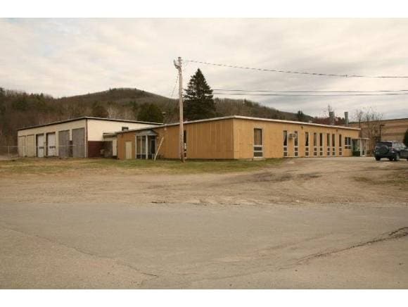
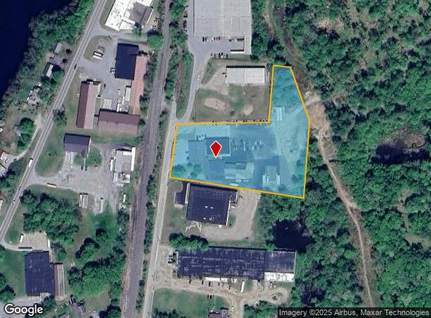
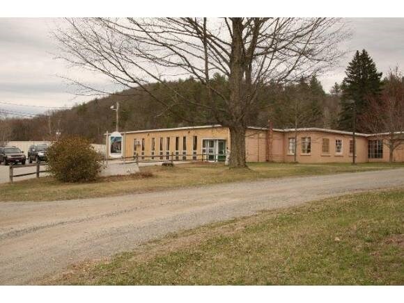
1164 Main St, North Walpole, NH 03609
NEARBY LISTINGS FOR SALE OR LEASE
-
-
View all North Walpole listings for sale on LoopNet.com
Property Detail
1164 Main St
WLPO-000027-000000-000008-000002
Cheshire
Commercialnec
New Hampshire
X
8
50025C0114E
3.89 AC
2024
Manchester/New Hampshire South Area
2024
Other Market Areas
970200
Keene, NH
5,790 SF
DEMOGRAPHICS near 1164 Main St
1 Mile
3 Mile
5 Mile
2024 Total Population
1,563
5,742
8,668
2029 Population
1,630
5,794
8,757
Pop Growth 2024-2029
+ 4.29%
+ 0.91%
+ 1.03%
Average Age
42
44
45
2024 Total Households
687
2,580
3,862
HH Growth 2024-2029
+ 3.93%
+ 0.74%
+ 0.78%
Median Household Inc
$64,687
$62,468
$65,197
Avg Household Size
2.20
2.20
2.20
2024 Avg HH Vehicles
2.00
2.00
2.00
Median Home Value
$182,050
$180,291
$198,774
Median Year Built
1957
1950
1960
Nearby Places
Map Layers
Map Styles
 Street
 Aerial
- Restaurants
- Banks
- Shops
- Fitness
- Groceries
PUBLIC TRANSPORTATION
COMMUTER RAIL
DRIVE
WALK
Distance
4 min
1.3 mi
SALE & LEASE HISTORY
LISTING DATE
SALE/LEASE

Sep 24, 2016
For Sale
Nearby Properties
Address
Land Use
TOTAL SIZE
Lot Size
Zoning
Address
Land Use
TOTAL SIZE
Lot Size
Zoning
13.51 AC
Address
Land Use
TOTAL SIZE
Lot Size
Zoning
Address
Land Use
TOTAL SIZE
Lot Size
Zoning
Address
Land Use
TOTAL SIZE
Lot Size
Zoning
Address
Land Use
TOTAL SIZE
Lot Size
Zoning
8.30 AC
Address
Land Use
TOTAL SIZE
Lot Size
Zoning
Address
Land Use
TOTAL SIZE
Lot Size
Zoning
137,353 SF
78.12 AC
Address
Land Use
TOTAL SIZE
Lot Size
Zoning
29,488 SF
11.59 AC
Address
Land Use
TOTAL SIZE
Lot Size
Zoning
12.40 AC
Address
Land Use
TOTAL SIZE
Lot Size
Zoning
141.30 AC
Address
Land Use
TOTAL SIZE
Lot Size
Zoning
7,056 SF
80.76 AC
Address
Land Use
TOTAL SIZE
Lot Size
Zoning
28,905 SF
5.85 AC
Address
Land Use
TOTAL SIZE
Lot Size
Zoning
60,615 SF
0.91 AC
Address
Land Use
TOTAL SIZE
Lot Size
Zoning
176 AC
IND I
Address
Land Use
TOTAL SIZE
Lot Size
Zoning
19,452 SF
4.92 AC
COM C
Address
Land Use
TOTAL SIZE
Lot Size
Zoning
31,161 SF
2.36 AC
NRB11N
Address
Land Use
TOTAL SIZE
Lot Size
Zoning
13.28 AC
Address
Land Use
TOTAL SIZE
Lot Size
Zoning
62,674 SF
5.65 AC
NRB11N
Address
Land Use
TOTAL SIZE
Lot Size
Zoning
Address
Land Use
TOTAL SIZE
Lot Size
Zoning
8.80 AC
Address
Land Use
TOTAL SIZE
Lot Size
Zoning
15,187 SF
10 AC
NRB11N
Address
Land Use
TOTAL SIZE
Lot Size
Zoning
5.94 AC
COM C
Address
Land Use
TOTAL SIZE
Lot Size
Zoning
13.20 AC
Address
Land Use
TOTAL SIZE
Lot Size
Zoning
13.20 AC
Address
Land Use
TOTAL SIZE
Lot Size
Zoning
12.70 AC
Address
Land Use
TOTAL SIZE
Lot Size
Zoning
3.38 AC
Address
Land Use
TOTAL SIZE
Lot Size
Zoning
10,148 SF
1.05 AC
COM C
Address
Land Use
TOTAL SIZE
Lot Size
Zoning
7,056 SF
80 AC
Address
Land Use
TOTAL SIZE
Lot Size
Zoning
45,009 SF
2.45 AC
NRB11N
Address
Land Use
TOTAL SIZE
Lot Size
Zoning
The World's #1 Commercial Real Estate Marketplace
Connect with us
© 2025 CoStar Group
The information above has been obtained from sources believed reliable. While we do not doubt its accuracy we have not verified it and make no guarantee, warranty or representation about it. It is your responsibility to independently confirm its accuracy and completeness. Any projections, opinions, assumptions, or estimates used are for example only and do not represent the current or future performance of the property. The value of this transaction to you depends on tax and other factors which should be evaluated by your tax, financial, and legal advisors. You and your advisors should conduct a careful, independent investigation of the property to determine to your satisfaction the suitability of the property for your needs.