Property Record
11640 Brooks School Rd, Fishers, IN 46037


NEARBY LISTINGS FOR SALE OR LEASE
Property Detail
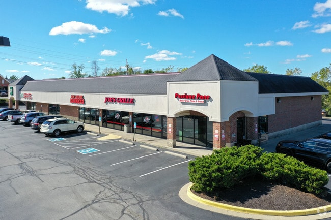
11640 Brooks School Rd
Indianapolis-Carmel-Anderson, IN
Sandstone Commons Phase 2
29-11-34-020-001.000-020
ACREAGE 1.68, SECTION 34, TOWNSHIP 18, RANGE 5, SANDSTONE COMMONS, PHASE 2, LOT 1, IRREGULAR SHAPE
Regionalshoppingcenterormallwithanchorstore
Hamilton
AE
Indiana
18057C0254G
1
2023
1.68 AC
2024
Fishers/Geist
110821
Indianapolis
15,168 SF
DEMOGRAPHICS near 11640 Brooks School Rd
1 Mile
3 Mile
5 Mile
2024 Total Population
8,552
63,254
152,474
2029 Population
9,488
70,692
168,596
Pop Growth 2024-2029
+ 10.94%
+ 11.76%
+ 10.57%
Average Age
36
36
37
2024 Total Households
2,594
20,810
54,789
HH Growth 2024-2029
+ 10.99%
+ 11.68%
+ 10.39%
Median Household Inc
$162,386
$135,265
$111,969
Avg Household Size
3.30
3.00
2.70
2024 Avg HH Vehicles
2.00
2.00
2.00
Median Home Value
$383,440
$363,078
$316,248
Median Year Built
2003
2004
2002
Nearby Places
Map Layers
Map Styles
 Street
 Aerial
- Restaurants
- Banks
- Shops
- Fitness
- Groceries
PUBLIC TRANSPORTATION
AIRPORT
Indianapolis International
DRIVE
WALK
Distance
Indianapolis International
55 min
33.9 mi
Freight Ports
Port of Toledo
DRIVE
WALK
Distance
Port of Toledo
246 min
207.2 mi
SALE & LEASE HISTORY
LISTING DATE
SALE/LEASE

Sep 25, 2016
For Lease
Sep 20, 2017
For Sale
Oct 17, 2018
For Sale
May 17, 2018
For Lease
Mar 20, 2017
For Lease
Feb 24, 2017
For Lease
Nearby Properties
Address
Land Use
TOTAL SIZE
Lot Size
Zoning
Address
Land Use
TOTAL SIZE
Lot Size
Zoning
250,101 SF
25.60 AC
Address
Land Use
TOTAL SIZE
Lot Size
Zoning
172,571 SF
36.77 AC
Address
Land Use
TOTAL SIZE
Lot Size
Zoning
434,376 SF
35.75 AC
Address
Land Use
TOTAL SIZE
Lot Size
Zoning
286,120 SF
8.03 AC
Address
Land Use
TOTAL SIZE
Lot Size
Zoning
321,878 SF
14.81 AC
Address
Land Use
TOTAL SIZE
Lot Size
Zoning
234,304 SF
5.85 AC
Address
Land Use
TOTAL SIZE
Lot Size
Zoning
224,860 SF
18.52 AC
Address
Land Use
TOTAL SIZE
Lot Size
Zoning
241,325 SF
26 AC
Address
Land Use
TOTAL SIZE
Lot Size
Zoning
139,271 SF
15.06 AC
Address
Land Use
TOTAL SIZE
Lot Size
Zoning
120,839 SF
Address
Land Use
TOTAL SIZE
Lot Size
Zoning
643,957 SF
34.93 AC
Address
Land Use
TOTAL SIZE
Lot Size
Zoning
178,207 SF
4.25 AC
Address
Land Use
TOTAL SIZE
Lot Size
Zoning
87,125 SF
7.40 AC
Address
Land Use
TOTAL SIZE
Lot Size
Zoning
105,277 SF
9.70 AC
Address
Land Use
TOTAL SIZE
Lot Size
Zoning
154,237 SF
9.09 AC
Address
Land Use
TOTAL SIZE
Lot Size
Zoning
67,674 SF
24.91 AC
Address
Land Use
TOTAL SIZE
Lot Size
Zoning
107,364 SF
29.96 AC
Address
Land Use
TOTAL SIZE
Lot Size
Zoning
88,088 SF
8.53 AC
Address
Land Use
TOTAL SIZE
Lot Size
Zoning
141,781 SF
12.23 AC
Address
Land Use
TOTAL SIZE
Lot Size
Zoning
79,556 SF
5.15 AC
Address
Land Use
TOTAL SIZE
Lot Size
Zoning
110,316 SF
10.50 AC
Address
Land Use
TOTAL SIZE
Lot Size
Zoning
77,108 SF
13.41 AC
Address
Land Use
TOTAL SIZE
Lot Size
Zoning
69,151 SF
23.86 AC
Address
Land Use
TOTAL SIZE
Lot Size
Zoning
75,806 SF
9.35 AC
Address
Land Use
TOTAL SIZE
Lot Size
Zoning
72,252 SF
4 AC
Address
Land Use
TOTAL SIZE
Lot Size
Zoning
117,517 SF
1.78 AC
Address
Land Use
TOTAL SIZE
Lot Size
Zoning
67,234 SF
6.56 AC
Address
Land Use
TOTAL SIZE
Lot Size
Zoning
262,096 SF
19.03 AC
Address
Land Use
TOTAL SIZE
Lot Size
Zoning
162,902 SF
10.44 AC
Address
Land Use
TOTAL SIZE
Lot Size
Zoning
69,672 SF
34.35 AC
The World's #1 Commercial Real Estate Marketplace
Connect with us
© 2025 CoStar Group
The information above has been obtained from sources believed reliable. While we do not doubt its accuracy we have not verified it and make no guarantee, warranty or representation about it. It is your responsibility to independently confirm its accuracy and completeness. Any projections, opinions, assumptions, or estimates used are for example only and do not represent the current or future performance of the property. The value of this transaction to you depends on tax and other factors which should be evaluated by your tax, financial, and legal advisors. You and your advisors should conduct a careful, independent investigation of the property to determine to your satisfaction the suitability of the property for your needs.