Property Record
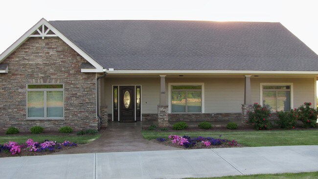
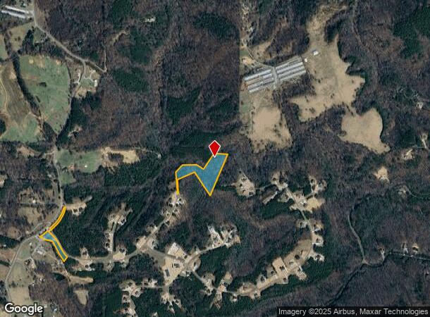
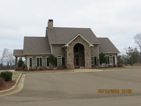
1165 Matthews Rd, Jasper, GA 30143
NEARBY LISTINGS FOR SALE OR LEASE
-
-
View all Jasper listings for sale on LoopNet.com
Property Detail
1165 Matthews Rd
Atlanta-Sandy Springs-Roswell, GA
Stoneledge
056-000-003-000
DIST13 LL75,77,104,105,76 16.28AC RDS & OPEN
Residentialacreage
Pickens
X
Georgia
13057C0050E
16.28 AC
2024
Pickens County
2024
Atlanta
050202
DEMOGRAPHICS near 1165 Matthews Rd
1 Mile
3 Mile
5 Mile
2024 Total Population
553
2,783
9,752
2029 Population
625
3,136
10,980
Pop Growth 2024-2029
+ 13.02%
+ 12.68%
+ 12.59%
Average Age
44
43
41
2024 Total Households
203
1,027
3,450
HH Growth 2024-2029
+ 13.30%
+ 12.56%
+ 12.46%
Median Household Inc
$65,769
$65,607
$67,210
Avg Household Size
2.60
2.60
2.70
2024 Avg HH Vehicles
2.00
3.00
2.00
Median Home Value
$262,222
$267,818
$261,916
Median Year Built
1998
1996
1997
Nearby Places
Map Layers
Map Styles
 Street
 Aerial
- Restaurants
- Banks
- Shops
- Fitness
- Groceries
SALE & LEASE HISTORY
LISTING DATE
SALE/LEASE

Sep 24, 2016
For Sale
Oct 11, 2016
For Sale
Dec 08, 2017
For Sale
Dec 01, 2016
For Sale
Aug 07, 2017
For Sale
Nearby Properties
Address
Land Use
TOTAL SIZE
Lot Size
Zoning
Address
Land Use
TOTAL SIZE
Lot Size
Zoning
74,652 SF
31.20 AC
HB
Address
Land Use
TOTAL SIZE
Lot Size
Zoning
646 AC
AG
Address
Land Use
TOTAL SIZE
Lot Size
Zoning
3,040 SF
7.15 AC
HB
Address
Land Use
TOTAL SIZE
Lot Size
Zoning
153.92 AC
RR
Address
Land Use
TOTAL SIZE
Lot Size
Zoning
117.48 AC
SRPC
Address
Land Use
TOTAL SIZE
Lot Size
Zoning
26 AC
AG
Address
Land Use
TOTAL SIZE
Lot Size
Zoning
737.07 AC
SRPC
Address
Land Use
TOTAL SIZE
Lot Size
Zoning
3,200 SF
0.80 AC
HB
Address
Land Use
TOTAL SIZE
Lot Size
Zoning
1,344 SF
266.55 AC
RR
Address
Land Use
TOTAL SIZE
Lot Size
Zoning
426.77 AC
AG
Address
Land Use
TOTAL SIZE
Lot Size
Zoning
158.61 AC
AG
Address
Land Use
TOTAL SIZE
Lot Size
Zoning
86.72 AC
RR
Address
Land Use
TOTAL SIZE
Lot Size
Zoning
34.54 AC
AG
Address
Land Use
TOTAL SIZE
Lot Size
Zoning
51.57 AC
AG
Address
Land Use
TOTAL SIZE
Lot Size
Zoning
3,400 SF
1.16 AC
HB
Address
Land Use
TOTAL SIZE
Lot Size
Zoning
159.83 AC
AG
Address
Land Use
TOTAL SIZE
Lot Size
Zoning
170.24 AC
RR
Address
Land Use
TOTAL SIZE
Lot Size
Zoning
46.76 AC
AG
Address
Land Use
TOTAL SIZE
Lot Size
Zoning
5,520 SF
3.62 AC
AG
Address
Land Use
TOTAL SIZE
Lot Size
Zoning
26.14 AC
AG
Address
Land Use
TOTAL SIZE
Lot Size
Zoning
5,400 SF
3 AC
AG
Address
Land Use
TOTAL SIZE
Lot Size
Zoning
67.85 AC
RR
Address
Land Use
TOTAL SIZE
Lot Size
Zoning
60.29 AC
RR
Address
Land Use
TOTAL SIZE
Lot Size
Zoning
4,544 SF
5.75 AC
HB
Address
Land Use
TOTAL SIZE
Lot Size
Zoning
148.80 AC
AG
Address
Land Use
TOTAL SIZE
Lot Size
Zoning
60.85 AC
AG
Address
Land Use
TOTAL SIZE
Lot Size
Zoning
8,400 SF
1.06 AC
HB
Address
Land Use
TOTAL SIZE
Lot Size
Zoning
15 AC
AG
Address
Land Use
TOTAL SIZE
Lot Size
Zoning
848 SF
32.56 AC
AG
Address
Land Use
TOTAL SIZE
Lot Size
Zoning
21.12 AC
RR
The World's #1 Commercial Real Estate Marketplace
Connect with us
© 2025 CoStar Group
The information above has been obtained from sources believed reliable. While we do not doubt its accuracy we have not verified it and make no guarantee, warranty or representation about it. It is your responsibility to independently confirm its accuracy and completeness. Any projections, opinions, assumptions, or estimates used are for example only and do not represent the current or future performance of the property. The value of this transaction to you depends on tax and other factors which should be evaluated by your tax, financial, and legal advisors. You and your advisors should conduct a careful, independent investigation of the property to determine to your satisfaction the suitability of the property for your needs.