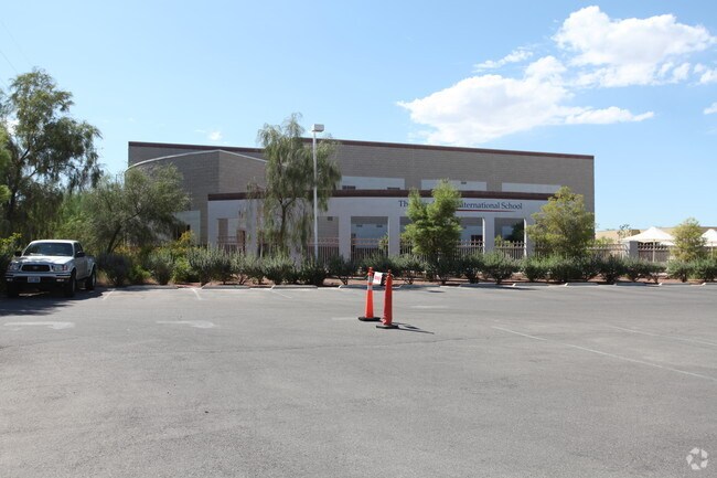
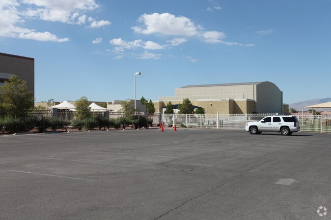
Property Record
1165 Sandy Ridge Ave, Henderson, NV 89052


NEARBY LISTINGS FOR SALE OR LEASE
Property Detail
1165 Sandy Ridge Ave
Las Vegas-Henderson-Paradise, NV
Parcel Map File 96 Page 7
178-31-812-002
PARCEL MAP FILE 96 PAGE 7 LOT 16-A
Publicschool
Clark
X
Nevada
32003C2930F
16-a
2025
13.99 AC
2025
South Las Vegas
005355
Las Vegas
47,365 SF
DEMOGRAPHICS near 1165 Sandy Ridge Ave
1 Mile
3 Mile
5 Mile
2024 Total Population
13,407
100,675
271,310
2029 Population
14,305
107,938
292,957
Pop Growth 2024-2029
+ 6.70%
+ 7.21%
+ 7.98%
Average Age
42
45
42
2024 Total Households
5,077
41,686
109,411
HH Growth 2024-2029
+ 6.78%
+ 7.19%
+ 7.90%
Median Household Inc
$114,565
$85,069
$84,450
Avg Household Size
2.60
2.40
2.40
2024 Avg HH Vehicles
2.00
2.00
2.00
Median Home Value
$470,829
$460,227
$428,053
Median Year Built
2002
2002
2001
Nearby Places
Map Layers
Map Styles
 Street
 Aerial
- Restaurants
- Banks
- Shops
- Fitness
- Groceries
PUBLIC TRANSPORTATION
AIRPORT
Harry Reid International
DRIVE
WALK
Distance
Harry Reid International
15 min
9.0 mi
Boulder City Municipal
DRIVE
WALK
Distance
Boulder City Municipal
29 min
19.3 mi
Freight Ports
Port of Long Beach
DRIVE
WALK
Distance
Port of Long Beach
309 min
275.8 mi
Nearby Properties
Address
Land Use
TOTAL SIZE
Lot Size
Zoning
Address
Land Use
TOTAL SIZE
Lot Size
Zoning
630,906 SF
39.87 AC
CT
Address
Land Use
TOTAL SIZE
Lot Size
Zoning
9,314 SF
23.10 AC
PS
Address
Land Use
TOTAL SIZE
Lot Size
Zoning
1,365 SF
22.68 AC
Address
Land Use
TOTAL SIZE
Lot Size
Zoning
7,177 SF
15.88 AC
Address
Land Use
TOTAL SIZE
Lot Size
Zoning
1,184,001 SF
57.02 AC
IP
Address
Land Use
TOTAL SIZE
Lot Size
Zoning
4,312 SF
19.42 AC
C:R-4
Address
Land Use
TOTAL SIZE
Lot Size
Zoning
438,778 SF
19.30 AC
C:R-4
Address
Land Use
TOTAL SIZE
Lot Size
Zoning
3,528 SF
18.15 AC
RH36
Address
Land Use
TOTAL SIZE
Lot Size
Zoning
161,090 SF
355.75 AC
Address
Land Use
TOTAL SIZE
Lot Size
Zoning
36.85 AC
PS
Address
Land Use
TOTAL SIZE
Lot Size
Zoning
3,990 SF
24.88 AC
RM16
Address
Land Use
TOTAL SIZE
Lot Size
Zoning
220,694 SF
44.74 AC
Address
Land Use
TOTAL SIZE
Lot Size
Zoning
22,009 SF
11.53 AC
Address
Land Use
TOTAL SIZE
Lot Size
Zoning
371,958 SF
22.85 AC
RM16
Address
Land Use
TOTAL SIZE
Lot Size
Zoning
Address
Land Use
TOTAL SIZE
Lot Size
Zoning
213,957 SF
19.68 AC
Address
Land Use
TOTAL SIZE
Lot Size
Zoning
4,444 SF
15.48 AC
H:RH-24
Address
Land Use
TOTAL SIZE
Lot Size
Zoning
61,157 SF
2.54 AC
Address
Land Use
TOTAL SIZE
Lot Size
Zoning
59,421 SF
14 AC
Address
Land Use
TOTAL SIZE
Lot Size
Zoning
9,196 SF
17.77 AC
R3
Address
Land Use
TOTAL SIZE
Lot Size
Zoning
341,744 SF
21.82 AC
RM16
Address
Land Use
TOTAL SIZE
Lot Size
Zoning
4,330 SF
21.45 AC
RM16
Address
Land Use
TOTAL SIZE
Lot Size
Zoning
20 AC
RE
Address
Land Use
TOTAL SIZE
Lot Size
Zoning
5,179 SF
24.21 AC
RM16
Address
Land Use
TOTAL SIZE
Lot Size
Zoning
17.31 AC
PS
Address
Land Use
TOTAL SIZE
Lot Size
Zoning
17.18 AC
PS
Address
Land Use
TOTAL SIZE
Lot Size
Zoning
328,208 SF
20.81 AC
Address
Land Use
TOTAL SIZE
Lot Size
Zoning
233,958 SF
12.49 AC
RS2
Address
Land Use
TOTAL SIZE
Lot Size
Zoning
216,315 SF
4.52 AC
The World's #1 Commercial Real Estate Marketplace
Connect with us
© 2025 CoStar Group
The information above has been obtained from sources believed reliable. While we do not doubt its accuracy we have not verified it and make no guarantee, warranty or representation about it. It is your responsibility to independently confirm its accuracy and completeness. Any projections, opinions, assumptions, or estimates used are for example only and do not represent the current or future performance of the property. The value of this transaction to you depends on tax and other factors which should be evaluated by your tax, financial, and legal advisors. You and your advisors should conduct a careful, independent investigation of the property to determine to your satisfaction the suitability of the property for your needs.