Property Record
20355 Eureka Rd, Taylor, MI 48180


NEARBY LISTINGS FOR SALE OR LEASE
Property Detail
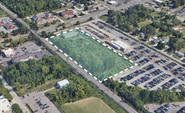
20355 Eureka Rd
60-093-99-0003-000
34D1A THAT PT OF THE N E 1/4 OF SEC 34 DES AS BEG AT A PT ON THE E LINE OF THE DT AND I RR RIGHT OF WAY DIS S 87D 15M 20SEC W ALONG THE N SEC LINE 1226.99 FT AND S 1D 41M 20SEC E 163 FT FROM THE N E COR OF SEC 34 AND PROCEEDING TH S 1D 41M 20SEC E AL
Industrialgeneral
Wayne
AE
Michigan
26163C0403E
0003
2025
4.36 AC
2025
Downriver South
584600
Detroit
6,000 SF
Detroit-Warren-Dearborn, MI
DEMOGRAPHICS near 20355 Eureka Rd
1 Mile
3 Mile
5 Mile
2024 Total Population
4,874
72,938
207,428
2029 Population
4,682
70,025
198,864
Pop Growth 2024-2029
(3.94%)
(3.99%)
(4.13%)
Average Age
46
42
41
2024 Total Households
2,185
30,952
86,320
HH Growth 2024-2029
(4.12%)
(4.03%)
(4.15%)
Median Household Inc
$54,161
$62,934
$65,211
Avg Household Size
2.10
2.30
2.40
2024 Avg HH Vehicles
2.00
2.00
2.00
Median Home Value
$170,967
$159,095
$157,889
Median Year Built
1974
1964
1959
Nearby Places
Map Layers
Map Styles
 Street
 Aerial
- Restaurants
- Banks
- Shops
- Fitness
- Groceries
PUBLIC TRANSPORTATION
AIRPORT
Detroit Metro Wayne County
DRIVE
WALK
Distance
Detroit Metro Wayne County
20 min
9.8 mi
Windsor International
DRIVE
WALK
Distance
Windsor International
41 min
23.3 mi
Nearby Properties
Address
Land Use
TOTAL SIZE
Lot Size
Zoning
Address
Land Use
TOTAL SIZE
Lot Size
Zoning
553,004 SF
61.46 AC
B-2
Address
Land Use
TOTAL SIZE
Lot Size
Zoning
3,122,068 SF
260 AC
I-1
Address
Land Use
TOTAL SIZE
Lot Size
Zoning
1,981,391 SF
166.35 AC
I-2
Address
Land Use
TOTAL SIZE
Lot Size
Zoning
1,606,527 SF
126.47 AC
I-2
Address
Land Use
TOTAL SIZE
Lot Size
Zoning
217,726 SF
27.60 AC
B-2
Address
Land Use
TOTAL SIZE
Lot Size
Zoning
479,851 SF
16.90 AC
RM MULTI F
Address
Land Use
TOTAL SIZE
Lot Size
Zoning
131,205 SF
13.95 AC
B-2
Address
Land Use
TOTAL SIZE
Lot Size
Zoning
729,040 SF
45.85 AC
I-2
Address
Land Use
TOTAL SIZE
Lot Size
Zoning
125,898 SF
10.62 AC
B-2
Address
Land Use
TOTAL SIZE
Lot Size
Zoning
125,898 SF
10.62 AC
B-2
Address
Land Use
TOTAL SIZE
Lot Size
Zoning
3,261 SF
23.39 AC
RM MULTI F
Address
Land Use
TOTAL SIZE
Lot Size
Zoning
247,238 SF
21.39 AC
I-1
Address
Land Use
TOTAL SIZE
Lot Size
Zoning
200,484 SF
48.86 AC
B-3
Address
Land Use
TOTAL SIZE
Lot Size
Zoning
214,489 SF
17.64 AC
RM-1
Address
Land Use
TOTAL SIZE
Lot Size
Zoning
287,791 SF
17.98 AC
RM MULTI F
Address
Land Use
TOTAL SIZE
Lot Size
Zoning
163,944 SF
17.51 AC
RM MULTI F
Address
Land Use
TOTAL SIZE
Lot Size
Zoning
236,908 SF
29.21 AC
B-2
Address
Land Use
TOTAL SIZE
Lot Size
Zoning
262,170 SF
15.27 AC
RM MULTI F
Address
Land Use
TOTAL SIZE
Lot Size
Zoning
356,200 SF
21.66 AC
I-2
Address
Land Use
TOTAL SIZE
Lot Size
Zoning
220,869 SF
25.31 AC
C-2 GEN BU
Address
Land Use
TOTAL SIZE
Lot Size
Zoning
912 SF
2.80 AC
RM MULTI F
Address
Land Use
TOTAL SIZE
Lot Size
Zoning
229,395 SF
15.46 AC
RM-1
Address
Land Use
TOTAL SIZE
Lot Size
Zoning
10.66 AC
RM MULTI F
Address
Land Use
TOTAL SIZE
Lot Size
Zoning
32,767 SF
17.81 AC
RM-1
Address
Land Use
TOTAL SIZE
Lot Size
Zoning
144,724 SF
12.13 AC
B-2
Address
Land Use
TOTAL SIZE
Lot Size
Zoning
252,833 SF
34.40 AC
RM1-MUL
Address
Land Use
TOTAL SIZE
Lot Size
Zoning
240,852 SF
15.44 AC
RM MULTI F
Address
Land Use
TOTAL SIZE
Lot Size
Zoning
172,500 SF
6.52 AC
RM-1
Address
Land Use
TOTAL SIZE
Lot Size
Zoning
217,548 SF
6.82 AC
RM MULTI F
Address
Land Use
TOTAL SIZE
Lot Size
Zoning
83,540 SF
2.90 AC
RM-2
The World's #1 Commercial Real Estate Marketplace
Connect with us
© 2026 CoStar Group
The information above has been obtained from sources believed reliable. While we do not doubt its accuracy we have not verified it and make no guarantee, warranty or representation about it. It is your responsibility to independently confirm its accuracy and completeness. Any projections, opinions, assumptions, or estimates used are for example only and do not represent the current or future performance of the property. The value of this transaction to you depends on tax and other factors which should be evaluated by your tax, financial, and legal advisors. You and your advisors should conduct a careful, independent investigation of the property to determine to your satisfaction the suitability of the property for your needs.