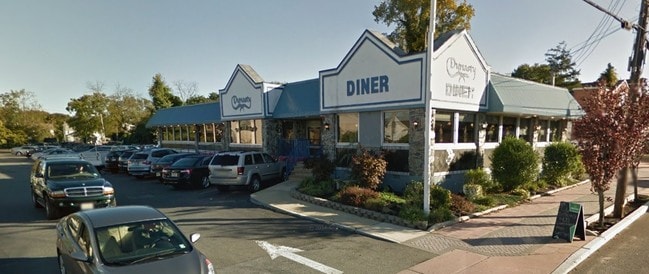
Property Record
117 E Main St, Tuckerton, NJ 08087

Property Detail
117 E Main St
33-00048-0000-00018
97X375IRR 17.01
Commercialnec
Ocean
SV
New Jersey
B and X Area of moderate flood hazard, usually the area between the limits of the 100-year and 500-year floods.
18
2025
1.13 AC
2025
Ocean County
737000
Northern New Jersey
2,656 SF
Lakewood-New Brunswick, NJ
NEARBY LISTINGS FOR SALE OR LEASE
DEMOGRAPHICS near 117 E Main St
1 mile
3 mile
5 mile
2024 Total Population
4,149
22,312
29,943
2029 Population
4,322
23,008
31,408
Pop Growth 2024-2029
+ 4.17%
+ 3.12%
+ 4.89%
Average Age
41
43
44
2024 Total Households
1,661
8,948
12,425
HH Growth 2024-2029
+ 3.85%
+ 2.69%
+ 4.67%
Median Household Inc
$88,267
$86,691
$87,334
Avg Household Size
2.50
2.40
2.30
2024 Avg HH Vehicles
2.00
2.00
2.00
Median Home Value
$351,750
$336,290
$360,125
Median Year Built
1983
1987
1986
Nearby Places
Map Layers
Map Styles
 Street
 Aerial
Transit
 Traffic
 Biking
Places
Listings with unknown addresses are not visible on the map
- Restaurants
- Banks
- Shops
- Fitness
- Groceries
PUBLIC TRANSPORTATION
AIRPORT
Atlantic City International
Drive
Walk
Distance
Atlantic City International
51 min
23.5 mi
Freight Ports
Broadway Terminal - Pier 5
Drive
Walk
Distance
Broadway Terminal - Pier 5
77 min
57.5 mi
Nearby Properties
Address
Land Use
TOTAL SIZE
Lot Size
Zoning
Address
Land Use
TOTAL SIZE
Lot Size
Zoning
61.73 AC
R1A
Address
Land Use
TOTAL SIZE
Lot Size
Zoning
63.04 AC
PSC
Address
Land Use
TOTAL SIZE
Lot Size
Zoning
4.15 AC
GB
Address
Land Use
TOTAL SIZE
Lot Size
Zoning
37.89 AC
GB+
Address
Land Use
TOTAL SIZE
Lot Size
Zoning
9.83 AC
GB
Address
Land Use
TOTAL SIZE
Lot Size
Zoning
13,320 SF
6.97 AC
B2
Address
Land Use
TOTAL SIZE
Lot Size
Zoning
43.71 AC
R1A
Address
Land Use
TOTAL SIZE
Lot Size
Zoning
12.17 AC
PRC
Address
Land Use
TOTAL SIZE
Lot Size
Zoning
30.78 AC
R1A
Address
Land Use
TOTAL SIZE
Lot Size
Zoning
6.20 AC
GBSG
Address
Land Use
TOTAL SIZE
Lot Size
Zoning
50,000 SF
8.01 AC
GB
Address
Land Use
TOTAL SIZE
Lot Size
Zoning
3.55 AC
R75
Address
Land Use
TOTAL SIZE
Lot Size
Zoning
1,980 SF
155.56 AC
PRD
Address
Land Use
TOTAL SIZE
Lot Size
Zoning
11.94 AC
GBSG
Address
Land Use
TOTAL SIZE
Lot Size
Zoning
41,194 SF
3.67 AC
R400
Address
Land Use
TOTAL SIZE
Lot Size
Zoning
19.53 AC
MF
Address
Land Use
TOTAL SIZE
Lot Size
Zoning
936 SF
32.80 AC
SV
Address
Land Use
TOTAL SIZE
Lot Size
Zoning
600 SF
13.54 AC
GBSG
Address
Land Use
TOTAL SIZE
Lot Size
Zoning
308 SF
4.13 AC
GB
Address
Land Use
TOTAL SIZE
Lot Size
Zoning
32.40 AC
Address
Land Use
TOTAL SIZE
Lot Size
Zoning
53,927 SF
1.87 AC
B2
Address
Land Use
TOTAL SIZE
Lot Size
Zoning
12,669 SF
1.73 AC
B2
Address
Land Use
TOTAL SIZE
Lot Size
Zoning
63.55 AC
R100
Address
Land Use
TOTAL SIZE
Lot Size
Zoning
11,044 SF
4.93 AC
GBSG
Address
Land Use
TOTAL SIZE
Lot Size
Zoning
0.98 AC
GB
Address
Land Use
TOTAL SIZE
Lot Size
Zoning
51,645 SF
11.39 AC
GB
Address
Land Use
TOTAL SIZE
Lot Size
Zoning
179.24 AC
GB+
Address
Land Use
TOTAL SIZE
Lot Size
Zoning
2,952 SF
3.70 AC
B1
Address
Land Use
TOTAL SIZE
Lot Size
Zoning
5,627 SF
7.42 AC
GB
Address
Land Use
TOTAL SIZE
Lot Size
Zoning
The World's #1 Commercial Real Estate Marketplace
Connect with us
© 2026 CoStar Group
The information above has been obtained from sources believed reliable. While we do not doubt its accuracy we have not verified it and make no guarantee, warranty or representation about it. It is your responsibility to independently confirm its accuracy and completeness. Any projections, opinions, assumptions, or estimates used are for example only and do not represent the current or future performance of the property. The value of this transaction to you depends on tax and other factors which should be evaluated by your tax, financial, and legal advisors. You and your advisors should conduct a careful, independent investigation of the property to determine to your satisfaction the suitability of the property for your needs.