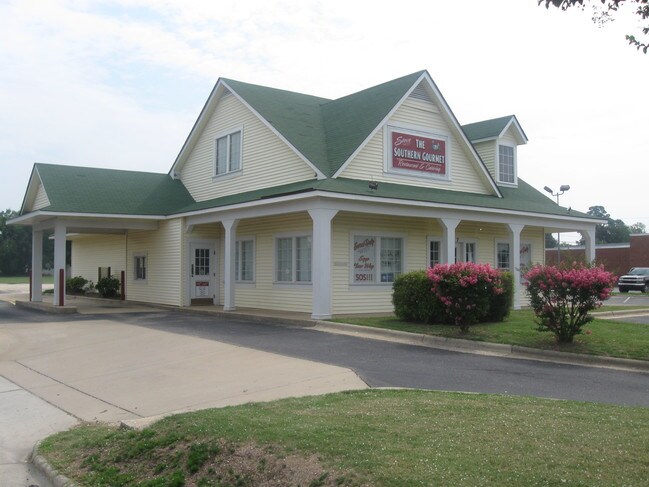
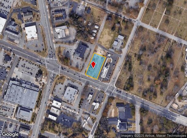
Property Record
117 Grove St, Fayetteville, NC 28301
NEARBY LISTINGS FOR SALE OR LEASE
Property Detail
117 Grove St
Fayetteville, NC
Grove Street/Rowan St Area
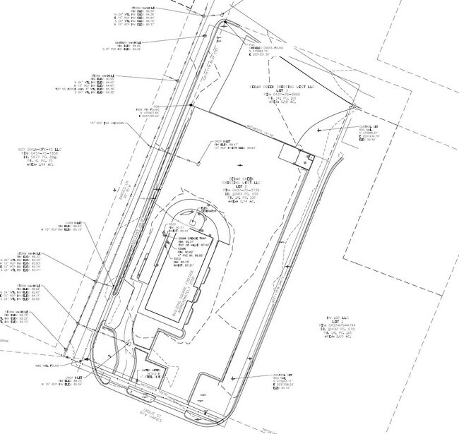
0437-75-3736
CEDAR CREEK CROSSING WEST LLC RECOMB LO:2 SE:01 PL:0141-0100
Restaurantdrivein
Cumberland
X
North Carolina
3720043700J
2
2025
0.74 AC
2025
Downtown Fayetteville
003800
Fayetteville
2,770 SF
DEMOGRAPHICS near 117 Grove St
1 Mile
3 Mile
5 Mile
2024 Total Population
3,737
34,191
88,042
2029 Population
3,886
34,652
88,333
Pop Growth 2024-2029
+ 3.99%
+ 1.35%
+ 0.33%
Average Age
38
39
39
2024 Total Households
1,441
14,285
37,475
HH Growth 2024-2029
+ 4.51%
+ 1.33%
+ 0.29%
Median Household Inc
$26,298
$38,983
$44,218
Avg Household Size
2.10
2.20
2.20
2024 Avg HH Vehicles
1.00
1.00
2.00
Median Home Value
$152,631
$164,527
$158,340
Median Year Built
1973
1970
1976
Nearby Places
Map Layers
Map Styles
 Street
 Aerial
- Restaurants
- Banks
- Shops
- Fitness
- Groceries
PUBLIC TRANSPORTATION
COMMUTER RAIL
DRIVE
WALK
Distance
2 min
16 min
0.8 mi
AIRPORT
Fayetteville Regional/Grannis Field
DRIVE
WALK
Distance
Fayetteville Regional/Grannis Field
9 min
5.4 mi
SALE & LEASE HISTORY
LISTING DATE
SALE/LEASE

Oct 31, 2018
For Sale
Oct 27, 2016
For Lease
Mar 04, 2025
For Sale
Nearby Properties
Address
Land Use
TOTAL SIZE
Lot Size
Zoning
Address
Land Use
TOTAL SIZE
Lot Size
Zoning
2,193 SF
133.52 AC
MR5
Address
Land Use
TOTAL SIZE
Lot Size
Zoning
46,110 SF
25.72 AC
OI
Address
Land Use
TOTAL SIZE
Lot Size
Zoning
91,620 SF
9.67 AC
CC
Address
Land Use
TOTAL SIZE
Lot Size
Zoning
11,894 SF
8.39 AC
DTCZ
Address
Land Use
TOTAL SIZE
Lot Size
Zoning
37,786 SF
9.55 AC
CC
Address
Land Use
TOTAL SIZE
Lot Size
Zoning
28,107 SF
34.33 AC
HI
Address
Land Use
TOTAL SIZE
Lot Size
Zoning
1 AC
DTCZ
Address
Land Use
TOTAL SIZE
Lot Size
Zoning
2,797 SF
54.38 AC
(UC) UNIVE
Address
Land Use
TOTAL SIZE
Lot Size
Zoning
29,896 SF
58.43 AC
SF6
Address
Land Use
TOTAL SIZE
Lot Size
Zoning
1 AC
DTCZ-DOWNT
Address
Land Use
TOTAL SIZE
Lot Size
Zoning
27,825 SF
1.67 AC
DT
Address
Land Use
TOTAL SIZE
Lot Size
Zoning
10,158 SF
11.49 AC
SF6
Address
Land Use
TOTAL SIZE
Lot Size
Zoning
26,818 SF
OI-OFFICE
Address
Land Use
TOTAL SIZE
Lot Size
Zoning
104,350 SF
23.28 AC
CC
Address
Land Use
TOTAL SIZE
Lot Size
Zoning
4,690 SF
11.13 AC
MR5
Address
Land Use
TOTAL SIZE
Lot Size
Zoning
4,602 SF
29.92 AC
MR5
Address
Land Use
TOTAL SIZE
Lot Size
Zoning
65,113 SF
28.39 AC
SF6
Address
Land Use
TOTAL SIZE
Lot Size
Zoning
4,141 SF
11.72 AC
MR5
Address
Land Use
TOTAL SIZE
Lot Size
Zoning
40,786 SF
3.80 AC
DT
Address
Land Use
TOTAL SIZE
Lot Size
Zoning
9,736 SF
3.40 AC
CC
Address
Land Use
TOTAL SIZE
Lot Size
Zoning
1,920 SF
16.30 AC
CC-COMMUNI
Address
Land Use
TOTAL SIZE
Lot Size
Zoning
40,590 SF
27.97 AC
SF6
Address
Land Use
TOTAL SIZE
Lot Size
Zoning
42,828 SF
20.40 AC
SF6
Address
Land Use
TOTAL SIZE
Lot Size
Zoning
74,169 SF
3.90 AC
DT
Address
Land Use
TOTAL SIZE
Lot Size
Zoning
10,493 SF
4.62 AC
CC
Address
Land Use
TOTAL SIZE
Lot Size
Zoning
18,034 SF
4.28 AC
CC-COMMUNI
Address
Land Use
TOTAL SIZE
Lot Size
Zoning
24,350 SF
4.30 AC
OI
Address
Land Use
TOTAL SIZE
Lot Size
Zoning
33,266 SF
4.15 AC
CC
Address
Land Use
TOTAL SIZE
Lot Size
Zoning
7,210 SF
1.81 AC
DT
Address
Land Use
TOTAL SIZE
Lot Size
Zoning
17,622 SF
17 AC
SF10
The World's #1 Commercial Real Estate Marketplace
Connect with us
© 2025 CoStar Group
The information above has been obtained from sources believed reliable. While we do not doubt its accuracy we have not verified it and make no guarantee, warranty or representation about it. It is your responsibility to independently confirm its accuracy and completeness. Any projections, opinions, assumptions, or estimates used are for example only and do not represent the current or future performance of the property. The value of this transaction to you depends on tax and other factors which should be evaluated by your tax, financial, and legal advisors. You and your advisors should conduct a careful, independent investigation of the property to determine to your satisfaction the suitability of the property for your needs.