Property Record
117 Longview Dr, Fayetteville, NC 28311


NEARBY LISTINGS FOR SALE OR LEASE
-
-
View all Fayetteville listings for sale on LoopNet.com
Property Detail
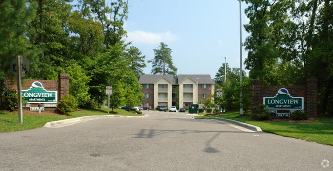
117 Longview Dr
Fayetteville, NC
Longview Green Apartments
0439-65-7682
ELIZABETH N CASHWELL LO:MAJ PT 4 SE:01 PL:0094-0135
Apartment
Cumberland
X
North Carolina
3720043900J
4
2025
5.51 AC
2025
Brookwood
002505
Fayetteville
1,761 SF
DEMOGRAPHICS near 117 Longview Dr
1 Mile
3 Mile
5 Mile
2024 Total Population
4,948
39,773
76,338
2029 Population
4,878
39,693
76,494
Pop Growth 2024-2029
(1.41%)
(0.20%)
+ 0.20%
Average Age
39
37
38
2024 Total Households
2,210
16,408
32,192
HH Growth 2024-2029
(1.49%)
(0.29%)
+ 0.22%
Median Household Inc
$50,447
$45,224
$45,145
Avg Household Size
2.20
2.20
2.20
2024 Avg HH Vehicles
2.00
2.00
2.00
Median Home Value
$165,221
$151,853
$170,673
Median Year Built
1988
1981
1978
Nearby Places
Map Layers
Map Styles
 Street
 Aerial
- Restaurants
- Banks
- Shops
- Fitness
- Groceries
PUBLIC TRANSPORTATION
COMMUTER RAIL
Fayetteville Amtrak Station (Palmetto - Amtrak, Silver Meteor - Amtrak)
DRIVE
WALK
Distance
Fayetteville Amtrak Station (Palmetto - Amtrak, Silver Meteor - Amtrak)
8 min
5.1 mi
AIRPORT
Fayetteville Regional/Grannis Field
DRIVE
WALK
Distance
Fayetteville Regional/Grannis Field
16 min
10.0 mi
Freight Ports
Port of Wilmington
DRIVE
WALK
Distance
Port of Wilmington
133 min
95.7 mi
Nearby Properties
Address
Land Use
TOTAL SIZE
Lot Size
Zoning
Address
Land Use
TOTAL SIZE
Lot Size
Zoning
7,981 SF
599.07 AC
OI
Address
Land Use
TOTAL SIZE
Lot Size
Zoning
2,193 SF
133.52 AC
MR5
Address
Land Use
TOTAL SIZE
Lot Size
Zoning
46,110 SF
25.72 AC
OI
Address
Land Use
TOTAL SIZE
Lot Size
Zoning
2,842 SF
23.27 AC
MR5
Address
Land Use
TOTAL SIZE
Lot Size
Zoning
1,920 SF
14.88 AC
MR5
Address
Land Use
TOTAL SIZE
Lot Size
Zoning
1,352 SF
43.38 AC
MR5
Address
Land Use
TOTAL SIZE
Lot Size
Zoning
4,380 SF
33.27 AC
SF10
Address
Land Use
TOTAL SIZE
Lot Size
Zoning
29,896 SF
58.43 AC
SF6
Address
Land Use
TOTAL SIZE
Lot Size
Zoning
212,754 SF
29.98 AC
CC
Address
Land Use
TOTAL SIZE
Lot Size
Zoning
1,289 SF
18.12 AC
MR5
Address
Land Use
TOTAL SIZE
Lot Size
Zoning
5,436 SF
14.01 AC
MR5
Address
Land Use
TOTAL SIZE
Lot Size
Zoning
2,080 SF
14.47 AC
MR5
Address
Land Use
TOTAL SIZE
Lot Size
Zoning
4,210 SF
22.02 AC
MR5
Address
Land Use
TOTAL SIZE
Lot Size
Zoning
40,590 SF
27.97 AC
SF6
Address
Land Use
TOTAL SIZE
Lot Size
Zoning
3,842 SF
13.56 AC
PND
Address
Land Use
TOTAL SIZE
Lot Size
Zoning
2,802 SF
3.47 AC
CP-PLANNED
Address
Land Use
TOTAL SIZE
Lot Size
Zoning
8.28 AC
MR5-MIXED
Address
Land Use
TOTAL SIZE
Lot Size
Zoning
3,006 SF
4.96 AC
MR5
Address
Land Use
TOTAL SIZE
Lot Size
Zoning
2,246 SF
4.47 AC
MR5
Address
Land Use
TOTAL SIZE
Lot Size
Zoning
16,705 SF
3.37 AC
CC
Address
Land Use
TOTAL SIZE
Lot Size
Zoning
6,437 SF
10.22 AC
MR5
Address
Land Use
TOTAL SIZE
Lot Size
Zoning
52,720 SF
15.71 AC
CC
Address
Land Use
TOTAL SIZE
Lot Size
Zoning
3,949 SF
8.95 AC
MR5
Address
Land Use
TOTAL SIZE
Lot Size
Zoning
135,386 SF
16.96 AC
CC
Address
Land Use
TOTAL SIZE
Lot Size
Zoning
3,054 SF
14.65 AC
MR5
Address
Land Use
TOTAL SIZE
Lot Size
Zoning
4,783 SF
12.50 AC
SF6
Address
Land Use
TOTAL SIZE
Lot Size
Zoning
2,550 SF
14.30 AC
SF10
Address
Land Use
TOTAL SIZE
Lot Size
Zoning
126,609 SF
11.99 AC
CC
Address
Land Use
TOTAL SIZE
Lot Size
Zoning
15,345 SF
0.62 AC
MUC
Address
Land Use
TOTAL SIZE
Lot Size
Zoning
13,231 SF
59.66 AC
MP
The World's #1 Commercial Real Estate Marketplace
Connect with us
© 2025 CoStar Group
The information above has been obtained from sources believed reliable. While we do not doubt its accuracy we have not verified it and make no guarantee, warranty or representation about it. It is your responsibility to independently confirm its accuracy and completeness. Any projections, opinions, assumptions, or estimates used are for example only and do not represent the current or future performance of the property. The value of this transaction to you depends on tax and other factors which should be evaluated by your tax, financial, and legal advisors. You and your advisors should conduct a careful, independent investigation of the property to determine to your satisfaction the suitability of the property for your needs.