Property Record
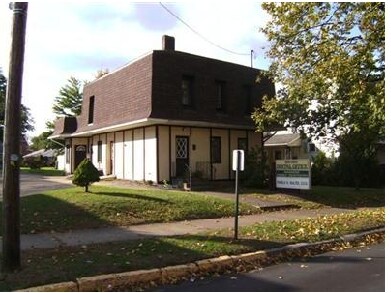
117 Main St N, Navarre, OH 44662


Property Detail
117 Main St N
01200157
428 WH
Medicalbuilding
Stark
B and X Area of moderate flood hazard, usually the area between the limits of the 100-year and 500-year floods.
Ohio
2025
0.22 AC
2025
Stark County
714600
Cleveland
3,268 SF
Canton-Massillon, OH
NEARBY LISTINGS FOR SALE OR LEASE
-
-
View all Navarre listings for sale on LoopNet.com
DEMOGRAPHICS near 117 Main St N
1 mile
3 mile
5 mile
2025 Total Population
2,600
5,667
28,412
2030 Population
2,596
5,640
28,411
Pop Growth 2025-2030
(0.15%)
(0.48%)
0.00%
Average Age
45
45
43
2025 Total Households
1,170
2,436
11,490
HH Growth 2025-2030
(0.17%)
(0.45%)
(0.02%)
Median Household Inc
$61,534
$64,580
$61,301
Avg Household Size
2.20
2.30
2.40
2025 Avg HH Vehicles
2.00
2.00
2.00
Median Home Value
$161,538
$183,585
$165,117
Median Year Built
1955
1967
1962
Nearby Places
Map Layers
Map Styles
 Street
 Aerial
Layers
 Traffic
 Biking
Places
Listings with unknown addresses are not visible on the map
- Restaurants
- Banks
- Shops
- Fitness
- Groceries
PUBLIC TRANSPORTATION
AIRPORT
Akron-Canton Regional
Drive
Walk
Distance
Akron-Canton Regional
29 min
21.0 mi
Nearby Properties
Address
Land Use
TOTAL SIZE
Lot Size
Zoning
Address
Land Use
TOTAL SIZE
Lot Size
Zoning
693,236 SF
Address
Land Use
TOTAL SIZE
Lot Size
Zoning
1,160,888 SF
58.06 AC
Address
Land Use
TOTAL SIZE
Lot Size
Zoning
310,252 SF
55.48 AC
Address
Land Use
TOTAL SIZE
Lot Size
Zoning
Address
Land Use
TOTAL SIZE
Lot Size
Zoning
Address
Land Use
TOTAL SIZE
Lot Size
Zoning
208,780 SF
40.77 AC
Address
Land Use
TOTAL SIZE
Lot Size
Zoning
702,000 SF
49.45 AC
Address
Land Use
TOTAL SIZE
Lot Size
Zoning
492,780 SF
21.73 AC
Address
Land Use
TOTAL SIZE
Lot Size
Zoning
174,284 SF
12.98 AC
Address
Land Use
TOTAL SIZE
Lot Size
Zoning
186,091 SF
15.67 AC
Address
Land Use
TOTAL SIZE
Lot Size
Zoning
509,280 SF
73.57 AC
Address
Land Use
TOTAL SIZE
Lot Size
Zoning
71,540 SF
7.44 AC
Address
Land Use
TOTAL SIZE
Lot Size
Zoning
48,350 SF
108.79 AC
Address
Land Use
TOTAL SIZE
Lot Size
Zoning
397,300 SF
43.76 AC
Address
Land Use
TOTAL SIZE
Lot Size
Zoning
37,631 SF
9.08 AC
Address
Land Use
TOTAL SIZE
Lot Size
Zoning
112,773 SF
11.18 AC
Address
Land Use
TOTAL SIZE
Lot Size
Zoning
215,659 SF
35.79 AC
Address
Land Use
TOTAL SIZE
Lot Size
Zoning
183,435 SF
Address
Land Use
TOTAL SIZE
Lot Size
Zoning
50,096 SF
8.20 AC
Address
Land Use
TOTAL SIZE
Lot Size
Zoning
29,831 SF
18.48 AC
Address
Land Use
TOTAL SIZE
Lot Size
Zoning
158,432 SF
7 AC
Address
Land Use
TOTAL SIZE
Lot Size
Zoning
208,925 SF
34.75 AC
Address
Land Use
TOTAL SIZE
Lot Size
Zoning
7,168 SF
28.92 AC
Address
Land Use
TOTAL SIZE
Lot Size
Zoning
19,725 SF
2.29 AC
Address
Land Use
TOTAL SIZE
Lot Size
Zoning
39.51 AC
Address
Land Use
TOTAL SIZE
Lot Size
Zoning
37,440 SF
1.51 AC
Address
Land Use
TOTAL SIZE
Lot Size
Zoning
106,960 SF
18.18 AC
Address
Land Use
TOTAL SIZE
Lot Size
Zoning
70,980 SF
15.53 AC
Address
Land Use
TOTAL SIZE
Lot Size
Zoning
84,847 SF
10.07 AC
Address
Land Use
TOTAL SIZE
Lot Size
Zoning
81,720 SF
5.54 AC
The World's #1 Commercial Real Estate Marketplace
Connect with us
© 2026 CoStar Group
The information above has been obtained from sources believed reliable. While we do not doubt its accuracy we have not verified it and make no guarantee, warranty or representation about it. It is your responsibility to independently confirm its accuracy and completeness. Any projections, opinions, assumptions, or estimates used are for example only and do not represent the current or future performance of the property. The value of this transaction to you depends on tax and other factors which should be evaluated by your tax, financial, and legal advisors. You and your advisors should conduct a careful, independent investigation of the property to determine to your satisfaction the suitability of the property for your needs.