No Photo
Property Record
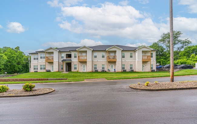
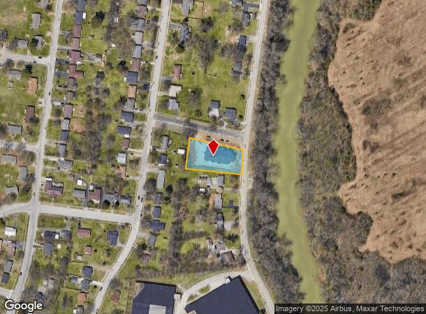
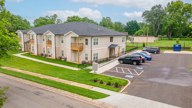
117 Owmby Way, Bowling Green, KY 42101
NEARBY LISTINGS FOR SALE OR LEASE
-
-
View all Bowling Green listings for sale on LoopNet.com
Property Detail
117 Owmby Way
Bowling Green, KY
Parker Bennett School Urban Renewal Proj
039B-02S-044
Warren
Residentialacreage
Kentucky
X
44
21227C0168E
0.71 AC
2025
Bowling Green Area
2025
Other Market Areas
010200
DEMOGRAPHICS near 117 Owmby Way
1 Mile
3 Mile
5 Mile
2024 Total Population
4,223
39,249
85,090
2029 Population
4,726
43,040
93,595
Pop Growth 2024-2029
+ 11.91%
+ 9.66%
+ 10.00%
Average Age
37
35
35
2024 Total Households
1,772
14,857
33,506
HH Growth 2024-2029
+ 12.42%
+ 10.76%
+ 10.71%
Median Household Inc
$30,303
$40,161
$45,551
Avg Household Size
2.20
2.20
2.30
2024 Avg HH Vehicles
1.00
2.00
2.00
Median Home Value
$95,700
$198,557
$200,802
Median Year Built
1976
1977
1989
Nearby Places
Map Layers
Map Styles
 Street
 Aerial
- Restaurants
- Banks
- Shops
- Fitness
- Groceries
SALE & LEASE HISTORY
LISTING DATE
SALE/LEASE

May 16, 2024
For Sale
Nearby Properties
Address
Land Use
TOTAL SIZE
Lot Size
Zoning
Address
Land Use
TOTAL SIZE
Lot Size
Zoning
15,440 SF
16.52 AC
Address
Land Use
TOTAL SIZE
Lot Size
Zoning
117,551 SF
5.06 AC
Address
Land Use
TOTAL SIZE
Lot Size
Zoning
12.29 AC
Address
Land Use
TOTAL SIZE
Lot Size
Zoning
261,579 SF
17.71 AC
Address
Land Use
TOTAL SIZE
Lot Size
Zoning
Address
Land Use
TOTAL SIZE
Lot Size
Zoning
150,327 SF
2.54 AC
Address
Land Use
TOTAL SIZE
Lot Size
Zoning
36,984 SF
7.26 AC
Address
Land Use
TOTAL SIZE
Lot Size
Zoning
93,730 SF
4.05 AC
Address
Land Use
TOTAL SIZE
Lot Size
Zoning
19.61 AC
Address
Land Use
TOTAL SIZE
Lot Size
Zoning
142,199 SF
12.95 AC
Address
Land Use
TOTAL SIZE
Lot Size
Zoning
Address
Land Use
TOTAL SIZE
Lot Size
Zoning
Address
Land Use
TOTAL SIZE
Lot Size
Zoning
77,160 SF
3.05 AC
Address
Land Use
TOTAL SIZE
Lot Size
Zoning
89,129 SF
49.26 AC
Address
Land Use
TOTAL SIZE
Lot Size
Zoning
176,450 SF
18.60 AC
Address
Land Use
TOTAL SIZE
Lot Size
Zoning
1,101 SF
16.07 AC
Address
Land Use
TOTAL SIZE
Lot Size
Zoning
3,840 SF
5.68 AC
Address
Land Use
TOTAL SIZE
Lot Size
Zoning
1,397 SF
6.89 AC
Address
Land Use
TOTAL SIZE
Lot Size
Zoning
3,120 SF
4.97 AC
Address
Land Use
TOTAL SIZE
Lot Size
Zoning
6,000 SF
242.33 AC
Address
Land Use
TOTAL SIZE
Lot Size
Zoning
13,277 SF
1.21 AC
Address
Land Use
TOTAL SIZE
Lot Size
Zoning
214,845 SF
4.38 AC
Address
Land Use
TOTAL SIZE
Lot Size
Zoning
1,740 SF
136.33 AC
Address
Land Use
TOTAL SIZE
Lot Size
Zoning
51,786 SF
2.25 AC
Address
Land Use
TOTAL SIZE
Lot Size
Zoning
191,054 SF
9.02 AC
Address
Land Use
TOTAL SIZE
Lot Size
Zoning
19,047 SF
3.77 AC
Address
Land Use
TOTAL SIZE
Lot Size
Zoning
13,661 SF
6.25 AC
Address
Land Use
TOTAL SIZE
Lot Size
Zoning
159,256 SF
11.44 AC
Address
Land Use
TOTAL SIZE
Lot Size
Zoning
2.68 AC
Address
Land Use
TOTAL SIZE
Lot Size
Zoning
62,052 SF
6.03 AC
The World's #1 Commercial Real Estate Marketplace
Connect with us
© 2026 CoStar Group
The information above has been obtained from sources believed reliable. While we do not doubt its accuracy we have not verified it and make no guarantee, warranty or representation about it. It is your responsibility to independently confirm its accuracy and completeness. Any projections, opinions, assumptions, or estimates used are for example only and do not represent the current or future performance of the property. The value of this transaction to you depends on tax and other factors which should be evaluated by your tax, financial, and legal advisors. You and your advisors should conduct a careful, independent investigation of the property to determine to your satisfaction the suitability of the property for your needs.