Property Record
117 S Avenue 64, Los Angeles, CA 90042
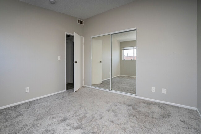
This Property Is For Sale
NEARBY LISTINGS FOR SALE OR LEASE
Property Detail
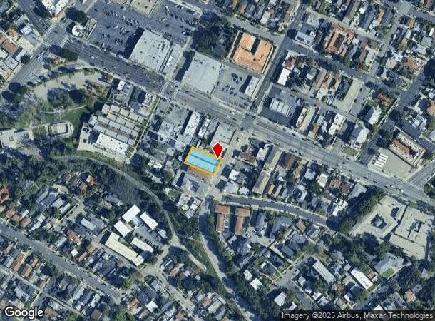
117 S Avenue 64
Los Angeles-Long Beach-Glendale, CA
Garvanza
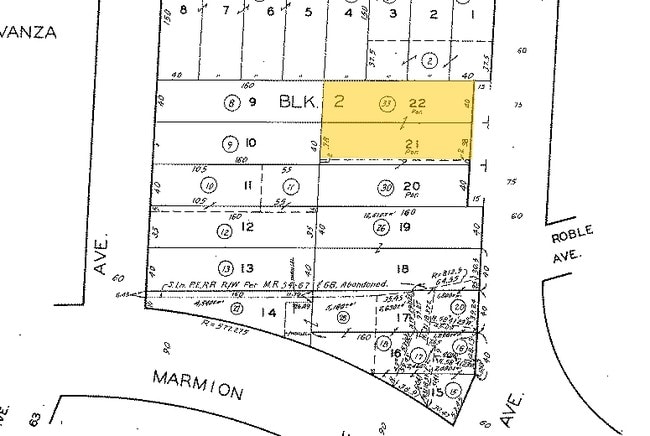
5492-035-033
TOWN OF GARVANZA NE 38 FT EX OF ST OF LOT 21 AND EX OF ST LOT 22 BLK 2
Multifamilydwelling
Los Angeles
X
California
06037C1635F
21,22
2024
0.26 AC
2025
Highland Park
183101
Los Angeles
13,674 SF
DEMOGRAPHICS near 117 S Avenue 64
1 Mile
3 Mile
5 Mile
2024 Total Population
34,661
224,450
648,917
2029 Population
33,399
217,012
627,251
Pop Growth 2024-2029
(3.64%)
(3.31%)
(3.34%)
Average Age
39
41
41
2024 Total Households
12,663
82,352
234,302
HH Growth 2024-2029
(3.89%)
(3.54%)
(3.57%)
Median Household Inc
$91,299
$95,251
$80,698
Avg Household Size
2.60
2.60
2.60
2024 Avg HH Vehicles
2.00
2.00
2.00
Median Home Value
$855,157
$906,085
$870,748
Median Year Built
1955
1954
1957
Nearby Places
Map Layers
Map Styles
 Street
 Aerial
- Restaurants
- Banks
- Shops
- Fitness
- Groceries
PUBLIC TRANSPORTATION
TRANSIT/SUBWAY
Highland Park Station (Gold Line - Los Angeles County Metropolitan Transportation Authority (Metro))
DRIVE
WALK
Distance
Highland Park Station (Gold Line - Los Angeles County Metropolitan Transportation Authority (Metro))
2 min
15 min
0.8 mi
COMMUTER RAIL
Glendale (Antelope Valley Line - Southern California Regional Rail Authority (Metrolink), Ventura County Line - Southern California Regional Rail Authority (Metrolink))
DRIVE
WALK
Distance
Glendale (Antelope Valley Line - Southern California Regional Rail Authority (Metrolink), Ventura County Line - Southern California Regional Rail Authority (Metrolink))
10 min
5.3 mi
Cal State La Metrolink Station (Metrolink San Bernardino Line - Metrolink Trains)
DRIVE
WALK
Distance
Cal State La Metrolink Station (Metrolink San Bernardino Line - Metrolink Trains)
13 min
10.0 mi
AIRPORT
Bob Hope
DRIVE
WALK
Distance
Bob Hope
23 min
16.4 mi
Los Angeles International
DRIVE
WALK
Distance
Los Angeles International
32 min
21.0 mi
Long Beach (Daugherty Field)
DRIVE
WALK
Distance
Long Beach (Daugherty Field)
38 min
26.3 mi
Freight Ports
Port of Long Beach
DRIVE
WALK
Distance
Port of Long Beach
40 min
29.2 mi
Nearby Properties
Address
Land Use
TOTAL SIZE
Lot Size
Zoning
Address
Land Use
TOTAL SIZE
Lot Size
Zoning
874,871 SF
25.01 AC
PSC*
Address
Land Use
TOTAL SIZE
Lot Size
Zoning
643,699 SF
9.73 AC
PSC-
Address
Land Use
TOTAL SIZE
Lot Size
Zoning
1,067,590 SF
7.22 AC
PSC-
Address
Land Use
TOTAL SIZE
Lot Size
Zoning
534,225 SF
Address
Land Use
TOTAL SIZE
Lot Size
Zoning
460,590 SF
23.95 AC
ALMPD*
Address
Land Use
TOTAL SIZE
Lot Size
Zoning
11,590 SF
14.43 AC
PSC*
Address
Land Use
TOTAL SIZE
Lot Size
Zoning
251,317 SF
114.56 AC
LAR1
Address
Land Use
TOTAL SIZE
Lot Size
Zoning
372,451 SF
3.24 AC
PSC*
Address
Land Use
TOTAL SIZE
Lot Size
Zoning
246,000 SF
5.67 AC
PSC-
Address
Land Use
TOTAL SIZE
Lot Size
Zoning
91,145 SF
1.21 AC
PSC-
Address
Land Use
TOTAL SIZE
Lot Size
Zoning
100,653 SF
1.41 AC
PSC-
Address
Land Use
TOTAL SIZE
Lot Size
Zoning
119,455 SF
5.04 AC
LACM
Address
Land Use
TOTAL SIZE
Lot Size
Zoning
345,558 SF
2.88 AC
PSC-
Address
Land Use
TOTAL SIZE
Lot Size
Zoning
158,307 SF
2.23 AC
PSC-
Address
Land Use
TOTAL SIZE
Lot Size
Zoning
130,553 SF
1.93 AC
PSR*
Address
Land Use
TOTAL SIZE
Lot Size
Zoning
52,970 SF
0.84 AC
PSC-
Address
Land Use
TOTAL SIZE
Lot Size
Zoning
241,167 SF
1.57 AC
PSCD
Address
Land Use
TOTAL SIZE
Lot Size
Zoning
75,577 SF
1.92 AC
PSC-
Address
Land Use
TOTAL SIZE
Lot Size
Zoning
187,132 SF
1.64 AC
PSC-
Address
Land Use
TOTAL SIZE
Lot Size
Zoning
65,757 SF
0.91 AC
PSC-
Address
Land Use
TOTAL SIZE
Lot Size
Zoning
100,611 SF
5.06 AC
PSC-
Address
Land Use
TOTAL SIZE
Lot Size
Zoning
25,161 SF
0.58 AC
PSC-
Address
Land Use
TOTAL SIZE
Lot Size
Zoning
264,405 SF
1.92 AC
PSCD
Address
Land Use
TOTAL SIZE
Lot Size
Zoning
87,738 SF
0.91 AC
PSC-
Address
Land Use
TOTAL SIZE
Lot Size
Zoning
122,517 SF
1.90 AC
PSC-
Address
Land Use
TOTAL SIZE
Lot Size
Zoning
161,205 SF
1.25 AC
PSC-
Address
Land Use
TOTAL SIZE
Lot Size
Zoning
66,146 SF
0.60 AC
PSC-
Address
Land Use
TOTAL SIZE
Lot Size
Zoning
63,406 SF
5 AC
LAC4
Address
Land Use
TOTAL SIZE
Lot Size
Zoning
88,304 SF
0.96 AC
PSC*
Address
Land Use
TOTAL SIZE
Lot Size
Zoning
58,559 SF
0.60 AC
PSC-
The World's #1 Commercial Real Estate Marketplace
Connect with us
© 2025 CoStar Group
The information above has been obtained from sources believed reliable. While we do not doubt its accuracy we have not verified it and make no guarantee, warranty or representation about it. It is your responsibility to independently confirm its accuracy and completeness. Any projections, opinions, assumptions, or estimates used are for example only and do not represent the current or future performance of the property. The value of this transaction to you depends on tax and other factors which should be evaluated by your tax, financial, and legal advisors. You and your advisors should conduct a careful, independent investigation of the property to determine to your satisfaction the suitability of the property for your needs.