Property Record
117 S Richards St, Benton, AR 72015

Save to a Folder
{{folder.Name}}
{{folder.ListingIds.length}} Properties
{{folder.ListingIds.length}} Property
Create a New Folder
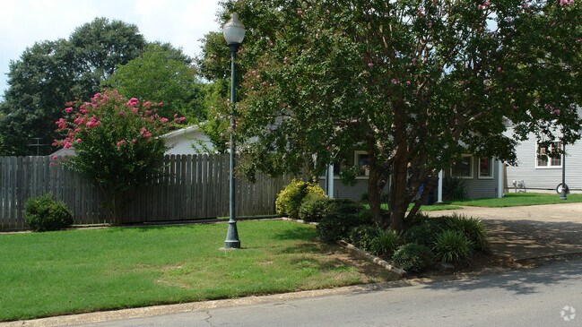
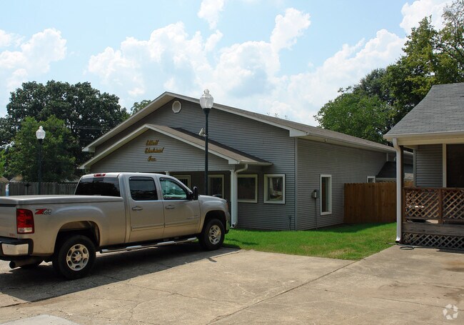
Property Detail
117 S Richards St
Little Rock-North Little Rock-Conway, AR
2018-011152
800-35872-000
Saline
Officebuilding
Arkansas
B and X Area of moderate flood hazard, usually the area between the limits of the 100-year and 500-year floods.
5
2025
0.17 AC
2025
Saline County
010601
Little Rock/N Little Rock
3,298 SF
NEARBY LISTINGS FOR SALE OR LEASE
-
-
View all Benton listings for sale on LoopNet.com
DEMOGRAPHICS near 117 S Richards St
1 mile
3 mile
5 mile
2025 Total Population
6,644
26,320
46,085
2030 Population
7,023
27,724
48,454
Pop Growth 2025-2030
+ 5.70%
+ 5.33%
+ 5.14%
Average Age
39
39
39
2025 Total Households
2,847
10,382
18,145
HH Growth 2025-2030
+ 5.83%
+ 5.45%
+ 5.18%
Median Household Inc
$57,787
$68,041
$72,322
Avg Household Size
2.30
2.50
2.50
2025 Avg HH Vehicles
2.00
2.00
2.00
Median Home Value
$150,757
$188,652
$219,227
Median Year Built
1962
1982
1993
Nearby Places
Map Layers
Map Styles
 Street
 Aerial
Layers
 Traffic
 Biking
Places
Listings with unknown addresses are not visible on the map
- Restaurants
- Banks
- Shops
- Fitness
- Groceries
PUBLIC TRANSPORTATION
AIRPORT
Bill and Hillary Clinton Ntl/Adams Field
Drive
Walk
Distance
Bill and Hillary Clinton Ntl/Adams Field
32 min
26.5 mi
Nearby Properties
Address
Land Use
TOTAL SIZE
Lot Size
Zoning
Address
Land Use
TOTAL SIZE
Lot Size
Zoning
297,680 SF
16.96 AC
Address
Land Use
TOTAL SIZE
Lot Size
Zoning
137,445 SF
28.75 AC
Address
Land Use
TOTAL SIZE
Lot Size
Zoning
98,702 SF
0.67 AC
Address
Land Use
TOTAL SIZE
Lot Size
Zoning
78,845 SF
15.44 AC
Address
Land Use
TOTAL SIZE
Lot Size
Zoning
63,870 SF
7.97 AC
Address
Land Use
TOTAL SIZE
Lot Size
Zoning
99,812 SF
11.36 AC
Address
Land Use
TOTAL SIZE
Lot Size
Zoning
47,958 SF
1.54 AC
Address
Land Use
TOTAL SIZE
Lot Size
Zoning
10,211 SF
12.73 AC
Address
Land Use
TOTAL SIZE
Lot Size
Zoning
92,420 SF
11.55 AC
Address
Land Use
TOTAL SIZE
Lot Size
Zoning
14,760 SF
2.55 AC
Address
Land Use
TOTAL SIZE
Lot Size
Zoning
19,265 SF
2.06 AC
Address
Land Use
TOTAL SIZE
Lot Size
Zoning
40,650 SF
5.88 AC
Address
Land Use
TOTAL SIZE
Lot Size
Zoning
90,176 SF
7.32 AC
Address
Land Use
TOTAL SIZE
Lot Size
Zoning
10,017 SF
0.96 AC
Address
Land Use
TOTAL SIZE
Lot Size
Zoning
102,000 SF
4.93 AC
Address
Land Use
TOTAL SIZE
Lot Size
Zoning
1,416 SF
6.71 AC
Address
Land Use
TOTAL SIZE
Lot Size
Zoning
27,840 SF
5.62 AC
Address
Land Use
TOTAL SIZE
Lot Size
Zoning
29,260 SF
4.02 AC
Address
Land Use
TOTAL SIZE
Lot Size
Zoning
10,366 SF
2.30 AC
Address
Land Use
TOTAL SIZE
Lot Size
Zoning
7,949 SF
2.22 AC
Address
Land Use
TOTAL SIZE
Lot Size
Zoning
29,612 SF
2.78 AC
Address
Land Use
TOTAL SIZE
Lot Size
Zoning
20,384 SF
2.04 AC
Address
Land Use
TOTAL SIZE
Lot Size
Zoning
21,673 SF
5 AC
Address
Land Use
TOTAL SIZE
Lot Size
Zoning
45,560 SF
2.63 AC
Address
Land Use
TOTAL SIZE
Lot Size
Zoning
6,480 SF
0.69 AC
Address
Land Use
TOTAL SIZE
Lot Size
Zoning
19,038 SF
2.93 AC
Address
Land Use
TOTAL SIZE
Lot Size
Zoning
2,220 SF
0.55 AC
Address
Land Use
TOTAL SIZE
Lot Size
Zoning
19,336 SF
1.53 AC
Address
Land Use
TOTAL SIZE
Lot Size
Zoning
1,800 SF
3.26 AC
Address
Land Use
TOTAL SIZE
Lot Size
Zoning
19,656 SF
2.63 AC
The World's #1 Commercial Real Estate Marketplace
Connect with us
© 2026 CoStar Group
The information above has been obtained from sources believed reliable. While we do not doubt its accuracy we have not verified it and make no guarantee, warranty or representation about it. It is your responsibility to independently confirm its accuracy and completeness. Any projections, opinions, assumptions, or estimates used are for example only and do not represent the current or future performance of the property. The value of this transaction to you depends on tax and other factors which should be evaluated by your tax, financial, and legal advisors. You and your advisors should conduct a careful, independent investigation of the property to determine to your satisfaction the suitability of the property for your needs.