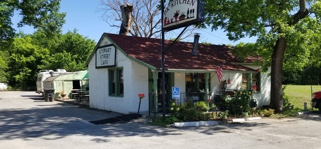
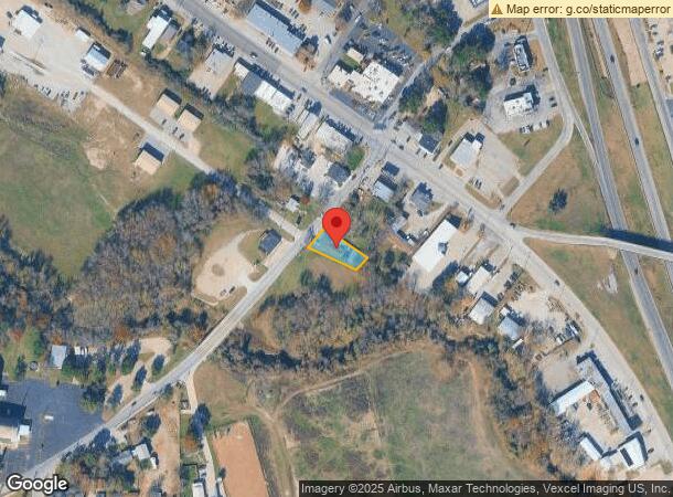
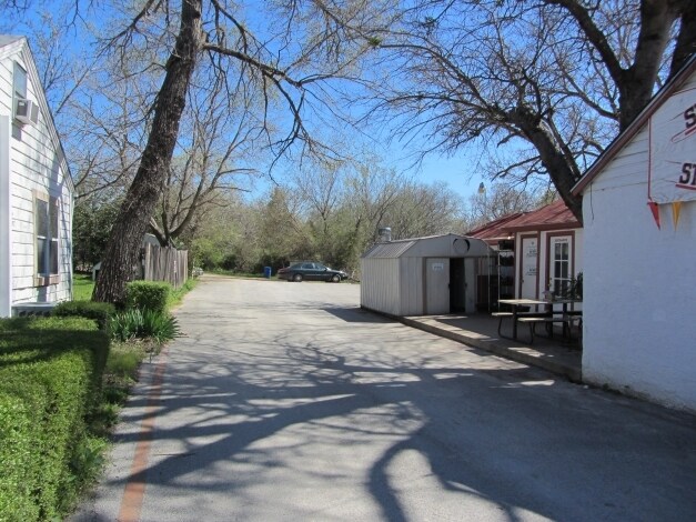
Property Record
117 S Stewart St, Azle, TX 76020
NEARBY LISTINGS FOR SALE OR LEASE
Property Detail
117 S Stewart St
Dallas-Fort Worth-Arlington, TX
Ledbetter Addition
06554490
LEDBETTER ADDITION BLOCK 1 LOT 1B
Commercialnec
Tarrant
AE
Texas
48497C0575D
1b
2024
0.19 AC
2025
White Settlement
114205
Dallas/Ft Worth
1,098 SF
DEMOGRAPHICS near 117 S Stewart St
1 Mile
3 Mile
5 Mile
2024 Total Population
4,318
23,673
41,954
2029 Population
4,870
26,876
48,657
Pop Growth 2024-2029
+ 12.78%
+ 13.53%
+ 15.98%
Average Age
40
40
41
2024 Total Households
1,651
8,870
15,637
HH Growth 2024-2029
+ 12.78%
+ 13.47%
+ 15.78%
Median Household Inc
$67,456
$75,693
$82,614
Avg Household Size
2.50
2.60
2.60
2024 Avg HH Vehicles
2.00
2.00
2.00
Median Home Value
$238,875
$257,222
$311,986
Median Year Built
1983
1987
1992
Nearby Places
Map Layers
Map Styles
 Street
 Aerial
- Restaurants
- Banks
- Shops
- Fitness
- Groceries
PUBLIC TRANSPORTATION
AIRPORT
Dallas-Fort Worth International
DRIVE
WALK
Distance
Dallas-Fort Worth International
49 min
38.0 mi
Freight Ports
Port of Shreveport
DRIVE
WALK
Distance
Port of Shreveport
270 min
245.9 mi
SALE & LEASE HISTORY
LISTING DATE
SALE/LEASE

Aug 22, 2019
For Lease
Aug 22, 2019
For Sale
Nearby Properties
Address
Land Use
TOTAL SIZE
Lot Size
Zoning
Address
Land Use
TOTAL SIZE
Lot Size
Zoning
504.76 AC
Address
Land Use
TOTAL SIZE
Lot Size
Zoning
281,946 SF
16.01 AC
Address
Land Use
TOTAL SIZE
Lot Size
Zoning
228,201 SF
9.96 AC
Address
Land Use
TOTAL SIZE
Lot Size
Zoning
208,984 SF
14.42 AC
Address
Land Use
TOTAL SIZE
Lot Size
Zoning
262,793 SF
67.85 AC
Address
Land Use
TOTAL SIZE
Lot Size
Zoning
185,807 SF
14.03 AC
Address
Land Use
TOTAL SIZE
Lot Size
Zoning
43,610 SF
15.02 AC
Address
Land Use
TOTAL SIZE
Lot Size
Zoning
28,901 SF
14.03 AC
Address
Land Use
TOTAL SIZE
Lot Size
Zoning
62,068 SF
18.93 AC
Address
Land Use
TOTAL SIZE
Lot Size
Zoning
384.71 AC
Address
Land Use
TOTAL SIZE
Lot Size
Zoning
119.88 AC
Address
Land Use
TOTAL SIZE
Lot Size
Zoning
36,452 SF
10 AC
Address
Land Use
TOTAL SIZE
Lot Size
Zoning
221.50 AC
Address
Land Use
TOTAL SIZE
Lot Size
Zoning
105,385 SF
20 AC
Address
Land Use
TOTAL SIZE
Lot Size
Zoning
50,103 SF
11.48 AC
Address
Land Use
TOTAL SIZE
Lot Size
Zoning
32,091 SF
117.44 AC
Address
Land Use
TOTAL SIZE
Lot Size
Zoning
1,728 SF
17.73 AC
Address
Land Use
TOTAL SIZE
Lot Size
Zoning
90,949 SF
5.32 AC
Address
Land Use
TOTAL SIZE
Lot Size
Zoning
32,334 SF
3.52 AC
Address
Land Use
TOTAL SIZE
Lot Size
Zoning
69,227 SF
19.02 AC
Address
Land Use
TOTAL SIZE
Lot Size
Zoning
62,538 SF
9.19 AC
Address
Land Use
TOTAL SIZE
Lot Size
Zoning
82.25 AC
Address
Land Use
TOTAL SIZE
Lot Size
Zoning
21,141 SF
4.14 AC
Address
Land Use
TOTAL SIZE
Lot Size
Zoning
33,930 SF
18.70 AC
Address
Land Use
TOTAL SIZE
Lot Size
Zoning
71,740 SF
1.75 AC
Address
Land Use
TOTAL SIZE
Lot Size
Zoning
148.37 AC
Address
Land Use
TOTAL SIZE
Lot Size
Zoning
44,264 SF
2.57 AC
Address
Land Use
TOTAL SIZE
Lot Size
Zoning
42,206 SF
2.67 AC
Address
Land Use
TOTAL SIZE
Lot Size
Zoning
41,371 SF
1.62 AC
Address
Land Use
TOTAL SIZE
Lot Size
Zoning
42,008 SF
4.13 AC
The World's #1 Commercial Real Estate Marketplace
Connect with us
© 2025 CoStar Group
The information above has been obtained from sources believed reliable. While we do not doubt its accuracy we have not verified it and make no guarantee, warranty or representation about it. It is your responsibility to independently confirm its accuracy and completeness. Any projections, opinions, assumptions, or estimates used are for example only and do not represent the current or future performance of the property. The value of this transaction to you depends on tax and other factors which should be evaluated by your tax, financial, and legal advisors. You and your advisors should conduct a careful, independent investigation of the property to determine to your satisfaction the suitability of the property for your needs.