Property Record
117 Sheriff Mill Rd, Easley, SC 29642
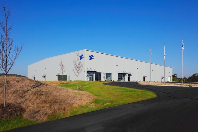

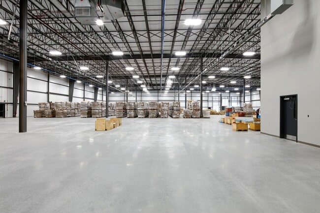
Property Detail
117 Sheriff Mill Rd
5027-07-67-2547
N/SIDE SHERIFF MILL RD PLAT 610/184
Centrallyassessed
PICKENS
IND
South Carolina
B and X Area of moderate flood hazard, usually the area between the limits of the 100-year and 500-year floods.
8.03 AC
0
Outlying Pickens Co
2025
Greenville/Spartanburg
010904
Greenville-Anderson-Greer, SC
NEARBY LISTINGS FOR SALE OR LEASE
-
-
View all Easley listings for sale on LoopNet.com
DEMOGRAPHICS near 117 Sheriff Mill Rd
1 mile
3 mile
5 mile
2025 Total Population
1,792
25,672
58,229
2030 Population
1,894
26,950
61,166
Pop Growth 2025-2030
+ 5.69%
+ 4.98%
+ 5.04%
Average Age
41
42
41
2025 Total Households
668
10,209
22,930
HH Growth 2025-2030
+ 6.14%
+ 5.24%
+ 5.34%
Median Household Inc
$71,420
$67,765
$69,105
Avg Household Size
2.60
2.50
2.50
2025 Avg HH Vehicles
2.00
2.00
2.00
Median Home Value
$258,613
$278,021
$270,443
Median Year Built
1993
1992
1991
Nearby Places
Map Layers
Map Styles
 Street
 Aerial
Layers
 Traffic
 Biking
Places
Listings with unknown addresses are not visible on the map
- Restaurants
- Banks
- Shops
- Fitness
- Groceries
PUBLIC TRANSPORTATION
AIRPORT
Greenville Spartanburg International
Drive
Walk
Distance
Greenville Spartanburg International
44 min
26.7 mi
Freight Ports
North Charleston Terminal
Drive
Walk
Distance
North Charleston Terminal
247 min
213.1 mi
SALE & LEASE HISTORY
LISTING DATE
SALE/LEASE

Aug 27, 2025
For Sale
Nearby Properties
Address
Land Use
TOTAL SIZE
Lot Size
Zoning
Address
Land Use
TOTAL SIZE
Lot Size
Zoning
81,245 SF
8.49 AC
GC
Address
Land Use
TOTAL SIZE
Lot Size
Zoning
9,800 SF
5.94 AC
R10
Address
Land Use
TOTAL SIZE
Lot Size
Zoning
24,362 SF
3.84 AC
GENERAL CO
Address
Land Use
TOTAL SIZE
Lot Size
Zoning
3,344 SF
3.04 AC
GR2
Address
Land Use
TOTAL SIZE
Lot Size
Zoning
162.06 AC
R10
Address
Land Use
TOTAL SIZE
Lot Size
Zoning
177,695 SF
20.43 AC
Address
Land Use
TOTAL SIZE
Lot Size
Zoning
1,532 SF
9.03 AC
GR2
Address
Land Use
TOTAL SIZE
Lot Size
Zoning
3,044 SF
2 AC
GENERAL RE
Address
Land Use
TOTAL SIZE
Lot Size
Zoning
8.75 AC
Address
Land Use
TOTAL SIZE
Lot Size
Zoning
220,956 SF
16.80 AC
GENERAL CO
Address
Land Use
TOTAL SIZE
Lot Size
Zoning
3.98 AC
NEIGHBORHO
Address
Land Use
TOTAL SIZE
Lot Size
Zoning
5,472 SF
1.28 AC
GR2
Address
Land Use
TOTAL SIZE
Lot Size
Zoning
1,800 SF
6.23 AC
Address
Land Use
TOTAL SIZE
Lot Size
Zoning
27.43 AC
R 10 ONE F
Address
Land Use
TOTAL SIZE
Lot Size
Zoning
7.09 AC
GC
Address
Land Use
TOTAL SIZE
Lot Size
Zoning
104,889 SF
10.68 AC
GC
Address
Land Use
TOTAL SIZE
Lot Size
Zoning
140,718 SF
18.32 AC
PUD
Address
Land Use
TOTAL SIZE
Lot Size
Zoning
41.39 AC
Address
Land Use
TOTAL SIZE
Lot Size
Zoning
16,494 SF
4.66 AC
GR2
Address
Land Use
TOTAL SIZE
Lot Size
Zoning
125,360 SF
15.26 AC
GENERAL CO
Address
Land Use
TOTAL SIZE
Lot Size
Zoning
3,200 SF
1.86 AC
GENERAL CO
Address
Land Use
TOTAL SIZE
Lot Size
Zoning
61,138 SF
10.17 AC
GC
Address
Land Use
TOTAL SIZE
Lot Size
Zoning
16,290 SF
4.68 AC
Address
Land Use
TOTAL SIZE
Lot Size
Zoning
9.07 AC
R 10 ONE F
Address
Land Use
TOTAL SIZE
Lot Size
Zoning
3,560 SF
0.41 AC
GR2
Address
Land Use
TOTAL SIZE
Lot Size
Zoning
1,904 SF
17.74 AC
R10
Address
Land Use
TOTAL SIZE
Lot Size
Zoning
14,417 SF
1.87 AC
GC
Address
Land Use
TOTAL SIZE
Lot Size
Zoning
60,200 SF
7.05 AC
GENERAL CO
Address
Land Use
TOTAL SIZE
Lot Size
Zoning
3,161 SF
0.34 AC
GENERAL RE
Address
Land Use
TOTAL SIZE
Lot Size
Zoning
33,217 SF
5.11 AC
OFFICE INS
The World's #1 Commercial Real Estate Marketplace
Connect with us
© 2026 CoStar Group
The information above has been obtained from sources believed reliable. While we do not doubt its accuracy we have not verified it and make no guarantee, warranty or representation about it. It is your responsibility to independently confirm its accuracy and completeness. Any projections, opinions, assumptions, or estimates used are for example only and do not represent the current or future performance of the property. The value of this transaction to you depends on tax and other factors which should be evaluated by your tax, financial, and legal advisors. You and your advisors should conduct a careful, independent investigation of the property to determine to your satisfaction the suitability of the property for your needs.