Property Record
117 Valentine Rd, Pendergrass, GA 30567
NEARBY LISTINGS FOR SALE OR LEASE
Property Detail
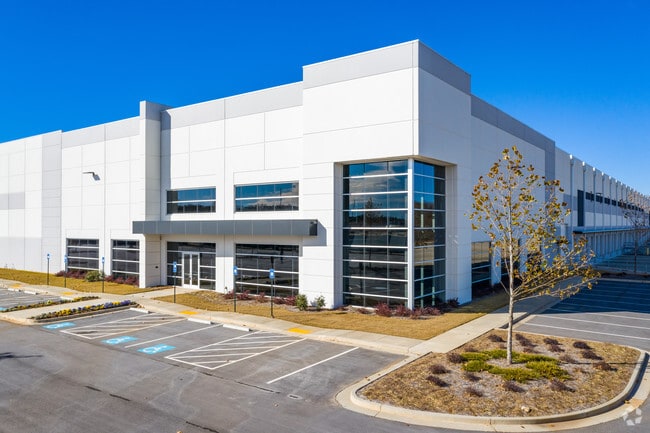
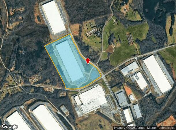
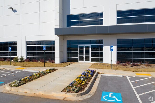
117 Valentine Rd
091-007C
74.807 ACRES TRACT 1 PLAT BK 71 PG 486
Distributionwarehouseregional
Jackson
X
Georgia
13139C0350G
74.81 AC
2024
E Jackson
2024
Atlanta
010200
Jefferson, GA
999,205 SF
DEMOGRAPHICS near 117 Valentine Rd
1 Mile
3 Mile
5 Mile
2024 Total Population
191
5,018
17,646
2029 Population
251
6,492
22,301
Pop Growth 2024-2029
+ 31.41%
+ 29.37%
+ 26.38%
Average Age
40
38
37
2024 Total Households
66
1,666
5,634
HH Growth 2024-2029
+ 30.30%
+ 27.97%
+ 25.20%
Median Household Inc
$70,714
$68,514
$70,146
Avg Household Size
2.80
2.90
3.00
2024 Avg HH Vehicles
3.00
3.00
2.00
Median Home Value
$519,231
$388,912
$318,594
Median Year Built
2002
2003
2002
Nearby Places
Map Layers
Map Styles
 Street
 Aerial
- Restaurants
- Banks
- Shops
- Fitness
- Groceries
SALE & LEASE HISTORY
LISTING DATE
SALE/LEASE

Sep 23, 2016
For Sale
Feb 28, 2019
For Lease
Nearby Properties
Address
Land Use
TOTAL SIZE
Lot Size
Zoning
Address
Land Use
TOTAL SIZE
Lot Size
Zoning
1,131,000 SF
94.67 AC
LI
Address
Land Use
TOTAL SIZE
Lot Size
Zoning
474,720 SF
40.19 AC
A1
Address
Land Use
TOTAL SIZE
Lot Size
Zoning
1,002,252 SF
90.41 AC
R
Address
Land Use
TOTAL SIZE
Lot Size
Zoning
147,528 SF
21.80 AC
001
Address
Land Use
TOTAL SIZE
Lot Size
Zoning
1,004,400 SF
61.31 AC
L1
Address
Land Use
TOTAL SIZE
Lot Size
Zoning
78.68 AC
001
Address
Land Use
TOTAL SIZE
Lot Size
Zoning
458,640 SF
54.96 AC
MI
Address
Land Use
TOTAL SIZE
Lot Size
Zoning
801,420 SF
80.72 AC
L-I
Address
Land Use
TOTAL SIZE
Lot Size
Zoning
639,000 SF
70.16 AC
LI
Address
Land Use
TOTAL SIZE
Lot Size
Zoning
1,040,000 SF
105.41 AC
LI
Address
Land Use
TOTAL SIZE
Lot Size
Zoning
1,053,360 SF
101.96 AC
001
Address
Land Use
TOTAL SIZE
Lot Size
Zoning
772,000 SF
86.10 AC
LI
Address
Land Use
TOTAL SIZE
Lot Size
Zoning
820,800 SF
46.50 AC
LI
Address
Land Use
TOTAL SIZE
Lot Size
Zoning
815,112 SF
104.67 AC
LI
Address
Land Use
TOTAL SIZE
Lot Size
Zoning
517,500 SF
79.14 AC
R1
Address
Land Use
TOTAL SIZE
Lot Size
Zoning
339,207 SF
65.25 AC
MI
Address
Land Use
TOTAL SIZE
Lot Size
Zoning
1,120,106 SF
66.43 AC
Address
Land Use
TOTAL SIZE
Lot Size
Zoning
810,600 SF
62.08 AC
M1
Address
Land Use
TOTAL SIZE
Lot Size
Zoning
404,608 SF
52.95 AC
M1
Address
Land Use
TOTAL SIZE
Lot Size
Zoning
719,200 SF
113.14 AC
M1
Address
Land Use
TOTAL SIZE
Lot Size
Zoning
749,700 SF
44.96 AC
LI
Address
Land Use
TOTAL SIZE
Lot Size
Zoning
366,300 SF
123.06 AC
I2
Address
Land Use
TOTAL SIZE
Lot Size
Zoning
147.44 AC
MI
Address
Land Use
TOTAL SIZE
Lot Size
Zoning
10,803 SF
74.86 AC
C2
Address
Land Use
TOTAL SIZE
Lot Size
Zoning
458,655 SF
37.64 AC
003
Address
Land Use
TOTAL SIZE
Lot Size
Zoning
848,000 SF
60.86 AC
I2
Address
Land Use
TOTAL SIZE
Lot Size
Zoning
518,500 SF
35.05 AC
LI
Address
Land Use
TOTAL SIZE
Lot Size
Zoning
242,306 SF
32.76 AC
I2
Address
Land Use
TOTAL SIZE
Lot Size
Zoning
518,125 SF
28.51 AC
I2
The World's #1 Commercial Real Estate Marketplace
Connect with us
© 2026 CoStar Group
The information above has been obtained from sources believed reliable. While we do not doubt its accuracy we have not verified it and make no guarantee, warranty or representation about it. It is your responsibility to independently confirm its accuracy and completeness. Any projections, opinions, assumptions, or estimates used are for example only and do not represent the current or future performance of the property. The value of this transaction to you depends on tax and other factors which should be evaluated by your tax, financial, and legal advisors. You and your advisors should conduct a careful, independent investigation of the property to determine to your satisfaction the suitability of the property for your needs.