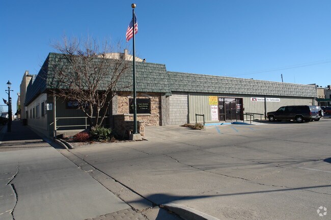
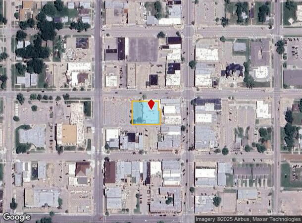
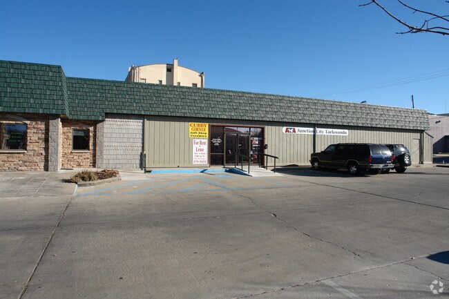
Property Record
117 W 8Th St, Junction City, KS 66441
NEARBY LISTINGS FOR SALE OR LEASE
Property Detail
117 W 8Th St
111-01-0-30-38-001.00-0
Jct City Pl
Storebuilding
JCT CITY PL, ALL LOTS 4-6 & E 24' LOT 7 & W 1/2 OF VAC ALLEY BEG SE COR LOT 4 E 9, N 140, W 9, S 140 TO POB; BLK 21 SECTION
X
Geary
20061C0089D
Kansas
2024
4-7
2025
0.53 AC
000500
Other Market Areas
13,187 SF
Junction City, KS
DEMOGRAPHICS near 117 W 8Th St
1 Mile
3 Mile
5 Mile
2024 Total Population
7,941
24,879
38,852
2029 Population
7,875
24,273
37,954
Pop Growth 2024-2029
(0.83%)
(2.44%)
(2.31%)
Average Age
35
33
30
2024 Total Households
3,356
9,728
12,895
HH Growth 2024-2029
(1.07%)
(2.42%)
(2.50%)
Median Household Inc
$43,359
$52,402
$51,814
Avg Household Size
2.20
2.40
2.60
2024 Avg HH Vehicles
2.00
2.00
2.00
Median Home Value
$122,394
$148,395
$150,682
Median Year Built
1963
1982
1989
Nearby Places
Map Layers
Map Styles
 Street
 Aerial
- Restaurants
- Banks
- Shops
- Fitness
- Groceries
PUBLIC TRANSPORTATION
AIRPORT
Manhattan Regional
DRIVE
WALK
Distance
Manhattan Regional
23 min
14.0 mi
SALE & LEASE HISTORY
LISTING DATE
SALE/LEASE

Sep 25, 2016
For Lease
Nearby Properties
Address
Land Use
TOTAL SIZE
Lot Size
Zoning
Address
Land Use
TOTAL SIZE
Lot Size
Zoning
67,133 SF
15.71 AC
RG
Address
Land Use
TOTAL SIZE
Lot Size
Zoning
177,550 SF
68.20 AC
A
Address
Land Use
TOTAL SIZE
Lot Size
Zoning
126,667 SF
3.17 AC
RM
Address
Land Use
TOTAL SIZE
Lot Size
Zoning
78,174 SF
35.10 AC
RM
Address
Land Use
TOTAL SIZE
Lot Size
Zoning
18,321 SF
0.67 AC
Address
Land Use
TOTAL SIZE
Lot Size
Zoning
16,850 SF
0.59 AC
CCS
Address
Land Use
TOTAL SIZE
Lot Size
Zoning
11,679 SF
49.73 AC
Address
Land Use
TOTAL SIZE
Lot Size
Zoning
62,043 SF
3.17 AC
CS
Address
Land Use
TOTAL SIZE
Lot Size
Zoning
34,700 SF
1.51 AC
RM
Address
Land Use
TOTAL SIZE
Lot Size
Zoning
17,388 SF
0.44 AC
Address
Land Use
TOTAL SIZE
Lot Size
Zoning
16,320 SF
6.78 AC
Address
Land Use
TOTAL SIZE
Lot Size
Zoning
8,828 SF
6.30 AC
RS
Address
Land Use
TOTAL SIZE
Lot Size
Zoning
56,611 SF
9.20 AC
CR
Address
Land Use
TOTAL SIZE
Lot Size
Zoning
56,546 SF
7.39 AC
RG
Address
Land Use
TOTAL SIZE
Lot Size
Zoning
20,898 SF
5.87 AC
CR
Address
Land Use
TOTAL SIZE
Lot Size
Zoning
29,248 SF
6.20 AC
RS
Address
Land Use
TOTAL SIZE
Lot Size
Zoning
15,452 SF
0.42 AC
Address
Land Use
TOTAL SIZE
Lot Size
Zoning
184,351 SF
29.28 AC
IL
Address
Land Use
TOTAL SIZE
Lot Size
Zoning
58,662 SF
3.34 AC
Address
Land Use
TOTAL SIZE
Lot Size
Zoning
16,235 SF
5.90 AC
Address
Land Use
TOTAL SIZE
Lot Size
Zoning
36,456 SF
2.72 AC
CS
Address
Land Use
TOTAL SIZE
Lot Size
Zoning
93,469 SF
12.98 AC
Address
Land Use
TOTAL SIZE
Lot Size
Zoning
35,825 SF
6.14 AC
RS
Address
Land Use
TOTAL SIZE
Lot Size
Zoning
43,404 SF
2.80 AC
Address
Land Use
TOTAL SIZE
Lot Size
Zoning
35,160 SF
2.30 AC
RS
Address
Land Use
TOTAL SIZE
Lot Size
Zoning
13,920 SF
1.47 AC
CCS
Address
Land Use
TOTAL SIZE
Lot Size
Zoning
41,330 SF
3.22 AC
RD
Address
Land Use
TOTAL SIZE
Lot Size
Zoning
832 SF
189 AC
AP
Address
Land Use
TOTAL SIZE
Lot Size
Zoning
7,233 SF
5.06 AC
CS
Address
Land Use
TOTAL SIZE
Lot Size
Zoning
617.75 AC
A
The World's #1 Commercial Real Estate Marketplace
Connect with us
© 2025 CoStar Group
The information above has been obtained from sources believed reliable. While we do not doubt its accuracy we have not verified it and make no guarantee, warranty or representation about it. It is your responsibility to independently confirm its accuracy and completeness. Any projections, opinions, assumptions, or estimates used are for example only and do not represent the current or future performance of the property. The value of this transaction to you depends on tax and other factors which should be evaluated by your tax, financial, and legal advisors. You and your advisors should conduct a careful, independent investigation of the property to determine to your satisfaction the suitability of the property for your needs.