Property Record
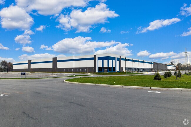
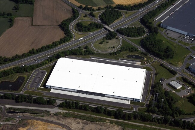
1170 Florence Rd, Mansfield, NJ 08022
NEARBY LISTINGS FOR SALE OR LEASE
-
-
View all Mansfield listings for lease on LoopNet.com
Property Detail
1170 Florence Rd
Philadelphia
Burlington
Philadelphia-Camden-Wilmington, PA-NJ-DE-MD
New Jersey
18-00045-01-00002
39.58 AC
Vacantlandnec
Burlington
11,594 SF
DEMOGRAPHICS near 1170 Florence Rd
1 Mile
3 Mile
5 Mile
2024 Total Population
301
17,236
53,592
2029 Population
303
17,484
54,358
Pop Growth 2024-2029
+ 0.66%
+ 1.44%
+ 1.43%
Average Age
46
45
43
2024 Total Households
115
6,666
20,533
HH Growth 2024-2029
+ 0.87%
+ 1.49%
+ 1.46%
Median Household Inc
$110,156
$102,429
$91,021
Avg Household Size
2.60
2.50
2.50
2024 Avg HH Vehicles
2.00
2.00
2.00
Median Home Value
$360,526
$311,826
$310,503
Median Year Built
1984
1986
1979
Nearby Places
Map Layers
Map Styles
 Street
 Aerial
- Restaurants
- Banks
- Shops
- Fitness
- Groceries
PUBLIC TRANSPORTATION
AIRPORT
Trenton Mercer
DRIVE
WALK
Distance
Trenton Mercer
30 min
19.1 mi
Freight Ports
Port of Philadelphia
DRIVE
WALK
Distance
Port of Philadelphia
38 min
27.6 mi
SALE & LEASE HISTORY
LISTING DATE
SALE/LEASE

Aug 22, 2023
For Lease
Nearby Properties
Address
Land Use
TOTAL SIZE
Lot Size
Zoning
Address
Land Use
TOTAL SIZE
Lot Size
Zoning
Address
Land Use
TOTAL SIZE
Lot Size
Zoning
Address
Land Use
TOTAL SIZE
Lot Size
Zoning
Address
Land Use
TOTAL SIZE
Lot Size
Zoning
Address
Land Use
TOTAL SIZE
Lot Size
Zoning
Address
Land Use
TOTAL SIZE
Lot Size
Zoning
53.60 AC
R-1
Address
Land Use
TOTAL SIZE
Lot Size
Zoning
Address
Land Use
TOTAL SIZE
Lot Size
Zoning
154 AC
C-2
Address
Land Use
TOTAL SIZE
Lot Size
Zoning
39.50 AC
R-1
Address
Land Use
TOTAL SIZE
Lot Size
Zoning
30.55 AC
R-1
Address
Land Use
TOTAL SIZE
Lot Size
Zoning
Address
Land Use
TOTAL SIZE
Lot Size
Zoning
47.85 AC
REO
Address
Land Use
TOTAL SIZE
Lot Size
Zoning
61 AC
C-2
Address
Land Use
TOTAL SIZE
Lot Size
Zoning
102.12 AC
ODL
Address
Land Use
TOTAL SIZE
Lot Size
Zoning
44.52 AC
C-2
Address
Land Use
TOTAL SIZE
Lot Size
Zoning
Address
Land Use
TOTAL SIZE
Lot Size
Zoning
107.60 AC
ODL
Address
Land Use
TOTAL SIZE
Lot Size
Zoning
88.58 AC
ODL
Address
Land Use
TOTAL SIZE
Lot Size
Zoning
27 AC
FM/C
Address
Land Use
TOTAL SIZE
Lot Size
Zoning
6.42 AC
ODL
Address
Land Use
TOTAL SIZE
Lot Size
Zoning
28.89 AC
C-2
Address
Land Use
TOTAL SIZE
Lot Size
Zoning
10.74 AC
R-1
Address
Land Use
TOTAL SIZE
Lot Size
Zoning
15.60 AC
AR3
Address
Land Use
TOTAL SIZE
Lot Size
Zoning
60.28 AC
C-2
Address
Land Use
TOTAL SIZE
Lot Size
Zoning
11,594 SF
23.64 AC
ODL
Address
Land Use
TOTAL SIZE
Lot Size
Zoning
3.53 AC
R-4
Address
Land Use
TOTAL SIZE
Lot Size
Zoning
60.91 AC
ODL
Address
Land Use
TOTAL SIZE
Lot Size
Zoning
47.23 AC
Address
Land Use
TOTAL SIZE
Lot Size
Zoning
2,184 SF
205.32 AC
R-1
Address
Land Use
TOTAL SIZE
Lot Size
Zoning
27.27 AC
R-1
The World's #1 Commercial Real Estate Marketplace
Connect with us
© 2026 CoStar Group
The information above has been obtained from sources believed reliable. While we do not doubt its accuracy we have not verified it and make no guarantee, warranty or representation about it. It is your responsibility to independently confirm its accuracy and completeness. Any projections, opinions, assumptions, or estimates used are for example only and do not represent the current or future performance of the property. The value of this transaction to you depends on tax and other factors which should be evaluated by your tax, financial, and legal advisors. You and your advisors should conduct a careful, independent investigation of the property to determine to your satisfaction the suitability of the property for your needs.