Property Record
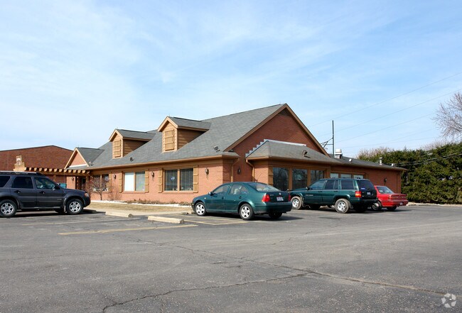
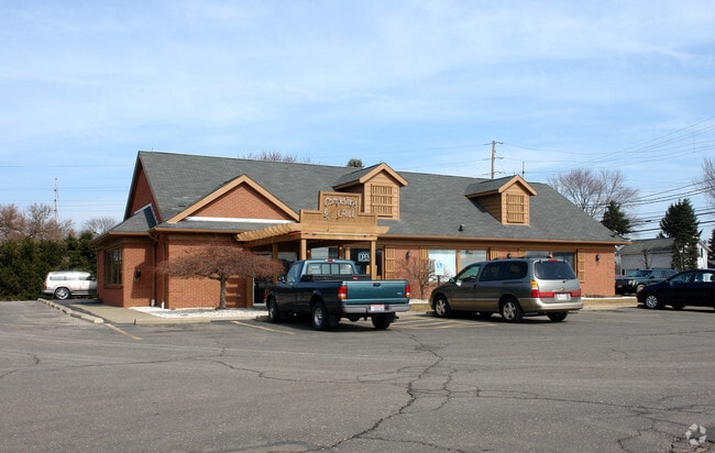
1170 N Wooster Ave, Strasburg, OH 44680

NEARBY LISTINGS FOR SALE OR LEASE
-
-
View all Strasburg listings for sale on LoopNet.com
Property Detail
1170 N Wooster Ave
2300869000
3 10 19 PR NE 4.980A
Regionalshoppingcenterormallwithanchorstore
Tuscarawas
X
Ohio
39157C0131D
4.98 AC
2024
Ohio North Area
2024
Other Market Areas
020100
New Philadelphia-Dover, OH
40,944 SF
DEMOGRAPHICS near 1170 N Wooster Ave
1 Mile
3 Mile
5 Mile
2024 Total Population
1,703
5,350
12,133
2029 Population
1,687
5,264
11,852
Pop Growth 2024-2029
(0.94%)
(1.61%)
(2.32%)
Average Age
44
43
43
2024 Total Households
705
2,170
4,848
HH Growth 2024-2029
(0.85%)
(1.61%)
(2.31%)
Median Household Inc
$68,194
$68,173
$73,091
Avg Household Size
2.40
2.40
2.50
2024 Avg HH Vehicles
2.00
2.00
2.00
Median Home Value
$183,476
$186,796
$198,679
Median Year Built
1979
1978
1978
Nearby Places
Map Layers
Map Styles
 Street
 Aerial
- Restaurants
- Banks
- Shops
- Fitness
- Groceries
PUBLIC TRANSPORTATION
AIRPORT
Akron-Canton Regional
DRIVE
WALK
Distance
Akron-Canton Regional
35 min
29.7 mi
Nearby Properties
Address
Land Use
TOTAL SIZE
Lot Size
Zoning
Address
Land Use
TOTAL SIZE
Lot Size
Zoning
819,992 SF
74.67 AC
Address
Land Use
TOTAL SIZE
Lot Size
Zoning
87,460 SF
5.02 AC
Address
Land Use
TOTAL SIZE
Lot Size
Zoning
6,462 SF
120.86 AC
Address
Land Use
TOTAL SIZE
Lot Size
Zoning
23,580 SF
4 AC
Address
Land Use
TOTAL SIZE
Lot Size
Zoning
6,462 SF
101.50 AC
Address
Land Use
TOTAL SIZE
Lot Size
Zoning
16,726 SF
102.23 AC
Address
Land Use
TOTAL SIZE
Lot Size
Zoning
14,791 SF
0.64 AC
Address
Land Use
TOTAL SIZE
Lot Size
Zoning
27,132 SF
10 AC
Address
Land Use
TOTAL SIZE
Lot Size
Zoning
23,202 SF
31.21 AC
Address
Land Use
TOTAL SIZE
Lot Size
Zoning
1,680 SF
117.88 AC
Address
Land Use
TOTAL SIZE
Lot Size
Zoning
33,892 SF
4.98 AC
Address
Land Use
TOTAL SIZE
Lot Size
Zoning
2,856 SF
214.58 AC
Address
Land Use
TOTAL SIZE
Lot Size
Zoning
3,667 SF
25.65 AC
Address
Land Use
TOTAL SIZE
Lot Size
Zoning
4,500 SF
309.45 AC
Address
Land Use
TOTAL SIZE
Lot Size
Zoning
6,232 SF
118.26 AC
Address
Land Use
TOTAL SIZE
Lot Size
Zoning
2,184 SF
66.12 AC
Address
Land Use
TOTAL SIZE
Lot Size
Zoning
5,032 SF
122.43 AC
Address
Land Use
TOTAL SIZE
Lot Size
Zoning
Address
Land Use
TOTAL SIZE
Lot Size
Zoning
8,942 SF
15 AC
Address
Land Use
TOTAL SIZE
Lot Size
Zoning
14,393 SF
50 AC
Address
Land Use
TOTAL SIZE
Lot Size
Zoning
4,752 SF
148.17 AC
Address
Land Use
TOTAL SIZE
Lot Size
Zoning
7,982 SF
40 AC
Address
Land Use
TOTAL SIZE
Lot Size
Zoning
19,010 SF
1.30 AC
Address
Land Use
TOTAL SIZE
Lot Size
Zoning
10,864 SF
18.10 AC
Address
Land Use
TOTAL SIZE
Lot Size
Zoning
1 SF
13.11 AC
Address
Land Use
TOTAL SIZE
Lot Size
Zoning
52.15 AC
Address
Land Use
TOTAL SIZE
Lot Size
Zoning
3,396 SF
105.84 AC
Address
Land Use
TOTAL SIZE
Lot Size
Zoning
1,805 SF
39.72 AC
Address
Land Use
TOTAL SIZE
Lot Size
Zoning
1,848 SF
54.42 AC
The World's #1 Commercial Real Estate Marketplace
Connect with us
© 2026 CoStar Group
The information above has been obtained from sources believed reliable. While we do not doubt its accuracy we have not verified it and make no guarantee, warranty or representation about it. It is your responsibility to independently confirm its accuracy and completeness. Any projections, opinions, assumptions, or estimates used are for example only and do not represent the current or future performance of the property. The value of this transaction to you depends on tax and other factors which should be evaluated by your tax, financial, and legal advisors. You and your advisors should conduct a careful, independent investigation of the property to determine to your satisfaction the suitability of the property for your needs.