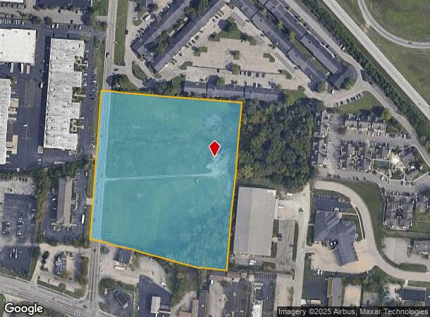
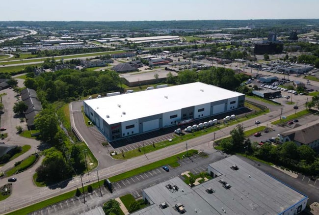
Property Record
11700 Chesterdale Rd, Cincinnati, OH 45246

NEARBY LISTINGS FOR SALE OR LEASE
Property Detail
11700 Chesterdale Rd
608-0022-0026
E KEMPER RD AC IRR R2-T3-S31
Warehouse
Hamilton
X
Ohio
39017C0337F
7.29 AC
2024
Tri-County
2024
Cincinnati/Dayton
023001
Cincinnati, OH-KY-IN
2,300 SF
DEMOGRAPHICS near 11700 Chesterdale Rd
1 Mile
3 Mile
5 Mile
2024 Total Population
4,892
39,377
140,718
2029 Population
4,999
39,601
141,134
Pop Growth 2024-2029
+ 2.19%
+ 0.57%
+ 0.30%
Average Age
37
40
40
2024 Total Households
1,856
16,474
56,893
HH Growth 2024-2029
+ 2.64%
+ 0.68%
+ 0.33%
Median Household Inc
$53,359
$59,929
$75,063
Avg Household Size
2.40
2.30
2.40
2024 Avg HH Vehicles
2.00
2.00
2.00
Median Home Value
$196,086
$178,333
$211,158
Median Year Built
1978
1978
1976
Nearby Places
Map Layers
Map Styles
 Street
 Aerial
- Restaurants
- Banks
- Shops
- Fitness
- Groceries
PUBLIC TRANSPORTATION
AIRPORT
Cincinnati/Northern Kentucky International
DRIVE
WALK
Distance
Cincinnati/Northern Kentucky International
49 min
29.6 mi
Freight Ports
Port of Toledo
DRIVE
WALK
Distance
Port of Toledo
225 min
192.1 mi
SALE & LEASE HISTORY
LISTING DATE
SALE/LEASE

Jun 10, 2025
For Lease
Dec 14, 2016
For Sale
Dec 12, 2016
For Lease
Nearby Properties
Address
Land Use
TOTAL SIZE
Lot Size
Zoning
Address
Land Use
TOTAL SIZE
Lot Size
Zoning
47.52 AC
Address
Land Use
TOTAL SIZE
Lot Size
Zoning
61.62 AC
Address
Land Use
TOTAL SIZE
Lot Size
Zoning
54,055 SF
18.17 AC
Address
Land Use
TOTAL SIZE
Lot Size
Zoning
69.99 AC
Address
Land Use
TOTAL SIZE
Lot Size
Zoning
10.85 AC
Address
Land Use
TOTAL SIZE
Lot Size
Zoning
Address
Land Use
TOTAL SIZE
Lot Size
Zoning
342,284 SF
37.92 AC
Address
Land Use
TOTAL SIZE
Lot Size
Zoning
782,765 SF
33.15 AC
Address
Land Use
TOTAL SIZE
Lot Size
Zoning
15.33 AC
Address
Land Use
TOTAL SIZE
Lot Size
Zoning
287,883 SF
10.90 AC
Address
Land Use
TOTAL SIZE
Lot Size
Zoning
4,620 SF
85.80 AC
Address
Land Use
TOTAL SIZE
Lot Size
Zoning
68.49 AC
Address
Land Use
TOTAL SIZE
Lot Size
Zoning
84,133 SF
4.28 AC
Address
Land Use
TOTAL SIZE
Lot Size
Zoning
498,300 SF
14.86 AC
Address
Land Use
TOTAL SIZE
Lot Size
Zoning
26.63 AC
Address
Land Use
TOTAL SIZE
Lot Size
Zoning
10.76 AC
Address
Land Use
TOTAL SIZE
Lot Size
Zoning
11.19 AC
Address
Land Use
TOTAL SIZE
Lot Size
Zoning
536,648 SF
22.28 AC
Address
Land Use
TOTAL SIZE
Lot Size
Zoning
2.24 AC
Address
Land Use
TOTAL SIZE
Lot Size
Zoning
25,098 SF
21.31 AC
Address
Land Use
TOTAL SIZE
Lot Size
Zoning
25.89 AC
Address
Land Use
TOTAL SIZE
Lot Size
Zoning
1,700 SF
35.39 AC
Address
Land Use
TOTAL SIZE
Lot Size
Zoning
434,916 SF
19.98 AC
Address
Land Use
TOTAL SIZE
Lot Size
Zoning
1,680 SF
15.17 AC
Address
Land Use
TOTAL SIZE
Lot Size
Zoning
76.09 AC
Address
Land Use
TOTAL SIZE
Lot Size
Zoning
Address
Land Use
TOTAL SIZE
Lot Size
Zoning
54.92 AC
Address
Land Use
TOTAL SIZE
Lot Size
Zoning
433,309 SF
21.87 AC
Address
Land Use
TOTAL SIZE
Lot Size
Zoning
9,744 SF
8.15 AC
Address
Land Use
TOTAL SIZE
Lot Size
Zoning
15.83 AC
The World's #1 Commercial Real Estate Marketplace
Connect with us
© 2025 CoStar Group
The information above has been obtained from sources believed reliable. While we do not doubt its accuracy we have not verified it and make no guarantee, warranty or representation about it. It is your responsibility to independently confirm its accuracy and completeness. Any projections, opinions, assumptions, or estimates used are for example only and do not represent the current or future performance of the property. The value of this transaction to you depends on tax and other factors which should be evaluated by your tax, financial, and legal advisors. You and your advisors should conduct a careful, independent investigation of the property to determine to your satisfaction the suitability of the property for your needs.