Property Record
11700 E 86Th St N, Owasso, OK 74055

Save to a Folder
{{folder.Name}}
{{folder.ListingIds.length}} Properties
{{folder.ListingIds.length}} Property
Create a New Folder
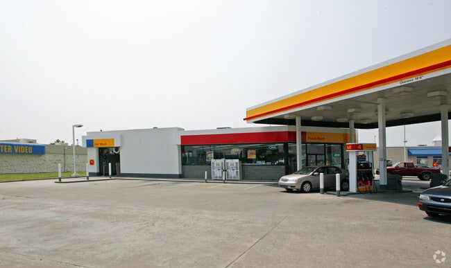
Property Detail
11700 E 86Th St N
61415-14-29-51620
PRT LT 67 BEG NWC TH E155 S195 W165.85 CRV LF155.01 N40.50 POB BLK 2
Storebuilding
Tulsa
CS
Oklahoma
B and X Area of moderate flood hazard, usually the area between the limits of the 100-year and 500-year floods.
67
2025
0.70 AC
2025
Northeast Tulsa
005805
Tulsa
3,442 SF
Tulsa, OK
NEARBY LISTINGS FOR SALE OR LEASE
DEMOGRAPHICS near 11700 E 86Th St N
1 mile
3 mile
5 mile
2025 Total Population
9,929
39,439
58,483
2030 Population
10,162
40,754
60,652
Pop Growth 2025-2030
+ 2.35%
+ 3.33%
+ 3.71%
Average Age
37
38
38
2025 Total Households
3,725
14,889
21,673
HH Growth 2025-2030
+ 2.39%
+ 3.33%
+ 3.71%
Median Household Inc
$68,096
$79,651
$86,240
Avg Household Size
2.60
2.60
2.70
2025 Avg HH Vehicles
2.00
2.00
2.00
Median Home Value
$207,562
$273,778
$275,436
Median Year Built
1982
1998
2000
Nearby Places
Map Layers
Map Styles
 Street
 Aerial
Layers
 Traffic
 Biking
Places
Listings with unknown addresses are not visible on the map
- Restaurants
- Banks
- Shops
- Fitness
- Groceries
PUBLIC TRANSPORTATION
AIRPORT
Tulsa International
Drive
Walk
Distance
Tulsa International
13 min
8.0 mi
Freight Ports
Drive
Walk
Distance
16 min
10.8 mi
Nearby Properties
Address
Land Use
TOTAL SIZE
Lot Size
Zoning
Address
Land Use
TOTAL SIZE
Lot Size
Zoning
299,471 SF
64.32 AC
AG
Address
Land Use
TOTAL SIZE
Lot Size
Zoning
111,792 SF
12.43 AC
OM
Address
Land Use
TOTAL SIZE
Lot Size
Zoning
209,620 SF
19.59 AC
IM
Address
Land Use
TOTAL SIZE
Lot Size
Zoning
65,354 SF
41.54 AC
AG
Address
Land Use
TOTAL SIZE
Lot Size
Zoning
115,952 SF
19.30 AC
RS3
Address
Land Use
TOTAL SIZE
Lot Size
Zoning
138,427 SF
8.90 AC
OM
Address
Land Use
TOTAL SIZE
Lot Size
Zoning
105,098 SF
18.22 AC
RS2
Address
Land Use
TOTAL SIZE
Lot Size
Zoning
64,520 SF
34.28 AC
NCU
Address
Land Use
TOTAL SIZE
Lot Size
Zoning
93,712 SF
14.01 AC
RM1
Address
Land Use
TOTAL SIZE
Lot Size
Zoning
91,189 SF
10.24 AC
AG
Address
Land Use
TOTAL SIZE
Lot Size
Zoning
34,066 SF
2.88 AC
CH
Address
Land Use
TOTAL SIZE
Lot Size
Zoning
78,464 SF
10.21 AC
AG
Address
Land Use
TOTAL SIZE
Lot Size
Zoning
270,386 SF
14.65 AC
RM
Address
Land Use
TOTAL SIZE
Lot Size
Zoning
246,823 SF
12.77 AC
Address
Land Use
TOTAL SIZE
Lot Size
Zoning
24,164 SF
11.81 AC
NCU
Address
Land Use
TOTAL SIZE
Lot Size
Zoning
31,502 SF
11.08 AC
AG
Address
Land Use
TOTAL SIZE
Lot Size
Zoning
43,252 SF
7.86 AC
RS3
Address
Land Use
TOTAL SIZE
Lot Size
Zoning
2,112 SF
10.89 AC
Address
Land Use
TOTAL SIZE
Lot Size
Zoning
266,778 SF
12.26 AC
CN
Address
Land Use
TOTAL SIZE
Lot Size
Zoning
17,600 SF
15.04 AC
RE
Address
Land Use
TOTAL SIZE
Lot Size
Zoning
226,062 SF
11.78 AC
RM2
Address
Land Use
TOTAL SIZE
Lot Size
Zoning
24,679 SF
46.96 AC
IM
Address
Land Use
TOTAL SIZE
Lot Size
Zoning
307,768 SF
31.31 AC
RM1
Address
Land Use
TOTAL SIZE
Lot Size
Zoning
133,467 SF
11.37 AC
CS
Address
Land Use
TOTAL SIZE
Lot Size
Zoning
101,776 SF
9.96 AC
CS
Address
Land Use
TOTAL SIZE
Lot Size
Zoning
38,608 SF
5.07 AC
RS1
Address
Land Use
TOTAL SIZE
Lot Size
Zoning
49,541 SF
5.28 AC
AG
Address
Land Use
TOTAL SIZE
Lot Size
Zoning
29,140 SF
2.75 AC
CH
Address
Land Use
TOTAL SIZE
Lot Size
Zoning
71,898 SF
3.66 AC
CS
Address
Land Use
TOTAL SIZE
Lot Size
Zoning
40,822 SF
11.39 AC
AG
The World's #1 Commercial Real Estate Marketplace
Connect with us
© 2026 CoStar Group
The information above has been obtained from sources believed reliable. While we do not doubt its accuracy we have not verified it and make no guarantee, warranty or representation about it. It is your responsibility to independently confirm its accuracy and completeness. Any projections, opinions, assumptions, or estimates used are for example only and do not represent the current or future performance of the property. The value of this transaction to you depends on tax and other factors which should be evaluated by your tax, financial, and legal advisors. You and your advisors should conduct a careful, independent investigation of the property to determine to your satisfaction the suitability of the property for your needs.