Property Record
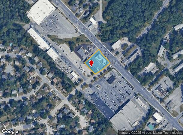
11700 Reisterstown Rd, Reisterstown, MD 21136

NEARBY LISTINGS FOR SALE OR LEASE
Property Detail
11700 Reisterstown Rd
04-0419051325
Nw Cor Cherry Valley
Restaurantdrivein
0.776 AC SWS NW COR CHERRY VALLEY
A
Baltimore
24013C0350D
Maryland
2024
0.78 AC
2025
Reisterstown Rd Corridor
404403
Baltimore
7,760 SF
Baltimore-Columbia-Towson, MD
DEMOGRAPHICS near 11700 Reisterstown Rd
1 Mile
3 Mile
5 Mile
2024 Total Population
17,425
65,376
114,871
2029 Population
17,174
64,638
113,572
Pop Growth 2024-2029
(1.44%)
(1.13%)
(1.13%)
Average Age
38
39
40
2024 Total Households
6,588
25,284
44,525
HH Growth 2024-2029
(1.50%)
(1.15%)
(1.18%)
Median Household Inc
$70,088
$85,413
$90,944
Avg Household Size
2.50
2.50
2.50
2024 Avg HH Vehicles
2.00
2.00
2.00
Median Home Value
$299,958
$345,127
$332,475
Median Year Built
1977
1987
1989
Nearby Places
Map Layers
Map Styles
 Street
 Aerial
- Restaurants
- Banks
- Shops
- Fitness
- Groceries
PUBLIC TRANSPORTATION
AIRPORT
Baltimore/Washington International Thurgood Marshall
DRIVE
WALK
Distance
Baltimore/Washington International Thurgood Marshall
36 min
23.2 mi
Freight Ports
Port of Baltimore
DRIVE
WALK
Distance
Port of Baltimore
36 min
23.8 mi
SALE & LEASE HISTORY
LISTING DATE
SALE/LEASE

Sep 25, 2016
For Lease
Nearby Properties
Address
Land Use
TOTAL SIZE
Lot Size
Zoning
Address
Land Use
TOTAL SIZE
Lot Size
Zoning
408,321 SF
39.16 AC
BM
Address
Land Use
TOTAL SIZE
Lot Size
Zoning
250,000 SF
1.61 AC
BMCT
Address
Land Use
TOTAL SIZE
Lot Size
Zoning
Address
Land Use
TOTAL SIZE
Lot Size
Zoning
12 AC
DR10
Address
Land Use
TOTAL SIZE
Lot Size
Zoning
23.07 AC
DR16
Address
Land Use
TOTAL SIZE
Lot Size
Zoning
4.31 AC
BM-CT
Address
Land Use
TOTAL SIZE
Lot Size
Zoning
300,838 SF
33.27 AC
DR105
Address
Land Use
TOTAL SIZE
Lot Size
Zoning
159.90 AC
Address
Land Use
TOTAL SIZE
Lot Size
Zoning
464,593 SF
6.38 AC
BM
Address
Land Use
TOTAL SIZE
Lot Size
Zoning
333,600 SF
8.39 AC
ML
Address
Land Use
TOTAL SIZE
Lot Size
Zoning
281,620 SF
8.58 AC
Address
Land Use
TOTAL SIZE
Lot Size
Zoning
756,000 SF
2.63 AC
Address
Land Use
TOTAL SIZE
Lot Size
Zoning
589,225 SF
1.96 AC
Address
Land Use
TOTAL SIZE
Lot Size
Zoning
146,149 SF
1.08 AC
BM-CT
Address
Land Use
TOTAL SIZE
Lot Size
Zoning
285,044 SF
15.16 AC
MLIM
Address
Land Use
TOTAL SIZE
Lot Size
Zoning
18.87 AC
DR16
Address
Land Use
TOTAL SIZE
Lot Size
Zoning
91,160 SF
2.53 AC
Address
Land Use
TOTAL SIZE
Lot Size
Zoning
151,140 SF
39.06 AC
Address
Land Use
TOTAL SIZE
Lot Size
Zoning
55,470 SF
9.69 AC
BM
Address
Land Use
TOTAL SIZE
Lot Size
Zoning
16.86 AC
Address
Land Use
TOTAL SIZE
Lot Size
Zoning
199,573 SF
6.35 AC
ML
Address
Land Use
TOTAL SIZE
Lot Size
Zoning
190,501 SF
1.63 AC
Address
Land Use
TOTAL SIZE
Lot Size
Zoning
114,141 SF
54.89 AC
Address
Land Use
TOTAL SIZE
Lot Size
Zoning
164,453 SF
4.49 AC
ML
Address
Land Use
TOTAL SIZE
Lot Size
Zoning
271,013 SF
25.64 AC
Address
Land Use
TOTAL SIZE
Lot Size
Zoning
15.86 AC
DR16
Address
Land Use
TOTAL SIZE
Lot Size
Zoning
4,762 SF
15.93 AC
BMCCC
Address
Land Use
TOTAL SIZE
Lot Size
Zoning
125,171 SF
8.80 AC
Address
Land Use
TOTAL SIZE
Lot Size
Zoning
261,295 SF
8.62 AC
BM
Address
Land Use
TOTAL SIZE
Lot Size
Zoning
205,549 SF
7.32 AC
OT
The World's #1 Commercial Real Estate Marketplace
Connect with us
© 2025 CoStar Group
The information above has been obtained from sources believed reliable. While we do not doubt its accuracy we have not verified it and make no guarantee, warranty or representation about it. It is your responsibility to independently confirm its accuracy and completeness. Any projections, opinions, assumptions, or estimates used are for example only and do not represent the current or future performance of the property. The value of this transaction to you depends on tax and other factors which should be evaluated by your tax, financial, and legal advisors. You and your advisors should conduct a careful, independent investigation of the property to determine to your satisfaction the suitability of the property for your needs.