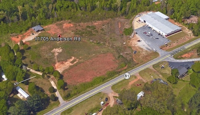
Property Record
11705 Anderson Rd, Greenville, SC 29611


NEARBY LISTINGS FOR SALE OR LEASE
Property Detail
11705 Anderson Rd
Greenville-Anderson-Mauldin, SC
Closing Survey For Gariesh Shiva Llc
236-00-04-011
Anderson
Sfr
South Carolina
X
5 AC
45007C0061E
Powdersville/Easley
1,193 SF
Greenville/Spartanburg
DEMOGRAPHICS near 11705 Anderson Rd
1 Mile
3 Mile
5 Mile
2024 Total Population
1,755
24,770
89,499
2029 Population
1,869
26,768
97,874
Pop Growth 2024-2029
+ 6.50%
+ 8.07%
+ 9.36%
Average Age
38
39
39
2024 Total Households
658
9,359
35,078
HH Growth 2024-2029
+ 6.53%
+ 8.12%
+ 9.54%
Median Household Inc
$64,119
$53,982
$52,201
Avg Household Size
2.70
2.60
2.50
2024 Avg HH Vehicles
2.00
2.00
2.00
Median Home Value
$252,083
$181,070
$204,318
Median Year Built
1994
1985
1985
Nearby Places
Map Layers
Map Styles
 Street
 Aerial
- Restaurants
- Banks
- Shops
- Fitness
- Groceries
PUBLIC TRANSPORTATION
COMMUTER RAIL
Greenville Amtrak Station (Crescent - Amtrak)
DRIVE
WALK
Distance
Greenville Amtrak Station (Crescent - Amtrak)
15 min
7.2 mi
AIRPORT
Greenville Spartanburg International
DRIVE
WALK
Distance
Greenville Spartanburg International
31 min
20.4 mi
Freight Ports
North Charleston Terminal
DRIVE
WALK
Distance
North Charleston Terminal
234 min
206.8 mi
SALE & LEASE HISTORY
LISTING DATE
SALE/LEASE

Sep 25, 2016
For Lease
Oct 11, 2016
For Sale
Mar 12, 2019
For Sale
Nearby Properties
Address
Land Use
TOTAL SIZE
Lot Size
Zoning
Address
Land Use
TOTAL SIZE
Lot Size
Zoning
5.60 AC
RM
Address
Land Use
TOTAL SIZE
Lot Size
Zoning
16.09 AC
S1
Address
Land Use
TOTAL SIZE
Lot Size
Zoning
14 AC
S1
Address
Land Use
TOTAL SIZE
Lot Size
Zoning
4.70 AC
RM
Address
Land Use
TOTAL SIZE
Lot Size
Zoning
14,544 SF
22.61 AC
Address
Land Use
TOTAL SIZE
Lot Size
Zoning
8.80 AC
I1
Address
Land Use
TOTAL SIZE
Lot Size
Zoning
14 AC
I1
Address
Land Use
TOTAL SIZE
Lot Size
Zoning
152.65 AC
I1
Address
Land Use
TOTAL SIZE
Lot Size
Zoning
45.18 AC
I1
Address
Land Use
TOTAL SIZE
Lot Size
Zoning
3.14 AC
S1
Address
Land Use
TOTAL SIZE
Lot Size
Zoning
3.20 AC
S1
Address
Land Use
TOTAL SIZE
Lot Size
Zoning
86.32 AC
I1,RS
Address
Land Use
TOTAL SIZE
Lot Size
Zoning
2.34 AC
I1
Address
Land Use
TOTAL SIZE
Lot Size
Zoning
1,346 SF
4.51 AC
R75
Address
Land Use
TOTAL SIZE
Lot Size
Zoning
3.80 AC
S1
Address
Land Use
TOTAL SIZE
Lot Size
Zoning
683 SF
16.53 AC
Address
Land Use
TOTAL SIZE
Lot Size
Zoning
4,778 SF
10.45 AC
Address
Land Use
TOTAL SIZE
Lot Size
Zoning
1.99 AC
S1
Address
Land Use
TOTAL SIZE
Lot Size
Zoning
32.02 AC
RMA
Address
Land Use
TOTAL SIZE
Lot Size
Zoning
30.96 AC
RM
Address
Land Use
TOTAL SIZE
Lot Size
Zoning
150,809 SF
15.35 AC
Address
Land Use
TOTAL SIZE
Lot Size
Zoning
2.04 AC
I1
Address
Land Use
TOTAL SIZE
Lot Size
Zoning
24.69 AC
S1
Address
Land Use
TOTAL SIZE
Lot Size
Zoning
19.33 AC
I1
Address
Land Use
TOTAL SIZE
Lot Size
Zoning
118.13 AC
I1
Address
Land Use
TOTAL SIZE
Lot Size
Zoning
90.23 AC
R75
Address
Land Use
TOTAL SIZE
Lot Size
Zoning
1.19 AC
S1
The World's #1 Commercial Real Estate Marketplace
Connect with us
© 2025 CoStar Group
The information above has been obtained from sources believed reliable. While we do not doubt its accuracy we have not verified it and make no guarantee, warranty or representation about it. It is your responsibility to independently confirm its accuracy and completeness. Any projections, opinions, assumptions, or estimates used are for example only and do not represent the current or future performance of the property. The value of this transaction to you depends on tax and other factors which should be evaluated by your tax, financial, and legal advisors. You and your advisors should conduct a careful, independent investigation of the property to determine to your satisfaction the suitability of the property for your needs.