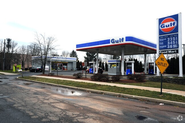
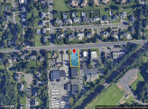
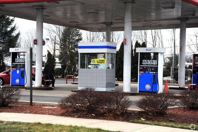
Property Record
1171 Inman Ave, Edison, NJ 08820
NEARBY LISTINGS FOR SALE OR LEASE
Property Detail
1171 Inman Ave
New York-Jersey City-White Plains, NY-NJ
Rosalind Estates Sec 01
05-00428-0000-00001-01
100X200
Servicestation
Middlesex
X
New Jersey
34023C0051F
1.1
2024
0.46 AC
2025
South Edison
001412
Northern New Jersey
DEMOGRAPHICS near 1171 Inman Ave
1 Mile
3 Mile
5 Mile
2024 Total Population
11,288
114,338
376,841
2029 Population
11,220
113,810
373,639
Pop Growth 2024-2029
(0.60%)
(0.46%)
(0.85%)
Average Age
41
41
40
2024 Total Households
3,725
37,697
128,801
HH Growth 2024-2029
(0.67%)
(0.52%)
(0.91%)
Median Household Inc
$149,248
$124,703
$113,358
Avg Household Size
3.00
2.90
2.80
2024 Avg HH Vehicles
2.00
2.00
2.00
Median Home Value
$551,273
$491,170
$454,529
Median Year Built
1984
1964
1961
Nearby Places
Map Layers
Map Styles
 Street
 Aerial
- Restaurants
- Banks
- Shops
- Fitness
- Groceries
PUBLIC TRANSPORTATION
COMMUTER RAIL
Netherwood (Raritan Valley Line - NJ Transit Commuter Rail (NJ Transit))
DRIVE
WALK
Distance
Netherwood (Raritan Valley Line - NJ Transit Commuter Rail (NJ Transit))
9 min
3.8 mi
Metropark (Northeast Corridor Line - NJ Transit Commuter Rail (NJ Transit))
DRIVE
WALK
Distance
Metropark (Northeast Corridor Line - NJ Transit Commuter Rail (NJ Transit))
9 min
4.1 mi
AIRPORT
Newark Liberty International
DRIVE
WALK
Distance
Newark Liberty International
27 min
18.0 mi
LaGuardia
DRIVE
WALK
Distance
LaGuardia
61 min
37.3 mi
Freight Ports
New York Container Terminal
DRIVE
WALK
Distance
New York Container Terminal
25 min
13.7 mi
Nearby Properties
Address
Land Use
TOTAL SIZE
Lot Size
Zoning
Address
Land Use
TOTAL SIZE
Lot Size
Zoning
37.46 AC
EI
Address
Land Use
TOTAL SIZE
Lot Size
Zoning
80,000 SF
23.37 AC
R50
Address
Land Use
TOTAL SIZE
Lot Size
Zoning
96.22 AC
RA
Address
Land Use
TOTAL SIZE
Lot Size
Zoning
5,645 SF
91.16 AC
O
Address
Land Use
TOTAL SIZE
Lot Size
Zoning
9.98 AC
RA
Address
Land Use
TOTAL SIZE
Lot Size
Zoning
30.80 AC
R10
Address
Land Use
TOTAL SIZE
Lot Size
Zoning
102,200 SF
6.68 AC
RA
Address
Land Use
TOTAL SIZE
Lot Size
Zoning
4.74 AC
NC
Address
Land Use
TOTAL SIZE
Lot Size
Zoning
19.50 AC
LR
Address
Land Use
TOTAL SIZE
Lot Size
Zoning
19.19 AC
R-3
Address
Land Use
TOTAL SIZE
Lot Size
Zoning
66,900 SF
12.75 AC
Address
Land Use
TOTAL SIZE
Lot Size
Zoning
21.60 AC
M3
Address
Land Use
TOTAL SIZE
Lot Size
Zoning
20.27 AC
PB
Address
Land Use
TOTAL SIZE
Lot Size
Zoning
43.03 AC
R-1
Address
Land Use
TOTAL SIZE
Lot Size
Zoning
1.46 AC
GB
Address
Land Use
TOTAL SIZE
Lot Size
Zoning
18.03 AC
LR
Address
Land Use
TOTAL SIZE
Lot Size
Zoning
16.69 AC
LR
Address
Land Use
TOTAL SIZE
Lot Size
Zoning
5.46 AC
RA
Address
Land Use
TOTAL SIZE
Lot Size
Zoning
1,092 SF
85.80 AC
Address
Land Use
TOTAL SIZE
Lot Size
Zoning
50.50 AC
O
Address
Land Use
TOTAL SIZE
Lot Size
Zoning
11.50 AC
UR
Address
Land Use
TOTAL SIZE
Lot Size
Zoning
12.31 AC
P
Address
Land Use
TOTAL SIZE
Lot Size
Zoning
18.02 AC
OBC3
Address
Land Use
TOTAL SIZE
Lot Size
Zoning
316.14 AC
Address
Land Use
TOTAL SIZE
Lot Size
Zoning
139,939 SF
16.22 AC
OBC4
Address
Land Use
TOTAL SIZE
Lot Size
Zoning
4.41 AC
CG
Address
Land Use
TOTAL SIZE
Lot Size
Zoning
34.57 AC
M3
Address
Land Use
TOTAL SIZE
Lot Size
Zoning
Address
Land Use
TOTAL SIZE
Lot Size
Zoning
51.56 AC
OSRC
Address
Land Use
TOTAL SIZE
Lot Size
Zoning
18.64 AC
The World's #1 Commercial Real Estate Marketplace
Connect with us
© 2025 CoStar Group
The information above has been obtained from sources believed reliable. While we do not doubt its accuracy we have not verified it and make no guarantee, warranty or representation about it. It is your responsibility to independently confirm its accuracy and completeness. Any projections, opinions, assumptions, or estimates used are for example only and do not represent the current or future performance of the property. The value of this transaction to you depends on tax and other factors which should be evaluated by your tax, financial, and legal advisors. You and your advisors should conduct a careful, independent investigation of the property to determine to your satisfaction the suitability of the property for your needs.